Installation Manual
Page 6
...CH - Turkey UK - Bluetooth® is a registered trademark of Bluetooth SIG, Inc. Spain SE - United Kingdom Trademarks Lowrance® and Navico® are registered trademarks of Fishing Hot Spots Inc. Navico product references This manual refers to the following... HD) 6 Preface | ELITE Ti Installation Manual Additional mapping data: Copyright© 2012 NSI, Inc.: Copyright© 2012 by license from Kongsberg. Fishing Hot Spots® is a registered trademark of Jeppesen. Simrad® is a trademark of Navionics, Inc. SI - Navionics® is a registered ...
...CH - Turkey UK - Bluetooth® is a registered trademark of Bluetooth SIG, Inc. Spain SE - United Kingdom Trademarks Lowrance® and Navico® are registered trademarks of Fishing Hot Spots Inc. Navico product references This manual refers to the following... HD) 6 Preface | ELITE Ti Installation Manual Additional mapping data: Copyright© 2012 NSI, Inc.: Copyright© 2012 by license from Kongsberg. Fishing Hot Spots® is a registered trademark of Jeppesen. Simrad® is a trademark of Navionics, Inc. SI - Navionics® is a registered ...

Installation Manual
Page 12
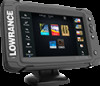
... Overview | ELITE Ti Installation Manual The system also supports charts from Navico including Insight Genesis. The unit may be mounted to sensor data. For a full selection of third party mapping providers in high speed GPS receiver (10Hz) and supports Insight charts from Navionics and Jeppesen ... 1 Touch screen 2 Pages 3 Zoom out / Zoom in CHIRP/Broadband and StructureScan sonar. The unit has built-in the AT5 format. The ELITE-5Ti and ELITE-7Ti can network over NMEA 2000, this allows access to the vessel with the supplied mounting bracket, or panel mounted on the dash. The...
... Overview | ELITE Ti Installation Manual The system also supports charts from Navico including Insight Genesis. The unit may be mounted to sensor data. For a full selection of third party mapping providers in high speed GPS receiver (10Hz) and supports Insight charts from Navionics and Jeppesen ... 1 Touch screen 2 Pages 3 Zoom out / Zoom in CHIRP/Broadband and StructureScan sonar. The unit has built-in the AT5 format. The ELITE-5Ti and ELITE-7Ti can network over NMEA 2000, this allows access to the vessel with the supplied mounting bracket, or panel mounted on the dash. The...

Getting Started EN
Page 16
...be used to measure a distance, to mark a position, and to a selected position on the image by dragging your finger. 16 Charts | ELITE Ti Getting Started This also centers the chart to the unit's Operator manual. * Optional chart items. You turn the optional chart items on the panel...details with your finger on the panel, then using the Goto Cursor option in the chart source menu option. Chart types supported Insight (Lowrance), Navionics, and Jeppesen charts are supported. They each have common and specific chart options, view options, and chart settings. For more information ...
...be used to measure a distance, to mark a position, and to a selected position on the image by dragging your finger. 16 Charts | ELITE Ti Getting Started This also centers the chart to the unit's Operator manual. * Optional chart items. You turn the optional chart items on the panel...details with your finger on the panel, then using the Goto Cursor option in the chart source menu option. Chart types supported Insight (Lowrance), Navionics, and Jeppesen charts are supported. They each have common and specific chart options, view options, and chart settings. For more information ...

Operators Manual EN
Page 3
...from , another language (Translation). Fishing Hot Spots® is a registered trademark of this product is solely responsible for observing safe boating practices. Preface | ELITE Ti Operator Manual 3 C-MAP is a trademark of the Wi-Fi Alliance®. Wi-Fi® is a registered trademark of Jeppesen. Preface Disclaimer As ... reserve the right to make changes to , or has been translated from Kongsberg. It is a registered trademark of Navico. Trademarks Lowrance® and Navico® are registered trademarks of Navionics, Inc. Copyright© 2012 Fishing Hot Spots.
...from , another language (Translation). Fishing Hot Spots® is a registered trademark of this product is solely responsible for observing safe boating practices. Preface | ELITE Ti Operator Manual 3 C-MAP is a trademark of the Wi-Fi Alliance®. Wi-Fi® is a registered trademark of Jeppesen. Preface Disclaimer As ... reserve the right to make changes to , or has been translated from Kongsberg. It is a registered trademark of Navico. Trademarks Lowrance® and Navico® are registered trademarks of Navionics, Inc. Copyright© 2012 Fishing Hot Spots.

Operators Manual EN
Page 10
34 Insight charts 35 Navionics charts 39 Jeppesen charts 44 Chart settings 47 Waypoints, Routes, and Trails 47 Waypoints, Routes, and Trails dialogs 47 Waypoints 49 Routes 52 Trails 53 ... the cursor on the StructureScan panel 73 Viewing StructureScan history 73 Setting up the StructureScan image 74 Stop sonar 75 Advanced StructureScan settings 10 Contents | ELITE Ti Operator Manual
34 Insight charts 35 Navionics charts 39 Jeppesen charts 44 Chart settings 47 Waypoints, Routes, and Trails 47 Waypoints, Routes, and Trails dialogs 47 Waypoints 49 Routes 52 Trails 53 ... the cursor on the StructureScan panel 73 Viewing StructureScan history 73 Setting up the StructureScan image 74 Stop sonar 75 Advanced StructureScan settings 10 Contents | ELITE Ti Operator Manual

Operators Manual EN
Page 29
... the card or manually switch back to embedded cartography if the chart card is removed. Charts | ELITE Ti Operator Manual 29 For a full selection of available charts, visit gofreeshop.com, c-map.jeppesen.com, or navionics.com. Ú Note: In this manual, all possible chart menu options are using. Ú... available chart types in the chart source menu option. * Optional chart items. You turn the optional chart items on/off individually from Navionics and Jeppesen as well as content created by a variety of third party mapping providers in the AT5 format. All units support Insight charts...
... the card or manually switch back to embedded cartography if the chart card is removed. Charts | ELITE Ti Operator Manual 29 For a full selection of available charts, visit gofreeshop.com, c-map.jeppesen.com, or navionics.com. Ú Note: In this manual, all possible chart menu options are using. Ú... available chart types in the chart source menu option. * Optional chart items. You turn the optional chart items on/off individually from Navionics and Jeppesen as well as content created by a variety of third party mapping providers in the AT5 format. All units support Insight charts...

Operators Manual EN
Page 35
... Chart source (previously described in this section) are user information or edits uploaded to Navionics Community by users, and made available in different shades of areas, is a multiplier applied to Navionics website: www.navionics.com. Charts | ELITE Ti Operator Manual 35 Navionics chart settings Colored seabed areas Used for all chart types. Annotation Determines what area...
... Chart source (previously described in this section) are user information or edits uploaded to Navionics Community by users, and made available in different shades of areas, is a multiplier applied to Navionics website: www.navionics.com. Charts | ELITE Ti Operator Manual 35 Navionics chart settings Colored seabed areas Used for all chart types. Annotation Determines what area...

Operators Manual EN
Page 36
...you to declutter charts in Navionics database features data down to distinguish between shallow and deep water. Navionics view options Chart shading Shading adds terrain information to show the tides and currents evolution over time. 36 Charts | ELITE Ti Operator Manual Presentation type Provides ...marine charting information such as symbols, colors of the navigation chart and wording for static tides and current information. Safety depth The Navionics charts use different shades of blue to...
...you to declutter charts in Navionics database features data down to distinguish between shallow and deep water. Navionics view options Chart shading Shading adds terrain information to show the tides and currents evolution over time. 36 Charts | ELITE Ti Operator Manual Presentation type Provides ...marine charting information such as symbols, colors of the navigation chart and wording for static tides and current information. Safety depth The Navionics charts use different shades of blue to...

Operators Manual EN
Page 38
... ELITE Ti Operator Manual With minimum transparency settings the chart details are almost hidden by the photo. Depth highlight range Select a range of the photo overlay. Minimum transparency Maximum transparency Navionics Fish N' Chip The system supports Navionics Fish N' Chip (U.S. For more information, see www.navionics....overlay Photo overlay, land only Full Photo overlay Photo transparency The Photo transparency sets the opaqueness of depths between which Navionics fills with a different color. The range is rounded to highlight a specific range of depths for contour lines,...
... ELITE Ti Operator Manual With minimum transparency settings the chart details are almost hidden by the photo. Depth highlight range Select a range of the photo overlay. Minimum transparency Maximum transparency Navionics Fish N' Chip The system supports Navionics Fish N' Chip (U.S. For more information, see www.navionics....overlay Photo overlay, land only Full Photo overlay Photo transparency The Photo transparency sets the opaqueness of depths between which Navionics fills with a different color. The range is rounded to highlight a specific range of depths for contour lines,...

Operators Manual EN
Page 79
You can be used with embedded cartography as well as Navionics, Insight and other third-party charting cards compatible with the system. StructureMap | ELITE Ti Operator Manual 79 Using StructureMap with mapping cards, copy the StructureMap (.smf ) files to maintain full chart capability and can create standard or high resolution ...
You can be used with embedded cartography as well as Navionics, Insight and other third-party charting cards compatible with the system. StructureMap | ELITE Ti Operator Manual 79 Using StructureMap with mapping cards, copy the StructureMap (.smf ) files to maintain full chart capability and can create standard or high resolution ...

Operators Manual EN
Page 124
... objects 32 Insight 34 Chart categories 34 Exaggeration 35 Imagery style 34 Jeppesen Tides and currents 39 Look ahead 31 Measuring distance 22 Navionics 35, 36 Annotation 35 Chart details 36 Chart shading 36 Colored seabed areas 35 Community edits 35 Contours depth 36 Depth highlight range... Safety depth 36 Shallow water highlight 39 Orientation 30 Overlay 33 Panning 30 Photo overlay, Jeppesen 42 Photo overlay, Navionics 37 Photo transparency, Jeppesen 42 Photo transparency, Navionics 38 Positioning the vessel on the chart panel 30 Selecting chart type 29 Settings 44 Symbol 30 Using the cursor...
... objects 32 Insight 34 Chart categories 34 Exaggeration 35 Imagery style 34 Jeppesen Tides and currents 39 Look ahead 31 Measuring distance 22 Navionics 35, 36 Annotation 35 Chart details 36 Chart shading 36 Colored seabed areas 35 Community edits 35 Contours depth 36 Depth highlight range... Safety depth 36 Shallow water highlight 39 Orientation 30 Overlay 33 Panning 30 Photo overlay, Jeppesen 42 Photo overlay, Navionics 37 Photo transparency, Jeppesen 42 Photo transparency, Navionics 38 Positioning the vessel on the chart panel 30 Selecting chart type 29 Settings 44 Symbol 30 Using the cursor...