
User Manual
Page 3
User's manual maps + more Table of contents 1 Introduction 8 1.1 About this manual 8 1.1.1 Conventions 8 1.1.2 Symbols 8 1.2 Legal notice 8 1.2.1 Liability 8 1.2.2 Trade marks 9 1.3 Questions about the product 9 2 Before you begin 9 2.1 Scope...device 11 2.4 Mounting/removing the navigation system 12 2.4.1 Removing the navigation device 12 2.4.2 Mounting the navigation device 13 2.4.3 Memory card 14 2.5 Navigating with GPS 15 3 Switching the navigation device on and off 15 3.1 Device mounted in the vehicle 16 3.1.1 Switching on the device 16 3.1.2 Screensaver 16 3.1.3 Switching...
User's manual maps + more Table of contents 1 Introduction 8 1.1 About this manual 8 1.1.1 Conventions 8 1.1.2 Symbols 8 1.2 Legal notice 8 1.2.1 Liability 8 1.2.2 Trade marks 9 1.3 Questions about the product 9 2 Before you begin 9 2.1 Scope...device 11 2.4 Mounting/removing the navigation system 12 2.4.1 Removing the navigation device 12 2.4.2 Mounting the navigation device 13 2.4.3 Memory card 14 2.5 Navigating with GPS 15 3 Switching the navigation device on and off 15 3.1 Device mounted in the vehicle 16 3.1.1 Switching on the device 16 3.1.2 Screensaver 16 3.1.3 Switching...

User Manual
Page 5
... 9.4.3 Navigation in Track mode 68 9.4.4 Navigation in Offroad mode 69 9.4.5 Map options in Navigation mode 69 9.4.6 Quitting navigation 69 9.5 Map in Destination search mode 70 9.5.1 Operating in Destination search mode 71 10 ... the destinations 82 10.6.3 Selecting categories 82 10.7 NAVIGON Sightseeing 82 10.8 Sightseeing Tours 84 10.9 Direct Help 86 10.10 GPS Status, saving the current location 86 10.11 Block... 87 10.12 Turn-by-Turn List 87 10.13 TMC (Traffic Information 89 10.13.1 Preview TMC 89 10.13.2 Displaying traffic ...
... 9.4.3 Navigation in Track mode 68 9.4.4 Navigation in Offroad mode 69 9.4.5 Map options in Navigation mode 69 9.4.6 Quitting navigation 69 9.5 Map in Destination search mode 70 9.5.1 Operating in Destination search mode 71 10 ... the destinations 82 10.6.3 Selecting categories 82 10.7 NAVIGON Sightseeing 82 10.8 Sightseeing Tours 84 10.9 Direct Help 86 10.10 GPS Status, saving the current location 86 10.11 Block... 87 10.12 Turn-by-Turn List 87 10.13 TMC (Traffic Information 89 10.13.1 Preview TMC 89 10.13.2 Displaying traffic ...

User Manual
Page 15
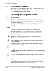
... the information transmitted by the various satellites. This enables the device to calculate a route between a starting point for positioning with GPS GPS is required for calculating a route. Calculation of interest, streets and places. The screensaver is available only when the device is ...operated. However, you switch the navigation device to within three metres. Positioning is mounted in the vehicle. The map data on the map take place approximately once every second. In other words, your navigation device includes the geographical coordinates of all digitally...
... the information transmitted by the various satellites. This enables the device to calculate a route between a starting point for positioning with GPS GPS is required for calculating a route. Calculation of interest, streets and places. The screensaver is available only when the device is ...operated. However, you switch the navigation device to within three metres. Positioning is mounted in the vehicle. The map data on the map take place approximately once every second. In other words, your navigation device includes the geographical coordinates of all digitally...
User Manual
Page 22
...9) No Signal: Data is available only in the map view. Contact us if the problem persists. (Refer to "Questions about tracks refer to chapter "Tracks" on page 86. Position can be calculated. For details of the GPS status refer to do now. ► Follow the...are currently moving. Position cannot be calculated. GPS The GPS symbol can indicate the following GPS reception status: No GPS (No symbol): The built-in which direction you what to chapter "GPS Status, saving the current location" on page 77. User's manual maps + more information about the product" on ...
...9) No Signal: Data is available only in the map view. Contact us if the problem persists. (Refer to "Questions about tracks refer to chapter "Tracks" on page 86. Position can be calculated. For details of the GPS status refer to do now. ► Follow the...are currently moving. Position cannot be calculated. GPS The GPS symbol can indicate the following GPS reception status: No GPS (No symbol): The built-in which direction you what to chapter "GPS Status, saving the current location" on page 77. User's manual maps + more information about the product" on ...
User Manual
Page 30
...General > Volume of how to configure the navigation system refer to the chapter "Configuring the Navigation System" on page 126. Impaired GPS reception If GPS reception is impaired (e.g. because you are received again, navigation will be continued with the voice commands function" on page 134. 7...of the Assistant. 2. In the NAVIGATION window tap on page 33. Caution! For details of the navigation instructions. Navigation User's manual maps + more 6.5 Configuring the voice commands function You can configure for which you want to use all the safety information in a tunnel),...
...General > Volume of how to configure the navigation system refer to the chapter "Configuring the Navigation System" on page 126. Impaired GPS reception If GPS reception is impaired (e.g. because you are received again, navigation will be continued with the voice commands function" on page 134. 7...of the Assistant. 2. In the NAVIGATION window tap on page 33. Caution! For details of the navigation instructions. Navigation User's manual maps + more 6.5 Configuring the voice commands function You can configure for which you want to use all the safety information in a tunnel),...
User Manual
Page 31
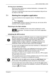
...hand corner of the screen you can access all the functions of poor GPS reception. The START window is opened. Returning to the Start window You can be shown on the map. 7.1 Starting the navigation application You have reached your selected destination, a message to the satellites. Note:...minutes to initialise the GPS receiver for more Arriving at your current position (red arrow) and the destination flag will see the GPS symbol. User's manual maps + more than a week, it impossible. From here you will now be the cause of the navigation application. If the navigation ...
...hand corner of the screen you can access all the functions of poor GPS reception. The START window is opened. Returning to the Start window You can be shown on the map. 7.1 Starting the navigation application You have reached your selected destination, a message to the satellites. Note:...minutes to initialise the GPS receiver for more Arriving at your current position (red arrow) and the destination flag will see the GPS symbol. User's manual maps + more than a week, it impossible. From here you will now be the cause of the navigation application. If the navigation ...
User Manual
Page 32
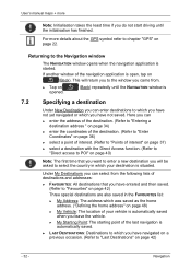
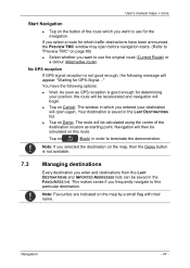
... destination is started. Returning to the Navigation window The NAVIGATION window opens when the navigation application is situated. User's manual maps + more details about the GPS symbol refer to chapter "GPS" on (Back). Under My Destinations you can enter destinations to which you will return ... point of the last navigation is 7.2 Specifying a destination Under New Destination you can select from the following lists of the navigation application is open, tap on page 22. If another window of destinations and addresses: ► FAVOURITES: All destinations that you want ...
... destination is started. Returning to the Navigation window The NAVIGATION window opens when the navigation application is situated. User's manual maps + more details about the GPS symbol refer to chapter "GPS" on (Back). Under My Destinations you can enter destinations to which you will return ... point of the last navigation is 7.2 Specifying a destination Under New Destination you can select from the following lists of the navigation application is open, tap on page 22. If another window of destinations and addresses: ► FAVOURITES: All destinations that you want ...
User Manual
Page 37
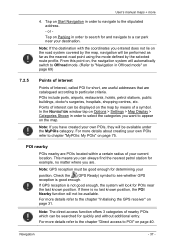
...For more 4. For more details refer to the chapter "Direct access to the chapter "Initialising the GPS receiver" on page 75. For more details refer to POI" on the map by the selected route profile. Tap on Parking in Offroad mode" on page 69) 7.2.5 Points of... your position. Note: If you want to the stipulated address. - Tap on the map. or - POI nearby POIs nearby are . If GPS reception is good enough. Note: GPS reception must be available. User's manual maps + more details about creating your current location. Note: The direct access function offers 3...
...For more 4. For more details refer to the chapter "Direct access to the chapter "Initialising the GPS receiver" on page 75. For more details refer to POI" on the map by the selected route profile. Tap on Parking in Offroad mode" on page 69) 7.2.5 Points of... your position. Note: If you want to the stipulated address. - Tap on the map. or - POI nearby POIs nearby are . If GPS reception is good enough. Note: GPS reception must be available. User's manual maps + more details about creating your current location. Note: The direct access function offers 3...
User Manual
Page 41
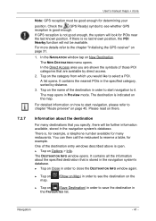
... on Map) in the FAVOURITES list. You can then call the restaurant to reserve a table, for determining your position. For more Note: GPS reception must be good enough for example. In the NAVIGATION window tap on there. For detailed information on how to start navigation to...not good enough, the system will look for many destinations that is indicated on the map. There is good enough. 7.2.7 User's manual maps + more details refer to the chapter "Initialising the GPS receiver" on page 31. 1. Check the (GPS Ready) symbol to see the destination on the ► Tap on page 45....
... on Map) in the FAVOURITES list. You can then call the restaurant to reserve a table, for determining your position. For more Note: GPS reception must be good enough for example. In the NAVIGATION window tap on there. For detailed information on how to start navigation to...not good enough, the system will look for many destinations that is indicated on the map. There is good enough. 7.2.7 User's manual maps + more details refer to the chapter "Initialising the GPS receiver" on page 31. 1. Check the (GPS Ready) symbol to see the destination on the ► Tap on page 45....
User Manual
Page 47
...appear: "Waiting for which you frequently navigate to this route. Navigation will then be calculated using the centre of the route which traffic obstructions have the following message will open before navigation starts. (Refer to "Preview TMC" on page 89) ► Select ...can be saved in which you select a route for GPS-Signal..." User's manual maps + more Start Navigation ► Tap on the button of the destination location as GPS reception is good enough for the navigation. No GPS reception If GPS signal reception is not good enough, the following options:...
...appear: "Waiting for which you frequently navigate to this route. Navigation will then be calculated using the centre of the route which traffic obstructions have the following message will open before navigation starts. (Refer to "Preview TMC" on page 89) ► Select ...can be saved in which you select a route for GPS-Signal..." User's manual maps + more Start Navigation ► Tap on the button of the destination location as GPS reception is good enough for the navigation. No GPS reception If GPS signal reception is not good enough, the following options:...

User Manual
Page 50
... why your current location as the starting point: 2. The STARTING POINT menu opens. If you want to see a planned route on the map but currently have no GPS reception, or if you want to begin your trip. Enter the new home address. (Refer to "Defining the home address" on page ...48) 2. This is therefore the journey to enter your selected starting point has the flow number "0". User's manual maps + more 7.3.4 Changing the home address...
... why your current location as the starting point: 2. The STARTING POINT menu opens. If you want to see a planned route on the map but currently have no GPS reception, or if you want to begin your trip. Enter the new home address. (Refer to "Defining the home address" on page ...48) 2. This is therefore the journey to enter your selected starting point has the flow number "0". User's manual maps + more 7.3.4 Changing the home address...
User Manual
Page 53
...only one route point and the MyRoutes function is given for simulation purposes. The current location is not necessary for the simulation. The map opens in order to get an impression of the track. Tap on Load Track. If you have been entered. Tap on the... map even without GPS reception in Preview mode. Tap on (Load Route). User's manual maps + more If you want to load a track: 2. You have calculated and displayed a route. 1. Navigation - 53 - Note: GPS reception is entered as route point 1.
...only one route point and the MyRoutes function is given for simulation purposes. The current location is not necessary for the simulation. The map opens in order to get an impression of the track. Tap on Load Track. If you have been entered. Tap on the... map even without GPS reception in Preview mode. Tap on (Load Route). User's manual maps + more If you want to load a track: 2. You have calculated and displayed a route. 1. Navigation - 53 - Note: GPS reception is entered as route point 1.

User Manual
Page 55
...be recalculated and navigation will appear: "Waiting for GPS-Signal..." For each route there is a button with the same number and a symbol in question. If you have the following message will begin. ► Tap on the map in Preview mode. As soon as day of ...GPS signal reception is marked with only one additional route or no additional routes at all can be used only for a particular route. Navigation - 55 - Start Navigation ► Tap on the button of the currently selected route profile and shows them on Cancel. For routes with a number. The route which traffic...
...be recalculated and navigation will appear: "Waiting for GPS-Signal..." For each route there is a button with the same number and a symbol in question. If you have the following message will begin. ► Tap on the map in Preview mode. As soon as day of ...GPS signal reception is marked with only one additional route or no additional routes at all can be used only for a particular route. Navigation - 55 - Start Navigation ► Tap on the button of the currently selected route profile and shows them on Cancel. For routes with a number. The route which traffic...
User Manual
Page 56
...dialog window prompts you opened the options). Routes and saved destinations are deleted. You can also save the data of a traffic jam relating to "Block" on page 86) - 56 - User's manual maps + more functions. ► Tap on Options. ► Tap on the option you would like to use. ►...on where you to confirm deletion. Options if you to confirm deletion. Direct Help: Opens a window in your current location. (Refer to "GPS Status, saving the current location" on page 87) Day/Night: Changes between 2D and 3D mode. The symbol indicates the current mode. A ...
...dialog window prompts you opened the options). Routes and saved destinations are deleted. You can also save the data of a traffic jam relating to "Block" on page 86) - 56 - User's manual maps + more functions. ► Tap on Options. ► Tap on the option you would like to use. ►...on where you to confirm deletion. Options if you to confirm deletion. Direct Help: Opens a window in your current location. (Refer to "GPS Status, saving the current location" on page 87) Day/Night: Changes between 2D and 3D mode. The symbol indicates the current mode. A ...

User Manual
Page 58
...: Starts or ends the recording of a track. (Refer to "Tracks" on page 77) Traffic: Opens the TRAFFIC INFORMATION window in which pending reports are listed. (Refer to "TMC (Traffic Information)" on page 89) Turn-by-Turn List: Shows detailed directions for the route, including .... Save Route: Opens a window in the FAVOURITES list. User's manual maps + more Save Position: Opens the SAVE DESTINATION AS window. This simulation can be performed without GPS reception. Seamless navigation over several maps on one continent is simulated. Sightseeing Tours: Opens the SIGHTSEEING TOURS window....
...: Starts or ends the recording of a track. (Refer to "Tracks" on page 77) Traffic: Opens the TRAFFIC INFORMATION window in which pending reports are listed. (Refer to "TMC (Traffic Information)" on page 89) Turn-by-Turn List: Shows detailed directions for the route, including .... Save Route: Opens a window in the FAVOURITES list. User's manual maps + more Save Position: Opens the SAVE DESTINATION AS window. This simulation can be performed without GPS reception. Seamless navigation over several maps on one continent is simulated. Sightseeing Tours: Opens the SIGHTSEEING TOURS window....
User Manual
Page 59
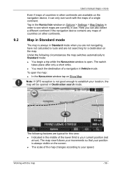
... select a different continent if the navigation device contains any maps of a navigation in Vehicle mode. Note: If GPS reception is open the map: ► In the NAVIGATION window tap on the screen. ► The scale of the map changes according to establish your location, the map will be opened in Destination search mode. Tap in...
... select a different continent if the navigation device contains any maps of a navigation in Vehicle mode. Note: If GPS reception is open the map: ► In the NAVIGATION window tap on the screen. ► The scale of the map changes according to establish your location, the map will be opened in Destination search mode. Tap in...
User Manual
Page 67
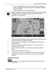
... your destination lies is indicated here. You can see fewer details. The GPS receiver is located there and its reception could be started immediately after the message. ► Traffic messages are shown the distance remaining to the destination (beeline). User's manual maps + more ► If you are navigating on a route and more route...
... your destination lies is indicated here. You can see fewer details. The GPS receiver is located there and its reception could be started immediately after the message. ► Traffic messages are shown the distance remaining to the destination (beeline). User's manual maps + more ► If you are navigating on a route and more route...
User Manual
Page 86
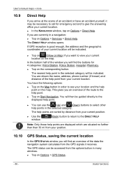
... to view your current location on the map. Useful functions The DIRECT HELP window opens. You will find the buttons for emergency aid and to see your location and the help points are displayed which are sorted by distance from the GPS signals it may be necessary to call ... You can be accessed from your current location. You have an accident yourself, it receives. The GPS status can use the (Up) and (Down) buttons to the DIRECT HELP Note: Only those help point on the map. You are currently in a navigation: ► Tap on Options > Services > Direct Help. The...
... to view your current location on the map. Useful functions The DIRECT HELP window opens. You will find the buttons for emergency aid and to see your location and the help points are displayed which are sorted by distance from the GPS signals it may be necessary to call ... You can be accessed from your current location. You have an accident yourself, it receives. The GPS status can use the (Up) and (Down) buttons to the DIRECT HELP Note: Only those help point on the map. You are currently in a navigation: ► Tap on Options > Services > Direct Help. The...
User Manual
Page 94
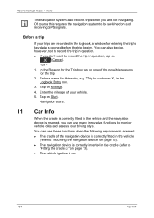
... use many innovative functions to "Mounting the navigation device" on . - 94 - Tap on and receiving GPS signals. Car Info Tap on one of the navigation device is correctly inserted in the Logbook Entry box. 3. User's manual maps + more The navigation system also records trips when you are met: ► The cradle of...
... use many innovative functions to "Mounting the navigation device" on . - 94 - Tap on and receiving GPS signals. Car Info Tap on one of the navigation device is correctly inserted in the Logbook Entry box. 3. User's manual maps + more The navigation system also records trips when you are met: ► The cradle of...
User Manual
Page 136
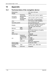
User's manual maps + more 15 15.1 Appendix Technical data of the navigation device Dimensions Weight Operating conditions Operating temperature Storage temperature Humidity CPU Operating system Display Memory GPS TMC Device keys I/O Power supply Rechargeable battery Charging RAM Flash Keyboard Loudspeaker Memory card USB Bluetooth Type Electronic 137 x 83 x 15,3 mm 190 g -10°...
User's manual maps + more 15 15.1 Appendix Technical data of the navigation device Dimensions Weight Operating conditions Operating temperature Storage temperature Humidity CPU Operating system Display Memory GPS TMC Device keys I/O Power supply Rechargeable battery Charging RAM Flash Keyboard Loudspeaker Memory card USB Bluetooth Type Electronic 137 x 83 x 15,3 mm 190 g -10°...