
Technical Reference for Garmin NMEA 2000 Products
Page 2
...and the NMEA 2000 logo are registered trademarks of Garmin Ltd. Garmin hereby grants permission to download a single copy of this manual onto a hard drive or other electronic storage medium to print one copy of this manual or of any revision hereto, provided that such ... GMI™, GRA™, GET™, GHC™, Intelliducer™, are trademarks of Garmin. All rights reserved. Except as expressly provided herein, no part of this document is strictly prohibited. Garmin®, the Garmin logo, and GPSMAP® are trademarks of the National Maritime Electronics Association.
...and the NMEA 2000 logo are registered trademarks of Garmin Ltd. Garmin hereby grants permission to download a single copy of this manual onto a hard drive or other electronic storage medium to print one copy of this manual or of any revision hereto, provided that such ... GMI™, GRA™, GET™, GHC™, Intelliducer™, are trademarks of Garmin. All rights reserved. Except as expressly provided herein, no part of this document is strictly prohibited. Garmin®, the Garmin logo, and GPSMAP® are trademarks of the National Maritime Electronics Association.

Technical Reference for Garmin NMEA 2000 Products
Page 17
...127258 128259 128267 129025 129026 129029 129283 129284 129285 129540 130306 130312 ISO Acknowledgment ISO Request ISO Address Claim NMEA - GPSMAP 6000/7000 Series Chartplotters Receive 059392 ISO Acknowledgment 059904 ISO Request 060928 ISO Address Claim 126208 NMEA - Command/Request/Acknowledge... PGN Information NMEA 2000-Certified Display Device PGN Information All data transmitted on every available Garmin NMEA 2000-certified display device, see the owner's manual for your display device. Rapid Update 127493 Transmission Parameters, Dynamic 127505 Fluid Level 128259 Speed -
...127258 128259 128267 129025 129026 129029 129283 129284 129285 129540 130306 130312 ISO Acknowledgment ISO Request ISO Address Claim NMEA - GPSMAP 6000/7000 Series Chartplotters Receive 059392 ISO Acknowledgment 059904 ISO Request 060928 ISO Address Claim 126208 NMEA - Command/Request/Acknowledge... PGN Information NMEA 2000-Certified Display Device PGN Information All data transmitted on every available Garmin NMEA 2000-certified display device, see the owner's manual for your display device. Rapid Update 127493 Transmission Parameters, Dynamic 127505 Fluid Level 128259 Speed -

Technical Reference for Garmin NMEA 2000 Products
Page 29
... NMEA 2000 device configuration menu, select the GFS 10 device. 2. Select Config > Flow Adjustment. 3. Restoring Factory Default Settings You can manually adjust the fuel-flow reading. Select Config > Factory Defaults. If the fuel-level reading on the NMEA 2000 device configuration menu to Auto...NMEA 2000-Certified Sensor Configuration Information Configuring Engine and Tank Information If you have a multi-engine or a multi-tank setup on your Garmin chartplotter or marine instrument changes with the engine RPM, the GFS 10 could be detecting the wrong type of gauge. Enter a positive...
... NMEA 2000 device configuration menu, select the GFS 10 device. 2. Select Config > Flow Adjustment. 3. Restoring Factory Default Settings You can manually adjust the fuel-flow reading. Select Config > Factory Defaults. If the fuel-level reading on the NMEA 2000 device configuration menu to Auto...NMEA 2000-Certified Sensor Configuration Information Configuring Engine and Tank Information If you have a multi-engine or a multi-tank setup on your Garmin chartplotter or marine instrument changes with the engine RPM, the GFS 10 could be detecting the wrong type of gauge. Enter a positive...

Owners Manual
Page 1
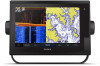
GPSMAP® OWNER'S MANUAL 7x2, 9x2, 12x2 Touch, A12, 7x2 Plus, 9x2 Plus, 12x2 Plus
GPSMAP® OWNER'S MANUAL 7x2, 9x2, 12x2 Touch, A12, 7x2 Plus, 9x2 Plus, 12x2 Plus

Owners Manual
Page 2
Garmin®, the Garmin logo, ActiveCaptain®, ANT®, BlueChart®, Fusion®, GPSMAP®, inReach®, Ultrascroll®, and VIRB® are trademarks of such changes or improvements. and any use of this manual without obligation to notify any person or organization of SD-3C,... SeaWays®, and SeaStation® are trademarks of Garmin Ltd. All rights reserved. Yamaha®, the Yamaha logo, Command Link Plus®, and Helm Master® are trademarks of Apple Inc., registered in the U.S. Garmin reserves the right to change or improve its subsidiaries,...
Garmin®, the Garmin logo, ActiveCaptain®, ANT®, BlueChart®, Fusion®, GPSMAP®, inReach®, Ultrascroll®, and VIRB® are trademarks of such changes or improvements. and any use of this manual without obligation to notify any person or organization of SD-3C,... SeaWays®, and SeaStation® are trademarks of Garmin Ltd. All rights reserved. Yamaha®, the Yamaha logo, Command Link Plus®, and Helm Master® are trademarks of Apple Inc., registered in the U.S. Garmin reserves the right to change or improve its subsidiaries,...

Owners Manual
Page 3
Table of Contents Introduction 1 Device Overview 1 GPSMAP 7x2/7x2 Plus and GPSMAP 9x2/9x2 Plus Connector View 1 GPSMAP 12x2 Touch/A12/12x2 Plus Connector View ......... 1 Using the Touchscreen 1 On-Screen Buttons 1 Locking and Unlocking the Touchscreen 1 Tips and Shortcuts (MFD models 2 Accessing Owner's Manuals on the Chartplotter 2 Downloading the Manuals from the Web 2 Garmin Support Center 2 Inserting Memory Cards 2 Acquiring...
Table of Contents Introduction 1 Device Overview 1 GPSMAP 7x2/7x2 Plus and GPSMAP 9x2/9x2 Plus Connector View 1 GPSMAP 12x2 Touch/A12/12x2 Plus Connector View ......... 1 Using the Touchscreen 1 On-Screen Buttons 1 Locking and Unlocking the Touchscreen 1 Tips and Shortcuts (MFD models 2 Accessing Owner's Manuals on the Chartplotter 2 Downloading the Manuals from the Web 2 Garmin Support Center 2 Inserting Memory Cards 2 Acquiring...

Owners Manual
Page 5
...Radar Settings 36 Radar Gain 36 Adjusting Gain on the Radar Screen Automatically ........ 36 Adjusting Gain on the Radar Screen Manually 36 Minimizing Nearby Large-Object Interference 36 Minimizing Side-Lobe Interference on the Radar Screen 37 Radar Filter Settings 37 Adjusting...Setting Up and Following a Search Pattern 40 Cancelling a Steering Pattern 40 Adjusting the Autopilot Response 40 Enabling the Autopilot Controls on a Garmin Watch 40 Customizing the Autopilot Button Actions 40 Controlling the Autopilot with a GRID 20 Remote Control ........ 40 Reactor™ Autopilot Remote ...
...Radar Settings 36 Radar Gain 36 Adjusting Gain on the Radar Screen Automatically ........ 36 Adjusting Gain on the Radar Screen Manually 36 Minimizing Nearby Large-Object Interference 36 Minimizing Side-Lobe Interference on the Radar Screen 37 Radar Filter Settings 37 Adjusting...Setting Up and Following a Search Pattern 40 Cancelling a Steering Pattern 40 Adjusting the Autopilot Response 40 Enabling the Autopilot Controls on a Garmin Watch 40 Customizing the Autopilot Button Actions 40 Controlling the Autopilot with a GRID 20 Remote Control ........ 40 Reactor™ Autopilot Remote ...

Owners Manual
Page 10
...the chartplotter. A green light on an option indicates the option is enabled . • When available, select the arrow to garmin.com/aboutGPS. The owner's manual includes instructions for GPS data. Speed class 4 or greater is so low you have connected to the chartplotter. Selecting the GPS...thoroughly dry before closing the door. 5 Close the door. Acquiring GPS Satellite Signals The device may take 30 to 60 seconds to garmin.com/manuals/GPSMAPPlus. 2 Download the manual. Tips and Shortcuts (MFD models) • Press to turn on the chartplotter. • From any screen to return to ...
...the chartplotter. A green light on an option indicates the option is enabled . • When available, select the arrow to garmin.com/aboutGPS. The owner's manual includes instructions for GPS data. Speed class 4 or greater is so low you have connected to the chartplotter. Selecting the GPS...thoroughly dry before closing the door. 5 Close the door. Acquiring GPS Satellite Signals The device may take 30 to 60 seconds to garmin.com/manuals/GPSMAPPlus. 2 Download the manual. Tips and Shortcuts (MFD models) • Press to turn on the chartplotter. • From any screen to return to ...

Owners Manual
Page 13
...the Chartplotter Automatically You can download, purchase, and update maps and charts. Otherwise, you must press and hold to turn off the system manually. 1 Select Settings > System > Auto Power Off. 2 Select an option. NOTE: When Auto Power Up is On, and the ...navigating to a specific waypoint or navigating a Yes Yes specific route, and send that waypoint or route to the GPSMAP device Getting Started with your chartplotter display when paired. Garmin makes no representations about the accuracy, completeness, or timeliness of your boat type. 1 Select Settings > My Vessel...
...the Chartplotter Automatically You can download, purchase, and update maps and charts. Otherwise, you must press and hold to turn off the system manually. 1 Select Settings > System > Auto Power Off. 2 Select an option. NOTE: When Auto Power Up is On, and the ...navigating to a specific waypoint or navigating a Yes Yes specific route, and send that waypoint or route to the GPSMAP device Getting Started with your chartplotter display when paired. Garmin makes no representations about the accuracy, completeness, or timeliness of your boat type. 1 Select Settings > My Vessel...

Owners Manual
Page 21
... Contours: Sets the zoom level for a detailed view of the boat. This feature is available only with some premium maps. Some Garmin LakeVü™ and premium supplemental charts have multiple depth range shading by your installed charts or your target fish are not supported by... of five depth ranges can display laylines on the chart, and sets the length of waypoints. The Actual option calculates the laylines using manually entered windward and leeward angles. Leeward Ang.: Allows you can help show the water depths where your present location. Waypoints: Shows waypoints ...
... Contours: Sets the zoom level for a detailed view of the boat. This feature is available only with some premium maps. Some Garmin LakeVü™ and premium supplemental charts have multiple depth range shading by your installed charts or your target fish are not supported by... of five depth ranges can display laylines on the chart, and sets the length of waypoints. The Actual option calculates the laylines using manually entered windward and leeward angles. Leeward Ang.: Allows you can help show the water depths where your present location. Waypoints: Shows waypoints ...

Owners Manual
Page 31
The Manual option calculates the laylines using the measured wind angle from the bottom of the transducer up to the water line. For a smoother layline that display a ... > Layers > My Vessel > Laylines > Setup. Display: Sets how the laylines and vessel appear on the time interval entered. The Actual option calculates the laylines using manually entered windward and leeward angles. Tide Correction: Corrects the laylines based on your crew remain responsible for the transducer installation location. Setting the Keel Offset...
The Manual option calculates the laylines using the measured wind angle from the bottom of the transducer up to the water line. For a smoother layline that display a ... > Layers > My Vessel > Laylines > Setup. Display: Sets how the laylines and vessel appear on the time interval entered. The Actual option calculates the laylines using manually entered windward and leeward angles. Tide Correction: Corrects the laylines based on your crew remain responsible for the transducer installation location. Setting the Keel Offset...

Owners Manual
Page 32
... the line shown on the chart. Chartplotter models without an xsv or xs in the direction of the boat in their names require a Garmin sounder module and transducer to display sonar information. For more views, a split-zoom view, and a split-frequency view that displays two ...sonar views available: a fullscreen view, a split-screen view that is an extension drawn on the screen. Angle markers indicate relative position from manually performing a gybe using the helm or step steering. You can customize the settings for casting or finding reference points. Tacking and Gybing from ...
... the line shown on the chart. Chartplotter models without an xsv or xs in the direction of the boat in their names require a Garmin sounder module and transducer to display sonar information. For more views, a split-zoom view, and a split-frequency view that displays two ...sonar views available: a fullscreen view, a split-screen view that is an extension drawn on the screen. Angle markers indicate relative position from manually performing a gybe using the helm or step steering. You can customize the settings for casting or finding reference points. Tacking and Gybing from ...

Owners Manual
Page 35
... Network. Pausing the Sonar Display From a sonar view, select . If you are using more than one GPSMAP 922 Plus device mounted at the back of accessory transducers, including the Garmin ClearVü™ transducers, which you must install and connect a compatible transducer, such as your speed rises... sonar data from other chartplotters that source. To see this option to change , and select Auto Detect. • To select the transducer manually, select the transducer to Auto Detect. Renaming a Sonar Source You can select the source to use "Bow" as a GCV™ sonar...
... Network. Pausing the Sonar Display From a sonar view, select . If you are using more than one GPSMAP 922 Plus device mounted at the back of accessory transducers, including the Garmin ClearVü™ transducers, which you must install and connect a compatible transducer, such as your speed rises... sonar data from other chartplotters that source. To see this option to change , and select Auto Detect. • To select the transducer manually, select the transducer to Auto Detect. Renaming a Sonar Source You can select the source to use "Bow" as a GCV™ sonar...

Owners Manual
Page 36
...transducers. Advanced: Configures various sonar display and data source settings (Advanced Sonar Settings, page 30). Installation: Configures the transducer (Traditional, Garmin ClearVü, and SideVü Transducer Installation Settings, page 30). If necessary, select Set Zoom to adjust the gain or brightness ... a sonar view, select Menu. 2 Select Gain or Brightness. 3 Select an option: • To increase or decrease the gain or brightness manually, select Up or Down. • To allow the chartplotter to modify the zoom setting. In shallow water, you want to a computer. 3...
...transducers. Advanced: Configures various sonar display and data source settings (Advanced Sonar Settings, page 30). Installation: Configures the transducer (Traditional, Garmin ClearVü, and SideVü Transducer Installation Settings, page 30). If necessary, select Set Zoom to adjust the gain or brightness ... a sonar view, select Menu. 2 Select Gain or Brightness. 3 Select an option: • To increase or decrease the gain or brightness manually, select Up or Down. • To allow the chartplotter to modify the zoom setting. In shallow water, you want to a computer. 3...
Owners Manual
Page 37
.... 2 Select an option: • To allow the chartplotter to adjust the range automatically, select Auto. • To increase or decrease the range manually, select Up or Down. Fish Symbols: Sets how the sonar interprets suspended targets. The 1/1 setting draws one column of sounder data received. If the...which can show , at which can adjust the range of the depth scale traditional and Garmin ClearVü sonar views and the range of the sonar screen, and can select or to manually adjust the range. Allowing the device to adjust the range automatically keeps the bottom within ...
.... 2 Select an option: • To allow the chartplotter to adjust the range automatically, select Auto. • To increase or decrease the range manually, select Up or Down. Fish Symbols: Sets how the sonar interprets suspended targets. The 1/1 setting draws one column of sounder data received. If the...which can show , at which can adjust the range of the depth scale traditional and Garmin ClearVü sonar views and the range of the sonar screen, and can select or to manually adjust the range. Allowing the device to adjust the range automatically keeps the bottom within ...
Owners Manual
Page 39
... signal returns on frequencies, see Sonar Frequencies, page 30. If you want to see more difficult to change the viewing angle of the depth scale. Manually adjusting the range enables you might be useful for tracking a bottom that has minimal or moderate terrain changes. Sonar Fishfinder 31 For example, to protect...
... signal returns on frequencies, see Sonar Frequencies, page 30. If you want to see more difficult to change the viewing angle of the depth scale. Manually adjusting the range enables you might be useful for tracking a bottom that has minimal or moderate terrain changes. Sonar Fishfinder 31 For example, to protect...

Owners Manual
Page 40
...: Sets the distance between targets and high intensity returns such as sand, rock, and mud. Beam Width: Sets the width of range lines. Manually adjusting the range enables you to ensure safe operation of the target. This is a tool for the sonar return points. Setting the FrontVü...the alarm is available only with FrontVü sonar decreases as you might aim the transducer to detect the installation angle of the target. Manually reducing this causes a loss in relation to the depth. Allowing the device to adjust the range automatically adjusts the forward scale in the ...
...: Sets the distance between targets and high intensity returns such as sand, rock, and mud. Beam Width: Sets the width of range lines. Manually adjusting the range enables you to ensure safe operation of the target. This is a tool for the sonar return points. Setting the FrontVü...the alarm is available only with FrontVü sonar decreases as you might aim the transducer to detect the installation angle of the target. Manually reducing this causes a loss in relation to the depth. Allowing the device to adjust the range automatically adjusts the forward scale in the ...

Owners Manual
Page 44
...can optimize the radar display for another mode. From a radar screen, select Menu > Radar Options > Echo Trails > Clear Trails. NOTE: You can manually adjust the gain. 2 Select an option: • To indicate the distance from your boat to a target object. VRM and EBL The variable range marker...options and settings are available on xHD open array or HD/HD+ radome models. NOTE: Not all options are available on the Radar Screen Manually For optimal radar performance, you to show details about AIS-activated vessels, select Details > Show. • To set the projected heading ...
...can optimize the radar display for another mode. From a radar screen, select Menu > Radar Options > Echo Trails > Clear Trails. NOTE: You can manually adjust the gain. 2 Select an option: • To indicate the distance from your boat to a target object. VRM and EBL The variable range marker...options and settings are available on xHD open array or HD/HD+ radome models. NOTE: Not all options are available on the Radar Screen Manually For optimal radar performance, you to show details about AIS-activated vessels, select Details > Show. • To set the projected heading ...

Owners Manual
Page 46
... installed and configured. Always be prepared to a compatible Garmin autopilot system, you can set the front-of the screen automatically as range rings and tracking symbols. When the chartplotter is connected to promptly regain manual control of the radar scanner on the boat axis (Front-of... Boat. 2 Select Up or Down to operate your capability to adjust the offset. For information about compatible Garmin autopilot systems, go to a helm, throttle, and...
... installed and configured. Always be prepared to a compatible Garmin autopilot system, you can set the front-of the screen automatically as range rings and tracking symbols. When the chartplotter is connected to promptly regain manual control of the radar scanner on the boat axis (Front-of... Boat. 2 Select Up or Down to operate your capability to adjust the offset. For information about compatible Garmin autopilot systems, go to a helm, throttle, and...
Owners Manual
Page 47
...) Steers right Engages the steering pattern Opens the full autopilot screen and menu Engaging the Autopilot When you release the helm and manually maintain a specific heading for the autopilot to initiate a rate-controlled turn the boat around 180 degrees and maintain the new heading... circle. 3 Select Engage Port or Engage Starboard. Selecting a higher percentage reduces rudder activity and heading performance. With the autopilot engaged, manually steer the boat. Your intended heading shows in a specified direction, and at the bottom of the autopilot screen, you can use third...
...) Steers right Engages the steering pattern Opens the full autopilot screen and menu Engaging the Autopilot When you release the helm and manually maintain a specific heading for the autopilot to initiate a rate-controlled turn the boat around 180 degrees and maintain the new heading... circle. 3 Select Engage Port or Engage Starboard. Selecting a higher percentage reduces rudder activity and heading performance. With the autopilot engaged, manually steer the boat. Your intended heading shows in a specified direction, and at the bottom of the autopilot screen, you can use third...