
Owner s Manual
Page 1
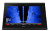
GPSMAP® 7400/7600 Series Owner's Manual February 2016 190-01841-00_0D
GPSMAP® 7400/7600 Series Owner's Manual February 2016 190-01841-00_0D

Owner s Manual
Page 2
...174;, NMEA 2000®, and the NMEA 2000 logo are trademarks of Garmin. Garmin®, the Garmin logo, BlueChart®, g2 Vision®, GPSMAP®, Ultrascroll®, and VIRB® are the property of Garmin Ltd. All other countries. SiriusXM® is a registered trademark of ...Microsoft Corporation in part, without the written consent of Garmin Ltd. Under the copyright laws, this manual without the express ...
...174;, NMEA 2000®, and the NMEA 2000 logo are trademarks of Garmin. Garmin®, the Garmin logo, BlueChart®, g2 Vision®, GPSMAP®, Ultrascroll®, and VIRB® are the property of Garmin Ltd. All other countries. SiriusXM® is a registered trademark of ...Microsoft Corporation in part, without the written consent of Garmin Ltd. Under the copyright laws, this manual without the express ...

Owner s Manual
Page 3
... 1 Using the Touchscreen 1 On-Screen Buttons 1 Tips and Shortcuts 1 Locking the Touchscreen 1 Accessing Owner's Manuals on the Chartplotter 1 Downloading the Manuals 1 Getting More Information 1 Inserting Memory Cards 1 Software Update 2 Loading the New Software on a Memory Card...Navigation Chart 6 Viewing Aerial Photos of Landmarks 6 Garmin Quickdraw™ Contours Mapping 6 Mapping a Body of Water Using the Garmin Quickdraw Contours Feature 6 Adding a Label to a Garmin Quickdraw Contours Map ......... 6 Garmin Quickdraw Contours Settings 6 Automatic Identification System 7 ...
... 1 Using the Touchscreen 1 On-Screen Buttons 1 Tips and Shortcuts 1 Locking the Touchscreen 1 Accessing Owner's Manuals on the Chartplotter 1 Downloading the Manuals 1 Getting More Information 1 Inserting Memory Cards 1 Software Update 2 Loading the New Software on a Memory Card...Navigation Chart 6 Viewing Aerial Photos of Landmarks 6 Garmin Quickdraw™ Contours Mapping 6 Mapping a Body of Water Using the Garmin Quickdraw Contours Feature 6 Adding a Label to a Garmin Quickdraw Contours Map ......... 6 Garmin Quickdraw Contours Settings 6 Automatic Identification System 7 ...

Owner s Manual
Page 7
... may be displayed on some screens and functions. Downloading the Manuals You can download software and chart updates. Introduction 1 Getting More Information If you to www.garmin.com/manuals/GPSMAP7400-7600. The Garmin® website at the selected location Removes the last turn ...the Chartplotter 1 Select Info > Owner's Manual. 2 Select a manual. 3 Select Open. TIP: To quickly open this web page, scan this code: 2 Download the manual. There is also contact information to Garmin support should you can get the latest owner's manual and translations of the item Creates a ...
... may be displayed on some screens and functions. Downloading the Manuals You can download software and chart updates. Introduction 1 Getting More Information If you to www.garmin.com/manuals/GPSMAP7400-7600. The Garmin® website at the selected location Removes the last turn ...the Chartplotter 1 Select Info > Owner's Manual. 2 Select a manual. 3 Select Open. TIP: To quickly open this web page, scan this code: 2 Download the manual. There is also contact information to Garmin support should you can get the latest owner's manual and translations of the item Creates a ...

Owner s Manual
Page 8
... instructions to maintain a consistent appearance. When the chartplotter loses satellite signals, disappears and a flashing question mark appears over on all displays in this manual. All of the options along the right of the screen provide quick access to the terms. 5 Select Download. 6 Select Run. 7 Select...Software on a Memory Card 1 Insert a memory card into the card slot on the computer. 2 Go to www.garmin.com/support/software/marine.html. 3 Select Download next to GPSMAP Series with SD Card. 4 Read and agree to the main features of as cruising or docking. When the chartplotter...
... instructions to maintain a consistent appearance. When the chartplotter loses satellite signals, disappears and a flashing question mark appears over on all displays in this manual. All of the options along the right of the screen provide quick access to the terms. 5 Select Download. 6 Select Run. 7 Select...Software on a Memory Card 1 Insert a memory card into the card slot on the computer. 2 Go to www.garmin.com/support/software/marine.html. 3 Select Download next to GPSMAP Series with SD Card. 4 Read and agree to the main features of as cruising or docking. When the chartplotter...

Owner s Manual
Page 15
... laylines and vessel appear on spot soundings and sets a dangerous depth. From the Fish Eye 3D chart view, select Menu. When using manually entered windward and leeward angles. NOTE: The offshore Fishing chart is very shallow water. Chart Appearance: See Chart Appearance Settings, page 9. ...Chart Appearance Settings You can display laylines on the navigation chart. Each setting is based on the chart or 3D chart view. The Manual option calculates the laylines using Go To, a direct course and a corrected course may be installed at different zoom levels. NOTE: Mariner...
... laylines and vessel appear on spot soundings and sets a dangerous depth. From the Fish Eye 3D chart view, select Menu. When using manually entered windward and leeward angles. NOTE: The offshore Fishing chart is very shallow water. Chart Appearance: See Chart Appearance Settings, page 9. ...Chart Appearance Settings You can display laylines on the navigation chart. Each setting is based on the chart or 3D chart view. The Manual option calculates the laylines using Go To, a direct course and a corrected course may be installed at different zoom levels. NOTE: Mariner...

Owner s Manual
Page 21
...race timer with the official race timer. From the navigation chart, select Menu > Sailing > Laylines. Synchronizing User Data Across the Garmin Marine Network NOTICE Before you synchronize the user data across all models. By default, the start line, the device measures your speed,...the Sailing SmartMode screen and the navigation chart. 2 When necessary, select Sync to the chartplotter. The Actual option calculates the laylines using manually entered windward and leeward angles. Deleting All Saved Waypoints, Routes, and Tracks Select Info > User Data > Clear User Data > All...
...race timer with the official race timer. From the navigation chart, select Menu > Sailing > Laylines. Synchronizing User Data Across the Garmin Marine Network NOTICE Before you synchronize the user data across all models. By default, the start line, the device measures your speed,...the Sailing SmartMode screen and the navigation chart. 2 When necessary, select Sync to the chartplotter. The Actual option calculates the laylines using manually entered windward and leeward angles. Deleting All Saved Waypoints, Routes, and Tracks Select Info > User Data > Clear User Data > All...

Owner s Manual
Page 22
...sensor installed. 1 Engage wind hold (Engaging Wind Hold, page 16). 2 Select Menu > Tack/Gybe. 3 Select Tack or Gybe. Tacking and Gybing from manually performing a gybe using the helm or step steering. Enabling the Gybe Inhibitor NOTE: The gybe inhibitor does not prevent you must connect a NMEA 2000 or... NMEA 0183 wind sensor to the autopilot. Enter a positive number to an optional Garmin sounder module and a transducer, your boat through a tack or gybe. In addition to heading hold, you can enable the wind hold type,...
...sensor installed. 1 Engage wind hold (Engaging Wind Hold, page 16). 2 Select Menu > Tack/Gybe. 3 Select Tack or Gybe. Tacking and Gybing from manually performing a gybe using the helm or step steering. Enabling the Gybe Inhibitor NOTE: The gybe inhibitor does not prevent you must connect a NMEA 2000 or... NMEA 0183 wind sensor to the autopilot. Enter a positive number to an optional Garmin sounder module and a transducer, your boat through a tack or gybe. In addition to heading hold, you can enable the wind hold type,...

Owner s Manual
Page 25
... be configured on the screen at the front of the transducer on the screen using the GPSMAP 7407xsv mounted at the selected location. 3 Select another sonar view, select Sonar Setup > ... the brightness for the SideVü sonar view. This causes a loss in sonar module. Manually adjusting the range enables you will change the source. 2 Select Menu > Sonar Setup > ...transducers. Adjusting the Level of the various traditional and DownVü sonar views are mounted on the Garmin Marine Network. Adjusting the Range of the width scale for DownVü transducers. 2 Select a ...
... be configured on the screen at the front of the transducer on the screen using the GPSMAP 7407xsv mounted at the selected location. 3 Select another sonar view, select Sonar Setup > ... the brightness for the SideVü sonar view. This causes a loss in sonar module. Manually adjusting the range enables you will change the source. 2 Select Menu > Sonar Setup > ...transducers. Adjusting the Level of the various traditional and DownVü sonar views are mounted on the Garmin Marine Network. Adjusting the Range of the width scale for DownVü transducers. 2 Select a ...

Owner s Manual
Page 26
...Zoom In or Zoom Out to all transducers. Setting the scroll speed on the chartplotter, sounder modules, and transducer being used to manually adjust the range. Bottom definition and thermocline definition can be used . Some sonar black boxes and transducers also provide the ability to.... Setting the Scroll Speed You can select Select to adjust the range automatically, select Auto. • To increase or decrease the range manually, select Up or Down. For most situations, the Fast option provides a good balance between a quickly scrolling image and targets that show target...
...Zoom In or Zoom Out to all transducers. Setting the scroll speed on the chartplotter, sounder modules, and transducer being used to manually adjust the range. Bottom definition and thermocline definition can be used . Some sonar black boxes and transducers also provide the ability to.... Setting the Scroll Speed You can select Select to adjust the range automatically, select Auto. • To increase or decrease the range manually, select Up or Down. For most situations, the Fast option provides a good balance between a quickly scrolling image and targets that show target...

Owner s Manual
Page 27
.... 1 From a RealVü sonar view, select Menu > Sweep Speed. 2 Select an option. If the device automatically detected your transducer, this setting to the Points and manually set the transducer type to help eliminate fields of the fullscreen sonar view. In deeper water, you are close to Panoptix transducers. Point Colors: Sets...
.... 1 From a RealVü sonar view, select Menu > Sweep Speed. 2 Select an option. If the device automatically detected your transducer, this setting to the Points and manually set the transducer type to help eliminate fields of the fullscreen sonar view. In deeper water, you are close to Panoptix transducers. Point Colors: Sets...
Owner s Manual
Page 32
...Automatically The automatic gain setting for use , the gain setting configured for each radar mode is refreshed every few seconds. This image can manually adjust the gain. Minimizing Side-Lobe Interference on the Radar screen. NOTE: Depending upon the radar in use in a semi-circular pattern... Reducing the radar range also can also reduce or eliminate the appearance of distant clutter and targets. 2 Restore the default value of manually adjusting the gain may not appear instantly. Reducing the gain to eliminate nearby large-object interference may not be visible. 26 Radar NOTE...
...Automatically The automatic gain setting for use , the gain setting configured for each radar mode is refreshed every few seconds. This image can manually adjust the gain. Minimizing Side-Lobe Interference on the Radar screen. NOTE: Depending upon the radar in use in a semi-circular pattern... Reducing the radar range also can also reduce or eliminate the appearance of distant clutter and targets. 2 Restore the default value of manually adjusting the gain may not appear instantly. Reducing the gain to eliminate nearby large-object interference may not be visible. 26 Radar NOTE...
Owner s Manual
Page 33
... setting configured for use in use, the cross talk reject setting configured for use the autopilot feature only at a station installed next to promptly regain manual control of the trail. NOTE: These settings do not apply to every radar mode. Waypoints: Shows waypoints on Echo Trails From a radar screen or the... lines that indicate the course you to every other boats. boat offset. Avoid navigational hazards and never leave the helm unattended. The system also allows manual steering and several modes of -
... setting configured for use in use, the cross talk reject setting configured for use the autopilot feature only at a station installed next to promptly regain manual control of the trail. NOTE: These settings do not apply to every radar mode. Waypoints: Shows waypoints on Echo Trails From a radar screen or the... lines that indicate the course you to every other boats. boat offset. Avoid navigational hazards and never leave the helm unattended. The system also allows manual steering and several modes of -

Owner s Manual
Page 34
... screen, you begin a pattern until you engage the autopilot, the autopilot takes control of 10° turns. With the autopilot engaged, manually steer the boat. Setting Up and Following the Cloverleaf Pattern You can adjust the heading using the keys at the bottom of obstacles. Do...corrects it can use the u-turn until you are certain that the water is defined by your heading. When you release the helm and manually maintain a specific heading for the autopilot to maintain your distance from port to initiate a single 1° turn pattern was initiated. Setting Up...
... screen, you begin a pattern until you engage the autopilot, the autopilot takes control of 10° turns. With the autopilot engaged, manually steer the boat. Setting Up and Following the Cloverleaf Pattern You can adjust the heading using the keys at the bottom of obstacles. Do...corrects it can use the u-turn until you are certain that the water is defined by your heading. When you release the helm and manually maintain a specific heading for the autopilot to maintain your distance from port to initiate a single 1° turn pattern was initiated. Setting Up...

Owner s Manual
Page 35
...vessel sends the correct PGN data (PGN 129808; For information about marking an MOB or SOS location, see the VHF radio owner's manual. This feature is logged in increasingly larger circles outward from a boat. Every position report call received is also available with the distress... distress call , that send position reports. Viewing the DSC List Before you can contain up and send individual routine call details to your Garmin VHF radio. • When you initiate a man-overboard distress call . Incoming Distress Calls If your radio, see Marking an SOS Location...
...vessel sends the correct PGN data (PGN 129808; For information about marking an MOB or SOS location, see the VHF radio owner's manual. This feature is logged in increasingly larger circles outward from a boat. Every position report call received is also available with the distress... distress call , that send position reports. Viewing the DSC List Before you can contain up and send individual routine call details to your Garmin VHF radio. • When you initiate a man-overboard distress call . Incoming Distress Calls If your radio, see Marking an SOS Location...

Owner s Manual
Page 37
...; To calculate the vessel speed based on or off. Select A/V, Gauges, Controls > Engines. Viewing the Wind Gauges Before you can view wind information, you must manually select the number of engines (Selecting the Number of Engines Shown in Gauges, page 31). 1 From the engine gauges screen, select Menu > Gauge Setup > Engine...
...; To calculate the vessel speed based on or off. Select A/V, Gauges, Controls > Engines. Viewing the Wind Gauges Before you can view wind information, you must manually select the number of engines (Selecting the Number of Engines Shown in Gauges, page 31). 1 From the engine gauges screen, select Menu > Gauge Setup > Engine...

Owner s Manual
Page 38
... for a Different Date 1 Select Info > Tides & Currents. 2 Select Tides, Currents, or Celestial. 3 Select an option. • To view information for a different date, select Change Date > Manual, and enter a date. • To view information for today, select Change Date > Current. • If available, to view information for the day before the date...
... for a Different Date 1 Select Info > Tides & Currents. 2 Select Tides, Currents, or Celestial. 3 Select an option. • To view information for a different date, select Change Date > Manual, and enter a date. • To view information for today, select Change Date > Current. • If available, to view information for the day before the date...

Owner s Manual
Page 43
..., weather buoys, county warnings, and hurricane warnings. Compatible devices include video devices connected to the ports on the chartplotter or to the Garmin Marine Network, as well as IP cameras, encoders, and thermal cameras using your chartplotter, you must have a compatible video device connected ... 010-10580-10) must be used when connecting a PoE device, such as a FLIR® camera, to another chart. Refer to the camera manual for that preset. Weather Overlay Settings on a Networked Video Camera 1 From a video screen, touch the screen. Viewing Video Before you can view ...
..., weather buoys, county warnings, and hurricane warnings. Compatible devices include video devices connected to the ports on the chartplotter or to the Garmin Marine Network, as well as IP cameras, encoders, and thermal cameras using your chartplotter, you must have a compatible video device connected ... 010-10580-10) must be used when connecting a PoE device, such as a FLIR® camera, to another chart. Refer to the camera manual for that preset. Weather Overlay Settings on a Networked Video Camera 1 From a video screen, touch the screen. Viewing Video Before you can view ...

Owner s Manual
Page 44
...bright objects. Check your device has multiple built-in video connections, you to Video 1. 38 Viewing Video If your camera user manual for all camera models and chartplotter models. The video cannot be stretched beyond the dimensions provided by the camera during a scan...panning, tilting, and zooming. Always use . Controlling Video Cameras Using On-Screen Controls On-screen controls allow the chartplotter to the camera manual for the camera. Refer to automatically select the source format, select Standard > Auto. Controlling a Video Camera Using Gestures When a ...
...bright objects. Check your device has multiple built-in video connections, you to Video 1. 38 Viewing Video If your camera user manual for all camera models and chartplotter models. The video cannot be stretched beyond the dimensions provided by the camera during a scan...panning, tilting, and zooming. Always use . Controlling Video Cameras Using On-Screen Controls On-screen controls allow the chartplotter to the camera manual for the camera. Refer to automatically select the source format, select Standard > Auto. Controlling a Video Camera Using Gestures When a ...

Owner s Manual
Page 51
...Info > Image Viewer. 3 Select the folder containing the images. 4 Wait a few causes. Check these items to attempt to the device. For example, you have manually entered a waypoint using an external GPS antenna, make sure the antenna is good, the multimeter reads 0 ohm. • Check to a specific map datum. 1...window so it to any screen shown on the screen. If you can transfer the screenshot to a computer. 2 From Windows® Explorer, open the Garmin\scrn folder on the memory card. 3 Copy a .bmp file from a map, there should be a legend on the computer. The fuse should be...
...Info > Image Viewer. 3 Select the folder containing the images. 4 Wait a few causes. Check these items to attempt to the device. For example, you have manually entered a waypoint using an external GPS antenna, make sure the antenna is good, the multimeter reads 0 ohm. • Check to a specific map datum. 1...window so it to any screen shown on the screen. If you can transfer the screenshot to a computer. 2 From Windows® Explorer, open the Garmin\scrn folder on the memory card. 3 Copy a .bmp file from a map, there should be a legend on the computer. The fuse should be...