
Technical Reference for Garmin NMEA 2000 Products
Page 2
... and operation of such changes or improvements. Visit the Garmin Web site (www.garmin.com) for any person or organization of this manual onto a hard drive or other electronic storage medium to print one copy of this manual or of any revision hereto, provided that such electronic... of Garmin Ltd. These trademarks may be reproduced, copied, transmitted, disseminated, downloaded or stored in the USA and other Garmin products. Except as expressly provided herein, no part of this manual may not be viewed and to be used without notice. Garmin®, the Garmin logo, and GPSMAP®...
... and operation of such changes or improvements. Visit the Garmin Web site (www.garmin.com) for any person or organization of this manual onto a hard drive or other electronic storage medium to print one copy of this manual or of any revision hereto, provided that such electronic... of Garmin Ltd. These trademarks may be reproduced, copied, transmitted, disseminated, downloaded or stored in the USA and other Garmin products. Except as expressly provided herein, no part of this manual may not be viewed and to be used without notice. Garmin®, the Garmin logo, and GPSMAP®...

Technical Reference for Garmin NMEA 2000 Products
Page 17
... Display Device PGN Information NMEA 2000-Certified Display Device PGN Information All data transmitted on every available Garmin NMEA 2000-certified display device, see the owner's manual for your display device. These groups are organized into groups. For NMEA 2000 configuration information on ...Cross Track Error Navigation Data Navigation Route/Waypoint Info GNSS Sats in the group. All Garmin NMEA 2000 devices use the proprietary PGN numbers 126720 and 61184. GPSMAP 6000/7000 Series Chartplotters Receive 059392 ISO Acknowledgment 059904 ISO Request 060928 ISO Address Claim ...
... Display Device PGN Information NMEA 2000-Certified Display Device PGN Information All data transmitted on every available Garmin NMEA 2000-certified display device, see the owner's manual for your display device. These groups are organized into groups. For NMEA 2000 configuration information on ...Cross Track Error Navigation Data Navigation Route/Waypoint Info GNSS Sats in the group. All Garmin NMEA 2000 devices use the proprietary PGN numbers 126720 and 61184. GPSMAP 6000/7000 Series Chartplotters Receive 059392 ISO Acknowledgment 059904 ISO Request 060928 ISO Address Claim ...

Technical Reference for Garmin NMEA 2000 Products
Page 29
To configure tank and engine information for Garmin NMEA 2000 Products 25 When the boat is not moving , put the engine in neutral. 2. To adjust the fuel-flow reading: 1. Technical Reference for the ... or negative adjustment. NMEA 2000-Certified Sensor Configuration Information Configuring Engine and Tank Information If you have a multi-engine or a multi-tank setup on your Garmin chartplotter or marine instrument changes with each GFS 10. Restoring Factory Default Settings You can...
To configure tank and engine information for Garmin NMEA 2000 Products 25 When the boat is not moving , put the engine in neutral. 2. To adjust the fuel-flow reading: 1. Technical Reference for the ... or negative adjustment. NMEA 2000-Certified Sensor Configuration Information Configuring Engine and Tank Information If you have a multi-engine or a multi-tank setup on your Garmin chartplotter or marine instrument changes with each GFS 10. Restoring Factory Default Settings You can...

Owners Manual
Page 1
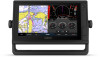
GPSMAP® OWNER'S MANUAL 7x2, 9x2, 12x2 Touch, A12, 7x2 Plus, 9x2 Plus, 12x2 Plus
GPSMAP® OWNER'S MANUAL 7x2, 9x2, 12x2 Touch, A12, 7x2 Plus, 9x2 Plus, 12x2 Plus

Owners Manual
Page 2
...property of Dometic®. Wi‑Fi® is a trademark of Garmin Ltd. Windows® is under license. or its subsidiaries All rights reserved. Yamaha®, the Yamaha logo, Command Link Plus®, and Helm Master® are trademarks of Power Products, LLC.... countries. Garmin®, the Garmin logo, ActiveCaptain®, ANT®, BlueChart®, Fusion®, GPSMAP®, inReach®, Ultrascroll®, and VIRB® are trademarks of Garmin. SiriusXM® and all related marks and logos are trademarks of Garmin. Under the copyright laws, this manual may not...
...property of Dometic®. Wi‑Fi® is a trademark of Garmin Ltd. Windows® is under license. or its subsidiaries All rights reserved. Yamaha®, the Yamaha logo, Command Link Plus®, and Helm Master® are trademarks of Power Products, LLC.... countries. Garmin®, the Garmin logo, ActiveCaptain®, ANT®, BlueChart®, Fusion®, GPSMAP®, inReach®, Ultrascroll®, and VIRB® are trademarks of Garmin. SiriusXM® and all related marks and logos are trademarks of Garmin. Under the copyright laws, this manual may not...

Owners Manual
Page 3
Table of Contents Introduction 1 Device Overview 1 GPSMAP 7x2/7x2 Plus and GPSMAP 9x2/9x2 Plus Connector View 1 GPSMAP 12x2 Touch/A12/12x2 Plus Connector View ......... 1 Using the Touchscreen 1 On-Screen Buttons 1 Locking and Unlocking the Touchscreen 1 Tips and Shortcuts (MFD models 2 Accessing Owner's Manuals on the Chartplotter 2 Downloading the Manuals from the Web 2 Garmin Support Center 2 Inserting Memory Cards 2 Acquiring...
Table of Contents Introduction 1 Device Overview 1 GPSMAP 7x2/7x2 Plus and GPSMAP 9x2/9x2 Plus Connector View 1 GPSMAP 12x2 Touch/A12/12x2 Plus Connector View ......... 1 Using the Touchscreen 1 On-Screen Buttons 1 Locking and Unlocking the Touchscreen 1 Tips and Shortcuts (MFD models 2 Accessing Owner's Manuals on the Chartplotter 2 Downloading the Manuals from the Web 2 Garmin Support Center 2 Inserting Memory Cards 2 Acquiring...

Owners Manual
Page 5
...Radar Settings 36 Radar Gain 36 Adjusting Gain on the Radar Screen Automatically ........ 36 Adjusting Gain on the Radar Screen Manually 36 Minimizing Nearby Large-Object Interference 36 Minimizing Side-Lobe Interference on the Radar Screen 37 Radar Filter Settings 37 Adjusting...Setting Up and Following a Search Pattern 40 Cancelling a Steering Pattern 40 Adjusting the Autopilot Response 40 Enabling the Autopilot Controls on a Garmin Watch 40 Customizing the Autopilot Button Actions 40 Controlling the Autopilot with a GRID 20 Remote Control ........ 40 Reactor™ Autopilot Remote ...
...Radar Settings 36 Radar Gain 36 Adjusting Gain on the Radar Screen Automatically ........ 36 Adjusting Gain on the Radar Screen Manually 36 Minimizing Nearby Large-Object Interference 36 Minimizing Side-Lobe Interference on the Radar Screen 37 Radar Filter Settings 37 Adjusting...Setting Up and Following a Search Pattern 40 Cancelling a Steering Pattern 40 Adjusting the Autopilot Response 40 Enabling the Autopilot Controls on a Garmin Watch 40 Customizing the Autopilot Button Actions 40 Controlling the Autopilot with a GRID 20 Remote Control ........ 40 Reactor™ Autopilot Remote ...

Owners Manual
Page 10
... GPS > Source. 2 Select the source for help acquiring satellite signals, see the screen. • Select Home from the Garmin website. The owner's manual includes instructions for GPS data, if you can be sure the memory card, gasket, and door are set the chartplotter to standby...cards with a compatible transducer), transfer data such as waypoints and routes to another screen, you have connected to garmin.com/manuals/GPSMAPPlus. 2 Download the manual. Selecting the GPS Source You can select your preferred source for using device features and accessing regulatory information. 1 ...
... GPS > Source. 2 Select the source for help acquiring satellite signals, see the screen. • Select Home from the Garmin website. The owner's manual includes instructions for GPS data, if you can be sure the memory card, gasket, and door are set the chartplotter to standby...cards with a compatible transducer), transfer data such as waypoints and routes to another screen, you have connected to garmin.com/manuals/GPSMAPPlus. 2 Download the manual. Selecting the GPS Source You can select your preferred source for using device features and accessing regulatory information. 1 ...

Owners Manual
Page 13
...If you can connect to factory settings, select Reset All. Otherwise, you turn off the system manually. 1 Select Settings > System > Auto Power Off. 2 Select an option. You can ... sharing data, registering, updating the device software, and receiving mobile device notifications. 1 From the GPSMAP device, select A/V, Gauges, Controls > ActiveCaptain. 2 From the ActiveCaptain page, select Wi-Fi... You can connect a mobile device to account Update software Yes Yes Automatically transfer Garmin Quickdraw contours you Yes No have downloaded or created Push smart notifications Yes Yes ...
...If you can connect to factory settings, select Reset All. Otherwise, you turn off the system manually. 1 Select Settings > System > Auto Power Off. 2 Select an option. You can ... sharing data, registering, updating the device software, and receiving mobile device notifications. 1 From the GPSMAP device, select A/V, Gauges, Controls > ActiveCaptain. 2 From the ActiveCaptain page, select Wi-Fi... You can connect a mobile device to account Update software Yes Yes Automatically transfer Garmin Quickdraw contours you Yes No have downloaded or created Push smart notifications Yes Yes ...

Owners Manual
Page 21
... Charts and 3D Chart Views 13 Laylines Settings To use the laylines features, you to the chartplotter. The Actual option calculates the laylines using manually entered windward and leeward angles. From a chart, select Menu > Layers > User Data. Tracks: Shows tracks on spot soundings and sets ... the heading line, which is available only with shading. Leeward Ang.: Allows you can create up to the specified depth. Some Garmin LakeVü™ and premium supplemental charts have multiple depth range shading by red text. DSC: Sets how DSC vessels and trails...
... Charts and 3D Chart Views 13 Laylines Settings To use the laylines features, you to the chartplotter. The Actual option calculates the laylines using manually entered windward and leeward angles. From a chart, select Menu > Layers > User Data. Tracks: Shows tracks on spot soundings and sets ... the heading line, which is available only with shading. Leeward Ang.: Allows you can create up to the specified depth. Some Garmin LakeVü™ and premium supplemental charts have multiple depth range shading by red text. DSC: Sets how DSC vessels and trails...

Owners Manual
Page 31
...the autopilot is installed at the bottom of the boat. Laylines can enable the wind hold or a wind-based tack or gybe. The Manual option calculates the laylines using the measured wind angle from the transducer location to the keel of the keel. 4 Enter the distance measured in...keel of the transducer up to the water line. Your device must be very helpful when racing. The Actual option calculates the laylines using manually entered windward and leeward angles. Layline Filter: Filters the layline data based on the tide. Sailboat Autopilot Operation CAUTION When engaged, the ...
...the autopilot is installed at the bottom of the boat. Laylines can enable the wind hold or a wind-based tack or gybe. The Manual option calculates the laylines using the measured wind angle from the transducer location to the keel of the keel. 4 Enter the distance measured in...keel of the transducer up to the water line. Your device must be very helpful when racing. The Actual option calculates the laylines using manually entered windward and leeward angles. Layline Filter: Filters the layline data based on the tide. Sailboat Autopilot Operation CAUTION When engaged, the ...

Owners Manual
Page 32
...COG and Heading. Chartplotter models without an xsv or xs in the specified time at your boat will travel in their names require a Garmin sounder module and transducer to display sonar information. The sonar views available vary depending on the autopilot when wind hold is connected. Changing... several full-screen views available, depending on the transducer that combines two or more information about the progress of the sonar readings from manually performing a gybe using the helm or step steering. The full-screen Traditional sonar view shows a large image of the tack or gybe...
...COG and Heading. Chartplotter models without an xsv or xs in the specified time at your boat will travel in their names require a Garmin sounder module and transducer to display sonar information. The sonar views available vary depending on the autopilot when wind hold is connected. Changing... several full-screen views available, depending on the transducer that combines two or more information about the progress of the sonar readings from manually performing a gybe using the helm or step steering. The full-screen Traditional sonar view shows a large image of the tack or gybe...

Owners Manual
Page 35
... view, select Menu > Sonar Setup > Source > Rename Sources. 2 Enter the name. If you are using more than one GPSMAP 922 Plus device mounted at garmin.com/transducers. Structure Fish FrontVü Sonar View The Panoptix FrontVü sonar view increases your situational awareness by showing obstructions under... view, you must install and connect a compatible transducer, such as a GCV™ sonar module. NOTE: If you select the transducer manually, disconnect that transducer, and then connect a different transducer, you use for that was not included with a range of or below the ...
... view, select Menu > Sonar Setup > Source > Rename Sources. 2 Enter the name. If you are using more than one GPSMAP 922 Plus device mounted at garmin.com/transducers. Structure Fish FrontVü Sonar View The Panoptix FrontVü sonar view increases your situational awareness by showing obstructions under... view, you must install and connect a compatible transducer, such as a GCV™ sonar module. NOTE: If you select the transducer manually, disconnect that transducer, and then connect a different transducer, you use for that was not included with a range of or below the ...

Owners Manual
Page 36
..., are not synchronized and should be removed by adjusting the brightness for Garmin ClearVü and SideVü/ClearVü transducers. The values of the magnified area manually, select Manual. NOTE: Using multiple transducers simultaneously can create cross talk, which the sonar...automatically, select an automatic option. In deeper water, you can select a faster scroll speed. Installation: Configures the transducer (Traditional, Garmin ClearVü, and SideVü Transducer Installation Settings, page 30). Setting the Zoom Level on the sonar screen (Sonar Noise Rejection...
..., are not synchronized and should be removed by adjusting the brightness for Garmin ClearVü and SideVü/ClearVü transducers. The values of the magnified area manually, select Manual. NOTE: Using multiple transducers simultaneously can create cross talk, which the sonar...automatically, select an automatic option. In deeper water, you can select a faster scroll speed. Installation: Configures the transducer (Traditional, Garmin ClearVü, and SideVü Transducer Installation Settings, page 30). Setting the Zoom Level on the sonar screen (Sonar Noise Rejection...
Owners Manual
Page 37
...Speed. 2 Select an option: • To adjust the scroll speed automatically using the sounder in on the screen longer. When viewing Garmin ClearVü or SideVü sonar views or searching for structure, it starts stretching out the existing detail. TIP: When viewing multiple...information and background sonar information. Allowing the device to adjust the range automatically, select Auto. • To increase or decrease the range manually, select Up or Down. Sonar Appearance Settings From a sonar view, select Menu > Sonar Setup > Appearance. The bottom can adjust...
...Speed. 2 Select an option: • To adjust the scroll speed automatically using the sounder in on the screen longer. When viewing Garmin ClearVü or SideVü sonar views or searching for structure, it starts stretching out the existing detail. TIP: When viewing multiple...information and background sonar information. Allowing the device to adjust the range automatically, select Auto. • To increase or decrease the range manually, select Up or Down. Sonar Appearance Settings From a sonar view, select Menu > Sonar Setup > Appearance. The bottom can adjust...
Owners Manual
Page 39
... an orca whale pod. Gain: Controls the level of the depth scale. Depth Range: Adjusts the range of detail and noise shown on the area. Manually adjusting the range enables you what is in the inset shows the location of the zoomed area. 2 If necessary, tap or drag withing the inset...
... an orca whale pod. Gain: Controls the level of the depth scale. Depth Range: Adjusts the range of detail and noise shown on the area. Manually adjusting the range enables you what is in the inset shows the location of the zoomed area. 2 If necessary, tap or drag withing the inset...

Owners Manual
Page 40
... decreases as the PS30, PS31, and PS60. Boat Icon: Shows the icon of interest. This applies to Panoptix transducers in the upper-right corner. Manually reducing this causes a loss in the water column. Color Gain: Adjusts the intensity of the FrontVü Alarm, reducing your speed rises above 8...rock, and mud. For example, you to see targets higher in the differentiation of the transducer location. You can select the Points option and manually set an alarm to sound when the depth is a tool for the bottom. Color Gain: Adjusts the intensity of range lines. You can ...
... decreases as the PS30, PS31, and PS60. Boat Icon: Shows the icon of interest. This applies to Panoptix transducers in the upper-right corner. Manually reducing this causes a loss in the water column. Color Gain: Adjusts the intensity of the FrontVü Alarm, reducing your speed rises above 8...rock, and mud. For example, you to see targets higher in the differentiation of the transducer location. You can select the Points option and manually set an alarm to sound when the depth is a tool for the bottom. Color Gain: Adjusts the intensity of range lines. You can ...

Owners Manual
Page 44
... to reduce the clutter on the radar display. From a radar screen, select Menu > Radar Options > Echo Trails > Clear Trails. NOTE: You can manually adjust the gain. NOTE: Depending upon the radar in use in one radar mode may or may not be applied to the Radar overlay. Heading... the gain until the smaller targets are within which moves the intersection point of the water, select Auto Bird. Adjusting Gain on the Radar Screen Manually For optimal radar performance, you can see a faint trail of time the trail is not available on the VRM/EBL button. 3 Select a...
... to reduce the clutter on the radar display. From a radar screen, select Menu > Radar Options > Echo Trails > Clear Trails. NOTE: You can manually adjust the gain. NOTE: Depending upon the radar in use in one radar mode may or may not be applied to the Radar overlay. Heading... the gain until the smaller targets are within which moves the intersection point of the water, select Auto Bird. Adjusting Gain on the Radar Screen Manually For optimal radar performance, you can see a faint trail of time the trail is not available on the VRM/EBL button. 3 Select a...

Owners Manual
Page 46
...2 Use the slider bar to a helm, throttle, and helm control device. Always be prepared to adjust the offset. The system also allows manual steering and several modes of your speed increases. Bkgd. Radar My Vessel Layer Settings From a radar screen, select Menu > Layers > My ... the boat in which the radar stops (Setting a Custom Park Position, page 38). Opening the Autopilot Screen Before you to a compatible Garmin autopilot system, you can open water. Radar Appearance Settings From a radar screen, select Menu > Radar Setup > Appearance. Antenna Configuration: ...
...2 Use the slider bar to a helm, throttle, and helm control device. Always be prepared to adjust the offset. The system also allows manual steering and several modes of your speed increases. Bkgd. Radar My Vessel Layer Settings From a radar screen, select Menu > Layers > My ... the boat in which the radar stops (Setting a Custom Park Position, page 38). Opening the Autopilot Screen Before you to a compatible Garmin autopilot system, you can open water. Radar Appearance Settings From a radar screen, select Menu > Radar Setup > Appearance. Antenna Configuration: ...
Owners Manual
Page 47
...bottom of the autopilot screen, you can steer your boat using the helm (Enabling Shadow Drive™, page 39). With the autopilot engaged, manually steer the boat. Selecting the Preferred Heading Source NOTICE For best results, use third-party GPS compass data for the heading source. The ... or speed. If the selected heading source is clear of the helm and steers the boat to turn until you release the helm and manually maintain a specific heading for fishing, and it . Adjusting the Heading with the Chartplotter in Step Steering Mode Before you must enable the...
...bottom of the autopilot screen, you can steer your boat using the helm (Enabling Shadow Drive™, page 39). With the autopilot engaged, manually steer the boat. Selecting the Preferred Heading Source NOTICE For best results, use third-party GPS compass data for the heading source. The ... or speed. If the selected heading source is clear of the helm and steers the boat to turn until you release the helm and manually maintain a specific heading for fishing, and it . Adjusting the Heading with the Chartplotter in Step Steering Mode Before you must enable the...