
Instruction Manual
Page 26
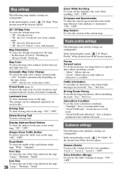
... the version of 2D map. - Traffic Information To calculate an alternative route when traffic messages are configurable. Guidance settings The following route guidance settings are received: "Use," "Not Use." "2D": Overhead view. - "3D" (level 1): Overhead view from a slight angle. - Preset Scale (page 6) To preset the... Allows the use only when no route guidance is available. Calculation Condition To set the preference for each facility. "3D" (level 3): Driver's view, with horizon. "Standard": Sets a recommended route. - "Avoid Toll Roads (Shortest)": Sets a distance-
... the version of 2D map. - Traffic Information To calculate an alternative route when traffic messages are configurable. Guidance settings The following route guidance settings are received: "Use," "Not Use." "2D": Overhead view. - "3D" (level 1): Overhead view from a slight angle. - Preset Scale (page 6) To preset the... Allows the use only when no route guidance is available. Calculation Condition To set the preference for each facility. "3D" (level 3): Driver's view, with horizon. "Standard": Sets a recommended route. - "Avoid Toll Roads (Shortest)": Sets a distance-