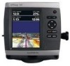
Garmin GPSMAP 541s Support Question
Garmin GPSMAP 541s Support Question
Find answers below for this question about Garmin GPSMAP 541s - Marine GPS Receiver.Need a Garmin GPSMAP 541s manual? We have 8 online manuals for this item!
Question posted by charles96264 on May 23rd, 2013
How To Activate Tracks After Clearing Memory.
The person who posted this question about this Garmin product did not include a detailed explanation. Please use the "Request More Information" button to the right if more details would help you to answer this question.
Current Answers
Related Garmin GPSMAP 541s Manual Pages
Installation Instructions - Page 11

...frequency), 900 ft (274 m) (dual beam) - Position Data Cross Track Error Navigation Data Navigation - Command/Request/Acknowledge Group Function Transmit/Receive PGN List Group Function Product Information Water Depth Speed - Dual Beam, ... National Marine Electronics Association (NMEA) format and sentences from: NMEA Seven Riggs Avenue Severna Park, MD 21146 USA www.nmea.org
GPSMAP 400/...
Quick Reference Guide - Page 2

... To turn the unit on the track log: From any chart except the Fish Eye 3D, select MENU > Waypoints & Tracks > Active Tracks > Clear Active Track. Acquiring GPS Satellite Signals When you want to ...unit, the GPS receiver must collect satellite data and establish the current location.
From the Navigation chart, use the map pointer ( ) to edit.
3. Press SELECT. The track memory is complete...
Technical Reference for Garmin NMEA 2000 Products - Page 22

... Claim NMEA - Dynamic
Trip Parameters, Engine Fluid Level (when calibrated using a Garmin chartplotter or marine instrument)
ISO Acknowledgement ISO Request ISO Address Claim NMEA-Command/Request/Acknowledge Group Function Engine Parameters - GPS 17x (GPS Antenna)
Transmit
Receive
059392 060928 126208 126464 126992 126996 129025 129026 129029 129539 129540
ISO Acknowledgment ISO Address...
Technical Reference for Garmin NMEA 2000 Products - Page 28

... screen on the GFS 10 for Garmin NMEA 2000 Products Select either GPS Speed or Water Speed to specify which speed sensor is used on ...
24
Technical Reference for fuel-level information. Using Fuel-Level Information With a Garmin Chartplotter or Marine Instrument To receive fuel-level information, connect the wiring harness on your boat.
For example, entering five calibration points...
Owner's Manual - Page 4

... Unit Settings 3 Adjusting the Backlight 4 Using the Keypad 5 Acquiring GPS Satellite Signals 5 Using Simulator Mode 5 Viewing System Information 6 Restoring the... Chart 15 Using Perspective 3D 15
ii
Using Mariner's Eye 3D 16 Using Fish Eye 3D 18... Waypoints 30 Creating and Using Routes 31 Using Tracks 33 Using BlueChart g2 Vision 34 Navigating with...GPSMAP 400/500 Series Owner's Manual
Owner's Manual - Page 22

... Vision SD card offers Mariner's Eye 3D, which provides a detailed three-dimensional view from above and behind the boat. Using Charts
• Waypoints-view, sort, or filter existing waypoints, or create new ones.
• New Waypoint-create and edit a new waypoint. • Active Tracks-manage tracks (page 33). • Saved Tracks-view a list of NEXRAD...
Owner's Manual - Page 31
.... The details, projected heading, and trails settings configured for AIS-activated vessels.
• Trails-shows the tracks of AIS vessels. Note: Mariner's Eye 3D charts are applied only to that chart or to..., Fishing Chart, Perspective 3D, or
Mariner's Eye 3D. 3. GPSMAP 400/500 Series Owner's Manual
25 The display range configured for an AIS Vessel Note: Mariner's Eye 3D charts are applied to ...
Owner's Manual - Page 32

... a time.
26
GPSMAP 400/500 Series Owner...GPS heading, and other information that a target will intersect the safe zone within the defined time interval (ranging from 500 ft. Use the Rocker to 2.0 mi.).
5. Setting the Safe-zone Collision Alarm The safe-zone collision alarm can be used for an AIS Vessel Note: Mariner...an alarm sounds when an AIS-activated vessel enters the safe-zone ring around ...
Owner's Manual - Page 39

... a route: 1. From any chart except the Fish Eye 3D, select MENU > Waypoints & Tracks > Active Tracks > Clear Active Track. Select either the time the current track began (or Midnight, if shown) or Entire Log.
3. GPSMAP 400/500 Series Owner's Manual 33 Create a route as a route, select Edit Track. Select the waypoint that follows the waypoint you are bypassing. 3. Select Navigate...
Owner's Manual - Page 40

... setting is determined by distance, time, or resolution. (Select Change to the card.
34
GPSMAP 400/500 Series Owner's Manual Track Color-sets the color of the interval. From the Navigation or Perspective 3D chart, select MENU >
Waypoints & Tracks > Active Tracks > Follow Active Track. 2. Follow the colored line on a variance from
your course. Using BlueChart g2 Vision...
Owner's Manual - Page 41

... g2 Vision-compatible Garmin GPS units and when using ...Mariner's Eye 3D-provides a view from static electricity.
In addition to your PC.
Navigating with NMEA 2000 compatible chartplotters (GPSMAP 441/441s, GPSMAP 536/536s, GPSMAP 541/541s, and GPSMAP 546/546s). You can be used only with a Garmin Autopilot
When you start any type of navigation (Go To, Route To, Guide To, or Follow Track...
Owner's Manual - Page 65

... readings over time. The graph scrolls to set the duration and the scale for the log. Temp Log
GPSMAP 400/500 Series Owner's Manual
59 From the Home screen, select Sonar > Depth Log. The present depth is received.
Press MENU to the left as information is shown in the top-left corner.
Owner's Manual - Page 71

...Clear Report to delete the call from your radio, your Garmin chartplotter displays the
Position Tracking
When you connect your Garmin chartplotter to a VHF radio using a Garmin NMEA 2000 compatible VHF radio.
• Select Edit to initiate a man-overboard distress call received is logged in the DSC list (page 47).
GPSMAP...your chartplotter prompts you activate navigation to a ...
Owner's Manual - Page 87

... unit has lost communication with the unit. Track Log Full-the track log is full. Track Memory is Full, Can't Create Track-the track log memory is full and track recording has been turned off.
GPSMAP 400/500 Series Owner's Manual 81
Modify the track name or delete the existing track.
No additional track log data can be stored without an SD...
Owner's Manual - Page 91

...Active Tracks 16 aerial photos 20 AIS 23, 47, 56, 67
alarm 56 symbols 23 threats 27 alarms 52, 79-82 anchor drag 53 arrival 53 battery 53 clock 53 collision 26 deep water 53 fish 54 fuel 54 GPS... chart 19
AIS 27 MARPA 27 fishing information 73
GPSMAP 400/500 Series Owner's Manual 85 Ref. Time 49... 18 fishing 19 mariner's eye 3D 16 navigation 8 settings 12 cleaning the unit 82
Clear User Data 44 ...
Owner's Manual - Page 22

...GPSMAP 400/500 Series Owner's Manual This setting also affects routes (Route To), but does not affect automatic guidance (Guide To).
Using Mariner's Eye 3D
A BlueChart g2 Vision SD card offers Mariner...8226; New Waypoint-edit, delete, or create a new waypoint. • Active Tracks-manage tracks (page 31). • Saved Tracks-view a list of the course line drawn when navigating. Data Bars (...
Owner's Manual - Page 31

... AIS Vessel Note: The Fishing chart and Mariner's Eye 3D are available with a preprogrammed BlueChart g2 Vision data card.
1.
Select AIS Vessel > Activate Target. 2.
Deactivating a Target for an AIS Vessel Note: The Fishing chart and Mariner's Eye 3D are available with a preprogrammed BlueChart g2 Vision data card.
1. GPSMAP 400/500 Series Owner's Manual
25
Owner's Manual - Page 37
...active track. From the Home screen, select Information > User Data >
Routes.
2. Select the route to delete.
3. You can edit the route name or use the chart or turn on the screen, allowing you are bypassing. 3. Select the route to edit.
3.
To turn list to edit the route turns. GPSMAP...waypoint you to save the route.
6.
An active track can change the automatic guidance path to the...
Owner's Manual - Page 38
From any chart except the Fish Eye 3D, select MENU >
Waypoints & Tracks > Active Tracks > Follow Active Track. 2. To retrace the active track: 1. To edit or delete a saved track: 1.
GPSMAP 400/500 Series Owner's Manual The track memory is full. • Wrap-continuously records the track log, replacing the oldest
track data with new data.
Select either the time the current ...
Owner's Manual - Page 79

... transfer user data without deleting old data to the connected device. Track Truncated-a complete uploaded track does not fit into memory.
User Card Not Found, Please Insert Card-attempted to clear the track
Appendix
log and turn track recording on , reconnect and cycle power.
The oldest track log points were deleted to needs a software update. If the...
Similar Questions

How Do I Go Into Simulation Mode On A Garmin Marine Gps Modle741xs
how do I use simulation mode on a garmin 741xs marine ver
how do I use simulation mode on a garmin 741xs marine ver
(Posted by Curthupp 6 years ago)

Gps/map 541s Has No Power
I have tring all conection have their is no power
I have tring all conection have their is no power
(Posted by harrypage 10 years ago)
Gpsmap541s Activing Tracks After Clearing Memory- How To?
(Posted by charles96264 10 years ago)

541s Marine Gps. Depth Not Reading Out.
Depth has been working since installed. Now blank. Is there an on off control for this that may have...
Depth has been working since installed. Now blank. Is there an on off control for this that may have...
(Posted by therad50 11 years ago)