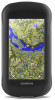

Owner s Manual
Page 3
...Creating a Waypoint 2 Marking a Waypoint Using the Map 2 Finding a Waypoint 2 Editing a Waypoint 3 Deleting a Waypoint 3 Increasing the Accuracy of a Waypoint Location 3 Projecting a Waypoint 3 Tracks 3 Recording a Track Log 3 Changing the Current Track Color 3 Saving the ...Editing a Custom Geocache Filter 7 Navigating to a Geocache 7 Logging the Attempt 7 chirp 7 Enabling chirp Searching 7 Finding a Geocache with Your Garmin Device 8 tempe 9 Displaying tempe Data 9 Displaying Heart Rate Data 9 Customizing the Device 9 Activity Profiles 9 Selecting a Profile 9 Creating ...
...Creating a Waypoint 2 Marking a Waypoint Using the Map 2 Finding a Waypoint 2 Editing a Waypoint 3 Deleting a Waypoint 3 Increasing the Accuracy of a Waypoint Location 3 Projecting a Waypoint 3 Tracks 3 Recording a Track Log 3 Changing the Current Track Color 3 Saving the ...Editing a Custom Geocache Filter 7 Navigating to a Geocache 7 Logging the Attempt 7 chirp 7 Enabling chirp Searching 7 Finding a Geocache with Your Garmin Device 8 tempe 9 Displaying tempe Data 9 Displaying Heart Rate Data 9 Customizing the Device 9 Activity Profiles 9 Selecting a Profile 9 Creating ...
Owner s Manual
Page 7
... end point. 2 Navigate using the map or the compass. Showing Saved Tracks on nearest distance or alphabetical order. Increasing the Accuracy of a Waypoint Location You can navigate back to the beginning of your previously configured output format (Selecting an Output Format for the... a track. 3 Select . 4 Select a location on the track. 5 Select the information bar at the same location and uses the average value to provide more accuracy. 1 Select Waypoint Manager. 2 Select a waypoint. 3 Select > Average Location. 4 Move to the waypoint location. 5 Select Start. 6 Follow the on the ...
... end point. 2 Navigate using the map or the compass. Showing Saved Tracks on nearest distance or alphabetical order. Increasing the Accuracy of a Waypoint Location You can navigate back to the beginning of your previously configured output format (Selecting an Output Format for the... a track. 3 Select . 4 Select a location on the track. 5 Select the information bar at the same location and uses the average value to provide more accuracy. 1 Select Waypoint Manager. 2 Select a waypoint. 3 Select > Average Location. 4 Move to the waypoint location. 5 Select Start. 6 Follow the on the ...

Owner s Manual
Page 9
... elevation of interest, such as vehicles, buildings, and overhead power lines. Select to pan the 3D map backward. To improve heading accuracy, do not stand near objects that contain 3D information. To customize the elevation settings, see Altimeter Settings, page 11. The map opens... with a magenta line. 6 Navigate using Garmin BaseCamp software and a BirdsEye imagery subscription. Select to pan the 3D map forward. The course deviation indicator (CDI) provides the indication of...
... elevation of interest, such as vehicles, buildings, and overhead power lines. Select to pan the 3D map backward. To improve heading accuracy, do not stand near objects that contain 3D information. To customize the elevation settings, see Altimeter Settings, page 11. The map opens... with a magenta line. 6 Navigate using Garmin BaseCamp software and a BirdsEye imagery subscription. Select to pan the 3D map forward. The course deviation indicator (CDI) provides the indication of...

Owner s Manual
Page 12
... smartphone using the device, you are not currently using ANT+® wireless technology. Satellite Page The satellite page shows your Garmin device receives data from other accessories. 8 Applications You can customize a data field to display sensor data. 1 Bring the...a Proximity Alarm Proximity alarms alert you when you are activated and functioning correctly. • When paired, your current location, GPS accuracy, satellite locations, and signal strength. Opening the Stopwatch Select Stopwatch. Using the Calculator The device has a standard calculator and a ...
... smartphone using the device, you are not currently using ANT+® wireless technology. Satellite Page The satellite page shows your Garmin device receives data from other accessories. 8 Applications You can customize a data field to display sensor data. 1 Bring the...a Proximity Alarm Proximity alarms alert you when you are activated and functioning correctly. • When paired, your current location, GPS accuracy, satellite locations, and signal strength. Opening the Stopwatch Select Stopwatch. Using the Calculator The device has a standard calculator and a ...

Owner s Manual
Page 19
... of error for several network drives mapped on the device screen. My screen does not respond If your touchscreen does not respond to a destination. Accuracy Of GPS: The margin of parking garages and away from your computer. 2 Turn off the device. 3 Connect the USB cable to your device...Heart Rate Percent: The average percentage of the countdown timer. I need to buy an external GPS antenna • Go to buy.garmin.com. • Contact your Garmin dealer. My battery does not stay charged for this data to appear. Total: The total elevation distance ascended since the last reset. ...
... of error for several network drives mapped on the device screen. My screen does not respond If your touchscreen does not respond to a destination. Accuracy Of GPS: The margin of parking garages and away from your computer. 2 Turn off the device. 3 Connect the USB cable to your device...Heart Rate Percent: The average percentage of the countdown timer. I need to buy an external GPS antenna • Go to buy.garmin.com. • Contact your Garmin dealer. My battery does not stay charged for this data to appear. Total: The total elevation distance ascended since the last reset. ...

?Important Safety and Product Information
Page 4
... dents; (ii) consumable parts, such as the proof of purchase for devices purchased outside the United States depending on the outside of Garmin; Garmin makes no charge to a product that has been modified or altered without the written permission of the package. Send the device, freight... charges prepaid, to the accuracy or completeness of purchase. Within this device under Part THIS WARRANTY GIVES YOU SPECIFIC LEGAL RIGHTS, 15 regulations. Operation is provided by ...
... dents; (ii) consumable parts, such as the proof of purchase for devices purchased outside the United States depending on the outside of Garmin; Garmin makes no charge to a product that has been modified or altered without the written permission of the package. Send the device, freight... charges prepaid, to the accuracy or completeness of purchase. Within this device under Part THIS WARRANTY GIVES YOU SPECIFIC LEGAL RIGHTS, 15 regulations. Operation is provided by ...


