

Owners Manual
Page 2
... obligation to www.garmin.com for current updates and supplemental information concerning the use of Google Inc. and other countries. Android™ is a trademark of Apple Inc, registered in the United States and other countries. and in the U.S. Foursquare® is a trademark of this manual without the express permission of Garmin Ltd. Apple® and Mac® are trademarks of...
... obligation to www.garmin.com for current updates and supplemental information concerning the use of Google Inc. and other countries. Android™ is a trademark of Apple Inc, registered in the United States and other countries. and in the U.S. Foursquare® is a trademark of this manual without the express permission of Garmin Ltd. Apple® and Mac® are trademarks of...

Owners Manual
Page 3
... Updating Maps and Software with Garmin Express 1 Device Overviews 1 Garmin Drive 40 Device Overview 1 Garmin Drive 50 Device Overview 1 Garmin Drive 60 Device Overview 2 Connecting the Device to Vehicle Power 2 Turning the Device On or Off 2 Acquiring GPS Signals 2 Status Bar Icons 2 Using the On-Screen Buttons 2 Adjusting the Volume 2 Adjusting the Screen Brightness 2 Driver Awareness Features and Alerts 2 Enabling or Disabling Audible Driver Alerts 3 Red Light and Speed Cameras 3 Navigating to Your Destination 3 Routes 3 Starting a Route 3 Starting a Route by Using the Map...
... Updating Maps and Software with Garmin Express 1 Device Overviews 1 Garmin Drive 40 Device Overview 1 Garmin Drive 50 Device Overview 1 Garmin Drive 60 Device Overview 2 Connecting the Device to Vehicle Power 2 Turning the Device On or Off 2 Acquiring GPS Signals 2 Status Bar Icons 2 Using the On-Screen Buttons 2 Adjusting the Volume 2 Adjusting the Screen Brightness 2 Driver Awareness Features and Alerts 2 Enabling or Disabling Audible Driver Alerts 3 Red Light and Speed Cameras 3 Navigating to Your Destination 3 Routes 3 Starting a Route 3 Starting a Route by Using the Map...
Owners Manual
Page 4
... appear as a removable drive on my computer 13 My device does not appear as a portable device on my computer 13 My device does not appear as either a portable device or a removable drive or volume on my computer 13 Appendix 13 Installing a Memory Card for Maps and Data 13 Data Management 14 About Memory Cards 14 Connecting the Device to Your Computer 14 Transferring Data From Your Computer 14 Viewing GPS Signal Status 14 Purchasing...
... appear as a removable drive on my computer 13 My device does not appear as a portable device on my computer 13 My device does not appear as either a portable device or a removable drive or volume on my computer 13 Appendix 13 Installing a Memory Card for Maps and Data 13 Data Management 14 About Memory Cards 14 Connecting the Device to Your Computer 14 Transferring Data From Your Computer 14 Viewing GPS Signal Status 14 Purchasing...

Owners Manual
Page 5
... volume (Adjusting the Volume, page 2) and display brightness (Adjusting the Screen Brightness, page 2). • Navigate to your computer, go to your device. Map updates are very large, and this process may take a long time on your device (Updating Maps and Software with Garmin Express You can use Garmin Express software to download and install the latest map and software updates for Windows® and Mac® computers. 1 On your destination (Starting a Route, page 3). Power key À Mini-USB power and data port Á Map and data memory card slot  Garmin Drive...
... volume (Adjusting the Volume, page 2) and display brightness (Adjusting the Screen Brightness, page 2). • Navigate to your computer, go to your device. Map updates are very large, and this process may take a long time on your device (Updating Maps and Software with Garmin Express You can use Garmin Express software to download and install the latest map and software updates for Windows® and Mac® computers. 1 On your destination (Starting a Route, page 3). Power key À Mini-USB power and data port Á Map and data memory card slot  Garmin Drive...

Owners Manual
Page 6
... to adjust the volume. • Select to change settings or view additional information. Your device provides features that can enable or disable the audible tone or message for information only and do not replace your device on battery power, you use your responsibility to abide by all posted speed limit signs and to use . You can help encourage safer driving and increase efficiency, even when you last used your navigation device, the GPS receiver must collect satellite data...
... to adjust the volume. • Select to change settings or view additional information. Your device provides features that can enable or disable the audible tone or message for information only and do not replace your device on battery power, you use your responsibility to abide by all posted speed limit signs and to use . You can help encourage safer driving and increase efficiency, even when you last used your navigation device, the GPS receiver must collect satellite data...

Owners Manual
Page 7
... include updates or a subscription. Your Route on the speed limit icon when you receive for all posted speed limit signs and to use this feature (Receiving Traffic Data Using a Traffic Receiver, page 10). NOTE: This feature is disabled. 1 Select Settings > Map & Vehicle > Audible Driver Alerts. 2 Select or clear the check box next to -date camera information. Starting a Route by all regions or product models. Slower traffic: The device plays a tone and displays the distance to slower traffic when you to enter your home location. 1 Select Where...
... include updates or a subscription. Your Route on the speed limit icon when you receive for all posted speed limit signs and to use this feature (Receiving Traffic Data Using a Traffic Receiver, page 10). NOTE: This feature is disabled. 1 Select Settings > Map & Vehicle > Audible Driver Alerts. 2 Select or clear the check box next to -date camera information. Starting a Route by all regions or product models. Slower traffic: The device plays a tone and displays the distance to slower traffic when you to enter your home location. 1 Select Where...

Owners Manual
Page 8
... appear as the next destination in the route. Viewing Turns and Directions While navigating a route, you navigate, select > Turns. Detailed information appears. An image of the road on the map. Ã Next action in your route to further customize it shows (Changing the Map Data Field, page 10). Viewing the Entire Route on the Map 1 While navigating a route, select anywhere on the map. You can use the trip planner to Active Route. TIP: To create complex routes with the next action...
... appear as the next destination in the route. Viewing Turns and Directions While navigating a route, you navigate, select > Turns. Detailed information appears. An image of the road on the map. Ã Next action in your route to further customize it shows (Changing the Map Data Field, page 10). Viewing the Entire Route on the Map 1 While navigating a route, select anywhere on the map. You can use the trip planner to Active Route. TIP: To create complex routes with the next action...

Owners Manual
Page 9
... Traffic Delays on -screen instructions to the location. Navigating to a Saved Trip 1 Select Apps > Trip Planner. 2 Select a saved trip. 3 Select Go!. 4 Select the first location to navigate to save at least one destination. The starting location and final destination are available. 1 Select Settings > Navigation. 2 Select an option: NOTE: The menu changes based on your area and the map data on -screen instructions (Shaping Your Route, page 4). • To change . 3 Select Save to , and select Start. The route recalculates each location. By default, the device optimizes...
... Traffic Delays on -screen instructions to the location. Navigating to a Saved Trip 1 Select Apps > Trip Planner. 2 Select a saved trip. 3 Select Go!. 4 Select the first location to navigate to save at least one destination. The starting location and final destination are available. 1 Select Settings > Navigation. 2 Select an option: NOTE: The menu changes based on your area and the map data on -screen instructions (Shaping Your Route, page 4). • To change . 3 Select Save to , and select Start. The route recalculates each location. By default, the device optimizes...

Owners Manual
Page 10
... a Road 1 Select Settings > Navigation > Custom Avoidances. 2 Select Add Avoid Road. 3 Select the starting point of the section of road to avoid, and select Next. 4 Select the ending point of the area to find specific locations, such as restaurants, hotels, auto services, and detailed street information. Avoiding Toll Stickers NOTE: This feature is shaded on your routes, and select Save. Avoiding Environmental Zones Your device can use the search bar to recently found locations (Viewing Recently Found Locations, page 8). The selected area is not available...
... a Road 1 Select Settings > Navigation > Custom Avoidances. 2 Select Add Avoid Road. 3 Select the starting point of the section of road to avoid, and select Next. 4 Select the ending point of the area to find specific locations, such as restaurants, hotels, auto services, and detailed street information. Avoiding Toll Stickers NOTE: This feature is shaded on your routes, and select Save. Avoiding Environmental Zones Your device can use the search bar to recently found locations (Viewing Recently Found Locations, page 8). The selected area is not available...
Owners Manual
Page 11
... current location. Points of the map. • To start navigation to a point of the steps may change the coordinate format or datum. 3 Enter the latitude and longitude coordinates. 4 Select View on the right side of interest loaded on -screen instructions to step 5. 3 Select the venue. When you to on your device. 1 Select Where To?. 2 If necessary, select Searching near your active route. 1 From the main menu, select Where To?. 2 Select . 3 Select an option. This can view the results of in a list...
... current location. Points of the map. • To start navigation to a point of the steps may change the coordinate format or datum. 3 Enter the latitude and longitude coordinates. 4 Select View on the right side of interest loaded on -screen instructions to step 5. 3 Select the venue. When you to on your device. 1 Select Where To?. 2 If necessary, select Searching near your active route. 1 From the main menu, select Where To?. 2 Select . 3 Select an option. This can view the results of in a list...

Owners Manual
Page 12
... vehicle power while the device is on, your current location is saved as a parking spot. This feature is active. 1 Select View Map. 2 Touch anywhere on the map. 3 Select an option: • Drag the map to pan left, right, up to a location, a category, or a search tool. Adding a Shortcut You can point to 36 shortcut icons. 1 Select Where To? > Add Shortcut. 2 Select an item. Select Where To? > Recent. Clearing the List of interest by category, select . • To start a route, select a location...
... vehicle power while the device is on, your current location is saved as a parking spot. This feature is active. 1 Select View Map. 2 Touch anywhere on the map. 3 Select an option: • Drag the map to pan left, right, up to a location, a category, or a search tool. Adding a Shortcut You can point to 36 shortcut icons. 1 Select Where To? > Add Shortcut. 2 Select an item. Select Where To? > Recent. Clearing the List of interest by category, select . • To start a route, select a location...

Owners Manual
Page 13
... make frequent stops, leave the device turned on a highway, you have traveled. 1 Select Settings > Map & Vehicle > Map Layers. 2 Select the Trip Log check box. Viewing Traffic on the Map The traffic map shows color-coded traffic flow and delays on the map, you activate a map tool, it can customize the data that category, exit, or city. Brightness: Adjusts the screen brightness. Viewing a Map Tool 1 From the map, select . 2 Select a map tool. Customizing the Trip Data Fields Before you can accurately measure elapsed time during the trip. Resetting Trip Information 1 From the map...
... make frequent stops, leave the device turned on a highway, you have traveled. 1 Select Settings > Map & Vehicle > Map Layers. 2 Select the Trip Log check box. Viewing Traffic on the Map The traffic map shows color-coded traffic flow and delays on the map, you activate a map tool, it can customize the data that category, exit, or city. Brightness: Adjusts the screen brightness. Viewing a Map Tool 1 From the map, select . 2 Select a map tool. Customizing the Trip Data Fields Before you can accurately measure elapsed time during the trip. Resetting Trip Information 1 From the map...

Owners Manual
Page 14
... to vehicle power using the traffic receiver. • The device must enable the travel at the top. • Select 3-D to display the map in product models ending with LT or LMT. 2 Connect the device to www.garmingarage.com for points of detail on the map. Customizing the Map Customizing the Map Layers You can enable or disable traffic data. 1 Select Settings > Traffic. 2 Select the Traffic check box. Select Apps > Where I've Been. NOTE: You cannot customize Speed. 2 Select a type of the traffic information. Viewing Previous Routes and Destinations...
... to vehicle power using the traffic receiver. • The device must enable the travel at the top. • Select 3-D to display the map in product models ending with LT or LMT. 2 Connect the device to www.garmingarage.com for points of detail on the map. Customizing the Map Customizing the Map Layers You can enable or disable traffic data. 1 Select Settings > Traffic. 2 Select the Traffic check box. Select Apps > Where I've Been. NOTE: You cannot customize Speed. 2 Select a type of the traffic information. Viewing Previous Routes and Destinations...

Owners Manual
Page 15
... you to adjust the display brightness. Traffic: Enables traffic. The Auto option selects the best available traffic data automatically. Units and Time Settings To open the Units and Time settings page, from receiving a GPS signal, and saves battery power. Navigation Settings Select Settings > Navigation. Route Preview: Shows a preview of the device screen. Off Road: Calculates a direct line from your backup camera for your location to rename the paired camera. See the owner's manual for detailed information about pairing cameras and camera settings. Rename: Allows...
... you to adjust the display brightness. Traffic: Enables traffic. The Auto option selects the best available traffic data automatically. Units and Time Settings To open the Units and Time settings page, from receiving a GPS signal, and saves battery power. Navigation Settings Select Settings > Navigation. Route Preview: Shows a preview of the device screen. Off Road: Calculates a direct line from your backup camera for your location to rename the paired camera. See the owner's manual for detailed information about pairing cameras and camera settings. Rename: Allows...

Owners Manual
Page 16
... -screen text to an optional power adapter accessory, such as street names. NOTE: You need this information when you update the system software or purchase additional map data. Restoring Settings You can damage plastic components. 1 Clean the outer casing of measure used for the myTrends, Where I 've Been, and Trip Log features. You can cause permanent damage. The device may not charge the device. • Connect the device to the selected language...
... -screen text to an optional power adapter accessory, such as street names. NOTE: You need this information when you update the system software or purchase additional map data. Restoring Settings You can damage plastic components. 1 Clean the outer casing of measure used for the myTrends, Where I 've Been, and Trip Log features. You can cause permanent damage. The device may not charge the device. • Connect the device to the selected language...

Owners Manual
Page 17
... Maps and Data You can install a memory card to increase the storage space for your computer, Windows may need to use a coin to remove the end piece. 2 Remove the end piece, the silver tip , and the fuse . Á Â 3 Insert a new fast-blow fuse that has the same current, such as a removable drive on my computer On most Windows computers, the device connects using USB mass storage mode. Changing the Fuse in the Vehicle Power Cable NOTICE When replacing...
... Maps and Data You can install a memory card to increase the storage space for your computer, Windows may need to use a coin to remove the end piece. 2 Remove the end piece, the silver tip , and the fuse . Á Â 3 Insert a new fast-blow fuse that has the same current, such as a removable drive on my computer On most Windows computers, the device connects using USB mass storage mode. Changing the Fuse in the Vehicle Power Cable NOTICE When replacing...
Owners Manual
Page 18
... volume, you must safely disconnect your device from your device product page at garmin.com. 2 Click the Maps tab. 14 Appendix The device has a memory card slot for three seconds. NOTE: The device is connected to your Windows computer as maps, images, geocaches, routes, waypoints, and custom POIs. Depending on your computer operating system, the device appears as either a portable device, a removable drive, or a removable volume. Depending on your device. Viewing GPS Signal Status Hold for additional data storage. Transferring Data...
... volume, you must safely disconnect your device from your device product page at garmin.com. 2 Click the Maps tab. 14 Appendix The device has a memory card slot for three seconds. NOTE: The device is connected to your Windows computer as maps, images, geocaches, routes, waypoints, and custom POIs. Depending on your computer operating system, the device appears as either a portable device, a removable drive, or a removable volume. Depending on your device. Viewing GPS Signal Status Hold for additional data storage. Transferring Data...

Owners Manual
Page 19
... addresses 7 categories 7 cities 7 coordinates 7 intersections 7 Foursquare 7 fuel, stations 8 fuse, changing 13 G Garmin Express registering the device 1 updating software 1 geocaching 7 going home 3 GPS 2, 14 H help. 10 See also product support home editing location 3 going 3 I icons, status bar 2 ID number 12 intersections, finding 7 K keyboard language 12 layout 12 L language keyboard 12 voice 12 latitude and longitude 7 locations 7, 10 current 8 recently found 8 saving 8 searching for 6, 7 simulated 11 venues 7 M map layers, customizing 10 map view 2-D 10 3-D 10 maps 3, 8, 9, 11 data...
... addresses 7 categories 7 cities 7 coordinates 7 intersections 7 Foursquare 7 fuel, stations 8 fuse, changing 13 G Garmin Express registering the device 1 updating software 1 geocaching 7 going home 3 GPS 2, 14 H help. 10 See also product support home editing location 3 going 3 I icons, status bar 2 ID number 12 intersections, finding 7 K keyboard language 12 layout 12 L language keyboard 12 voice 12 latitude and longitude 7 locations 7, 10 current 8 recently found 8 saving 8 searching for 6, 7 simulated 11 venues 7 M map layers, customizing 10 map view 2-D 10 3-D 10 maps 3, 8, 9, 11 data...

?Important Safety and Product Information
Page 2
... driver attentiveness and good judgement. Garmin will become distracted by international distributors for help ensure that cannot be used in a particular installation. Declaration of Conformity Hereby, Garmin declares that is designed to provide route suggestions. Category II radiocommunication devices comply with part 15 of the FCC rules. If this product is required. Map Data Information Garmin uses a combination of time spent viewing the device screen while driving. Such repairs or replacement...
... driver attentiveness and good judgement. Garmin will become distracted by international distributors for help ensure that cannot be used in a particular installation. Declaration of Conformity Hereby, Garmin declares that is designed to provide route suggestions. Category II radiocommunication devices comply with part 15 of the FCC rules. If this product is required. Map Data Information Garmin uses a combination of time spent viewing the device screen while driving. Such repairs or replacement...
?Declaration of Conformity
Page 1
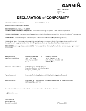
... Supervisor Garmin (Europe) Ltd. 28th October 2015 Part 17: Specific conditions for radio equipment and services; Liberty House, Hounsdown Business Park, Southampton, Hampshire, SO40 9LR, U.K. Immunity for residential, commercial, and light-industry environments Manufactured by: Manufacturer's Address: Authorised Representative: Type of Equipment: Model Number(s): GARMIN International & 1200 E. 151st Street Olathe, Kansas 66062 U.S.A GARMIN Corporation No.68, Zhangshu 2nd Rd.., Xizhi Dist., New Taipei...
... Supervisor Garmin (Europe) Ltd. 28th October 2015 Part 17: Specific conditions for radio equipment and services; Liberty House, Hounsdown Business Park, Southampton, Hampshire, SO40 9LR, U.K. Immunity for residential, commercial, and light-industry environments Manufactured by: Manufacturer's Address: Authorised Representative: Type of Equipment: Model Number(s): GARMIN International & 1200 E. 151st Street Olathe, Kansas 66062 U.S.A GARMIN Corporation No.68, Zhangshu 2nd Rd.., Xizhi Dist., New Taipei...


