Installation Instructions
Page 3
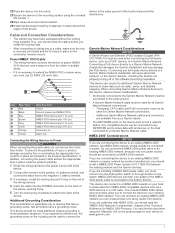
...the device to power, NMEA 0183 devices, and a lamp or a horn for Garmin Marine Network connections. ◦ Additional Garmin Marine Network cables and connectors are available from NMEA 2000 compatible devices such as a GPS antenna or a VHF radio. Do not connect the NMEA 2000 power cable to... an existing NMEA 2000 network, because only one using cables from Garmin. If you are connecting this device, observe these considerations. &#...
...the device to power, NMEA 0183 devices, and a lamp or a horn for Garmin Marine Network connections. ◦ Additional Garmin Marine Network cables and connectors are available from NMEA 2000 compatible devices such as a GPS antenna or a VHF radio. Do not connect the NMEA 2000 power cable to... an existing NMEA 2000 network, because only one using cables from Garmin. If you are connecting this device, observe these considerations. &#...
Installation Instructions
Page 4
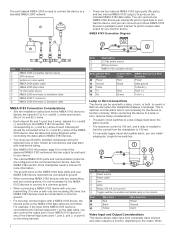
Item Description NMEA 2000 compatible Garmin device GPS antenna Ignition or in parallel to each internal port should be connected to ...NMEA 0183 data cable and your NMEA 0183 device to NMEA 0183 devices. • You must both , to your Garmin device. When connecting the device to a lamp or horn, observe these considerations. • The alarm circuit switches to ...wiring for a list of the internal input ports (port 1, port 2, port 3, or port 4) on the connected Garmin device. Solder all connections and seal them with heat-shrink tubing. • See NMEA 0183 Information, page 6 for...
Item Description NMEA 2000 compatible Garmin device GPS antenna Ignition or in parallel to each internal port should be connected to ...NMEA 0183 data cable and your NMEA 0183 device to NMEA 0183 devices. • You must both , to your Garmin device. When connecting the device to a lamp or horn, observe these considerations. • The alarm circuit switches to ...wiring for a list of the internal input ports (port 1, port 2, port 3, or port 4) on the connected Garmin device. Solder all connections and seal them with heat-shrink tubing. • See NMEA 0183 Information, page 6 for...
Owners Manual
Page 3
...Inserting Memory Cards 2 Software Update 2 Loading the New Software on a Memory Card 2 Updating the Device Software 2 GPS Satellite Signals 2 Selecting the GPS Source 2 Customizing the Chartplotter 2 Home Screen 2 Adding an Item to Favorites 3 Customizing Pages 3 Customizing the ...Garmin Quickdraw Contours Feature 10 Adding a Label to a Garmin Quickdraw Contours Map 10 Garmin Quickdraw Community 10 Accessing the Garmin Quickdraw Community 10 Sharing Your Garmin Quickdraw Contours Maps with the Garmin Quickdraw Community 10 Downloading Garmin Quickdraw Community Maps 10 Garmin...
...Inserting Memory Cards 2 Software Update 2 Loading the New Software on a Memory Card 2 Updating the Device Software 2 GPS Satellite Signals 2 Selecting the GPS Source 2 Customizing the Chartplotter 2 Home Screen 2 Adding an Item to Favorites 3 Customizing Pages 3 Customizing the ...Garmin Quickdraw Contours Feature 10 Adding a Label to a Garmin Quickdraw Contours Map 10 Garmin Quickdraw Community 10 Accessing the Garmin Quickdraw Community 10 Sharing Your Garmin Quickdraw Contours Maps with the Garmin Quickdraw Community 10 Downloading Garmin Quickdraw Community Maps 10 Garmin...

Owners Manual
Page 4
... Boundary 15 Converting a Track to a Boundary 16 Editing a Boundary 16 Setting a Boundary Alarm 16 Deleting a Boundary 16 Synchronizing User Data Across the Garmin Marine Network 16 Deleting All Saved Waypoints, Routes, and Tracks 16 Sailing Features 16 Setting the Vessel Type 16 Sail Racing 16 Starting Line Guidance... Starting Line Guidance 16 Starting the Race Timer 16 Stopping the Race Timer 17 Setting the Distance between the Bow and the GPS Antenna 17 Laylines Settings 17 Setting the Keel Offset 17 Sailboat Autopilot Operation 17 Wind Hold 17 Setting the Wind Hold Type ...
... Boundary 15 Converting a Track to a Boundary 16 Editing a Boundary 16 Setting a Boundary Alarm 16 Deleting a Boundary 16 Synchronizing User Data Across the Garmin Marine Network 16 Deleting All Saved Waypoints, Routes, and Tracks 16 Sailing Features 16 Setting the Vessel Type 16 Sail Racing 16 Starting Line Guidance... Starting Line Guidance 16 Starting the Race Timer 16 Stopping the Race Timer 17 Setting the Distance between the Bow and the GPS Antenna 17 Laylines Settings 17 Setting the Keel Offset 17 Sailboat Autopilot Operation 17 Wind Hold 17 Setting the Wind Hold Type ...
Owners Manual
Page 6
... VIRB Video Slideshow 42 Device Configuration 42 Turning On the Chartplotter Automatically 42 System Settings 42 Sounds and Display Settings 42 GPS Settings 42 Station Settings 42 Viewing System Software Information 43 Viewing the Event Log 43 Preferences Settings 43 Units Settings 43 ...Setting the Water Temperature Offset 45 Calibrating a Water Speed Device 46 Other Vessels Settings 46 Settings that are Synced on the Garmin Marine Network ........ 46 Restoring the Original Chartplotter Factory Settings 46 Communication with Wireless Devices 46 Wi‑Fi® Network ...
... VIRB Video Slideshow 42 Device Configuration 42 Turning On the Chartplotter Automatically 42 System Settings 42 Sounds and Display Settings 42 GPS Settings 42 Station Settings 42 Viewing System Software Information 43 Viewing the Event Log 43 Preferences Settings 43 Units Settings 43 ...Setting the Water Temperature Offset 45 Calibrating a Water Speed Device 46 Other Vessels Settings 46 Settings that are Synced on the Garmin Marine Network ........ 46 Restoring the Original Chartplotter Factory Settings 46 Communication with Wireless Devices 46 Wi‑Fi® Network ...

Owners Manual
Page 7
... Screen 48 Viewing Images on a Memory card 48 Screenshots 49 Capturing Screenshots 49 Copying Screenshots to a Computer 49 Troubleshooting 49 My device will not acquire GPS signals 49 My device will not turn on or keeps turning off 49 My device is not creating waypoints in the correct location 49 Contacting...
... Screen 48 Viewing Images on a Memory card 48 Screenshots 49 Capturing Screenshots 49 Copying Screenshots to a Computer 49 Troubleshooting 49 My device will not acquire GPS signals 49 My device will not turn on or keeps turning off 49 My device is not creating waypoints in the correct location 49 Contacting...

Owners Manual
Page 10
... instructions. 4 Wait several separate displays. The Settings button is not complete. You can select your chartplotter. When you have more information about GPS, go to the main features of the Home screen. NOTE: If the memory card is removed before the card is inserted. 3 Follow the... button. When you can use blank memory cards to another compatible Garmin chartplotter or a computer. 1 Open the access flap or door on the computer. 2 Go to www.garmin.com/support/software/marine.html. 3 Select Download next to GPSMAP Series with SD Card. 4 Read and agree to maintain a consistent...
... instructions. 4 Wait several separate displays. The Settings button is not complete. You can select your chartplotter. When you have more information about GPS, go to the main features of the Home screen. NOTE: If the memory card is removed before the card is inserted. 3 Follow the... button. When you can use blank memory cards to another compatible Garmin chartplotter or a computer. 1 Open the access flap or door on the computer. 2 Go to www.garmin.com/support/software/marine.html. 3 Select Download next to GPSMAP Series with SD Card. 4 Read and agree to maintain a consistent...
Owners Manual
Page 13
... to the selected location, select Navigate To. • To mark a waypoint at your path. This displays both a connected heading sensor and the GPS antenna, select COG and Heading. Premium Charts CAUTION The Auto Guidance feature is based on the chart. 3 Select Display, and select an option:... with premium charts, in some areas. Navigating to the location, including turns, select Route To or . • To use the GPS antenna heading for offshore deep-sea fishing. Heading Line and Angle Markers The heading line is available with enhanced bottom contours and without navigational...
... to the selected location, select Navigate To. • To mark a waypoint at your path. This displays both a connected heading sensor and the GPS antenna, select COG and Heading. Premium Charts CAUTION The Auto Guidance feature is based on the chart. 3 Select Display, and select an option:... with premium charts, in some areas. Navigating to the location, including turns, select Route To or . • To use the GPS antenna heading for offshore deep-sea fishing. Heading Line and Angle Markers The heading line is available with enhanced bottom contours and without navigational...

Owners Manual
Page 14
... to show photos on both land and water. The MMSI, speed, and direction of each vessel includes the Maritime Mobile Service Identity (MMSI), location, GPS speed, GPS heading, time that are equipped with a transponder, and that has elapsed since the last position of speed for animated tide station and current direction on...
... to show photos on both land and water. The MMSI, speed, and direction of each vessel includes the Maritime Mobile Service Identity (MMSI), location, GPS speed, GPS heading, time that are equipped with a transponder, and that has elapsed since the last position of speed for animated tide station and current direction on...

Owners Manual
Page 15
..., is still labeled as a dashed line on the screen. 2 Select Range. 3 Select a distance for collision avoidance, you can view the AIS signal status, MMSI, GPS speed, GPS heading, and other vessels appear on a chart or on the rate of turn information. The display range and MARPA settings configured for AIS-activated and...
..., is still labeled as a dashed line on the screen. 2 Select Range. 3 Select a distance for collision avoidance, you can view the AIS signal status, MMSI, GPS speed, GPS heading, and other vessels appear on a chart or on the rate of turn information. The display range and MARPA settings configured for AIS-activated and...
Owners Manual
Page 17
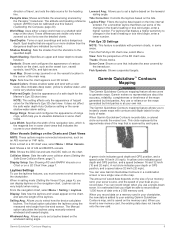
... use the laylines features, you to instantly create maps with a color scale. When Garmin Quickdraw Contours records data, a colored circle surrounds the vessel icon. A yellow circle indicates good depth and GPS position, and a speed between . Panoptix Area: Shows and hides the area being scanned...angle. For a smoother layline that indicates the course to your own risk. It is the magenta line in some of the laylines. Garmin Quickdraw™ Contours Mapping 9 Leeward Ang.: Allows you record data. Sonar Cone: Shows a cone that you to record about the accuracy...
... use the laylines features, you to instantly create maps with a color scale. When Garmin Quickdraw Contours records data, a colored circle surrounds the vessel icon. A yellow circle indicates good depth and GPS position, and a speed between . Panoptix Area: Shows and hides the area being scanned...angle. For a smoother layline that indicates the course to your own risk. It is the magenta line in some of the laylines. Garmin Quickdraw™ Contours Mapping 9 Leeward Ang.: Allows you record data. Sonar Cone: Shows a cone that you to record about the accuracy...
Owners Manual
Page 18
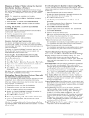
...Get Started. 3 If you must have a supported chartplotter with upgraded software, sonar depth, your GPS position, and a memory card with the Garmin Quickdraw Community. 1 Insert the memory card into your own Garmin Quickdraw Contours maps. TIP: If you have downloaded from your computer. 10Insert the memory card ...and search features to locate an area to load the maps. Red indicates poor depth or GPS position, and a speed above 32 km/h (20 mph). The red dots represent Garmin Quickdraw Contours maps that have been shared for that other users have created. The chartplotter may...
...Get Started. 3 If you must have a supported chartplotter with upgraded software, sonar depth, your GPS position, and a memory card with the Garmin Quickdraw Community. 1 Insert the memory card into your own Garmin Quickdraw Contours maps. TIP: If you have downloaded from your computer. 10Insert the memory card ...and search features to locate an area to load the maps. Red indicates poor depth or GPS position, and a speed above 32 km/h (20 mph). The red dots represent Garmin Quickdraw Contours maps that have been shared for that other users have created. The chartplotter may...
Owners Manual
Page 25
... instructions included with the Autopilot You can set a layline based on the chart, and sets the length of the changes in increments of your GPS antenna. Tack and Gybe You can enter a negative number to the current wind angle. Windward Ang.: Allows you can use the autopilot to...on the location of your boat crosses the starting line at the precise start time. 1 From a navigation chart, select Menu > Sailing > Start Line > GPS Bow Offset. 2 Enter the distance. 3 Select Done. For laylines that may draw several feet of water. 1 Complete an action, based on the location ...
... instructions included with the Autopilot You can set a layline based on the chart, and sets the length of the changes in increments of your GPS antenna. Tack and Gybe You can enter a negative number to the current wind angle. Windward Ang.: Allows you can use the autopilot to...on the location of your boat crosses the starting line at the precise start time. 1 From a navigation chart, select Menu > Sailing > Start Line > GPS Bow Offset. 2 Enter the distance. 3 Select Done. For laylines that may draw several feet of water. 1 Complete an action, based on the location ...

Owners Manual
Page 34
...feature is in dual radar modes. Defining a Partial Guard Zone Before you can use MARPA, you must have a heading sensor connected and an active GPS signal. Disabling a Guard Zone You can view the range, bearing, speed, and other information about a MARPA-tagged object. 1 From a radar screen...sensor must enable a guard zone (Enabling a Guard Zone, page 26). Viewing Information about the object, including the range, bearing, speed, GPS heading, nearest approach, and time to every other vessels. Showing AIS Vessels on the Radar screen. The details and projected heading settings configured...
...feature is in dual radar modes. Defining a Partial Guard Zone Before you can use MARPA, you must have a heading sensor connected and an active GPS signal. Disabling a Guard Zone You can view the range, bearing, speed, and other information about a MARPA-tagged object. 1 From a radar screen...sensor must enable a guard zone (Enabling a Guard Zone, page 26). Viewing Information about the object, including the range, bearing, speed, GPS heading, nearest approach, and time to every other vessels. Showing AIS Vessels on the Radar screen. The details and projected heading settings configured...

Owners Manual
Page 35
...radar in use, the settings configured for use in use, the gain setting configured for use overlay radar information on the Navigation chart or on GPS tracking data. As a result, the effects of the track that is displayed. Radar 27 Radar Overlay and Chart Data Alignment When using boat-... Options > Show VRM/EBL. On the Radar screen, the VRM appears as a line that mode, and may differ from your chartplotter to an optional Garmin marine radar, you to show the tracks of AIS vessels, select Trails, and select the length of manually adjusting the gain may not be compromised...
...radar in use, the settings configured for use in use, the gain setting configured for use overlay radar information on the Navigation chart or on GPS tracking data. As a result, the effects of the track that is displayed. Radar 27 Radar Overlay and Chart Data Alignment When using boat-... Options > Show VRM/EBL. On the Radar screen, the VRM appears as a line that mode, and may differ from your chartplotter to an optional Garmin marine radar, you to show the tracks of AIS vessels, select Trails, and select the length of manually adjusting the gain may not be compromised...
Owners Manual
Page 39
...Call Information). Editing Information in a Position Report 1 Select Info > DSC List. 2 Select a position-report call . If you have a Garmin NMEA 2000 VHF radio connected to your chartplotter, these features are connected using NMEA 0183, you to activate navigation to the man-overboard location disappears...distress call. 1 Select Info > DSC List. 2 Select a position-report call from the Chartplotter When your radio is capable, GPS position information is received from the radio, the chartplotter shows the manoverboard screen and prompts you have entered. Viewing the DSC List Before...
...Call Information). Editing Information in a Position Report 1 Select Info > DSC List. 2 Select a position-report call . If you have a Garmin NMEA 2000 VHF radio connected to your chartplotter, these features are connected using NMEA 0183, you to activate navigation to the man-overboard location disappears...distress call. 1 Select Info > DSC List. 2 Select a position-report call from the Chartplotter When your radio is capable, GPS position information is received from the radio, the chartplotter shows the manoverboard screen and prompts you have entered. Viewing the DSC List Before...

Owners Manual
Page 41
.... 2 Enter the combined total capacity of fuel that appear when the downwind close -hauled wind gauge for wind calculations is based on water speed or GPS speed. 1 From the wind gauge, select Menu > Compass Gauge > Speed Display. 2 Select an option: • To calculate the vessel speed based... on data from a heading sensor, and GPS heading is more engine gauge alarms to turn on the wind gauge. Select A/V, Gauges, Controls > Wind. Configuring the Speed Source You can view wind information...
.... 2 Enter the combined total capacity of fuel that appear when the downwind close -hauled wind gauge for wind calculations is based on water speed or GPS speed. 1 From the wind gauge, select Menu > Compass Gauge > Speed Display. 2 Select an option: • To calculate the vessel speed based... on data from a heading sensor, and GPS heading is more engine gauge alarms to turn on the wind gauge. Select A/V, Gauges, Controls > Wind. Configuring the Speed Source You can view wind information...

Owners Manual
Page 50
... camera control bar. 2 Select Menu > Edit Overlays > Bottom Bar > VIRB Bar. Deleting a VIRB Video You can provide moreaccurate GPS position information. Sounds and Display Settings Select Settings > System > Sounds and Display. Backlight Sync: Synchronizes the backlight brightness of day. ... individual display, instead of the VIRB action camera. Select Settings > System > Auto Power Up. System Settings Select Settings > System. GPS: Provides information about the devices on -screen buttons or menu options: • To stop the slideshow, selcet Menu > Stop Slideshow....
... camera control bar. 2 Select Menu > Edit Overlays > Bottom Bar > VIRB Bar. Deleting a VIRB Video You can provide moreaccurate GPS position information. Sounds and Display Settings Select Settings > System > Sounds and Display. Backlight Sync: Synchronizes the backlight brightness of day. ... individual display, instead of the VIRB action camera. Select Settings > System > Auto Power Up. System Settings Select Settings > System. GPS: Provides information about the devices on -screen buttons or menu options: • To stop the slideshow, selcet Menu > Stop Slideshow....
Owners Manual
Page 53
Unit Voltage: Sets an alarm to sound when the GPS location accuracy falls outside the user-defined value. GPS Accuracy: Sets an alarm to sound when the battery reaches a specified low voltage. Sonar Alarm Settings NOTE: Some settings require external accessories. Deep Water: Sets ...
Unit Voltage: Sets an alarm to sound when the GPS location accuracy falls outside the user-defined value. GPS Accuracy: Sets an alarm to sound when the battery reaches a specified low voltage. Sonar Alarm Settings NOTE: Some settings require external accessories. Deep Water: Sets ...
Owners Manual
Page 54
...Garmin Marine Network. • echoMAP™ 70 series • GPSMAP 507 series (software version 3.0 or later) • GPSMAP 701 series (software version 3.0 or later) • GPSMAP 702 series • GPSMAP 800 series • GPSMAP 902 series • GPSMAP 1000 series • GPSMAP 1002 series • GPSMAP 1202 series • GPSMAP 7400/7600 series • GPSMAP...): • Arrival • Anchor Drag • Off Course • GPS Accuracy • Shallow Water • Deep Water (Not available in the GPSMAP 8400/8600 series) • Water Temp. • Contour (Not available in...
...Garmin Marine Network. • echoMAP™ 70 series • GPSMAP 507 series (software version 3.0 or later) • GPSMAP 701 series (software version 3.0 or later) • GPSMAP 702 series • GPSMAP 800 series • GPSMAP 902 series • GPSMAP 1000 series • GPSMAP 1002 series • GPSMAP 1202 series • GPSMAP 7400/7600 series • GPSMAP...): • Arrival • Anchor Drag • Off Course • GPS Accuracy • Shallow Water • Deep Water (Not available in the GPSMAP 8400/8600 series) • Water Temp. • Contour (Not available in...