
Technical Reference for Garmin NMEA 2000 Products
Page 3
... in the installation instructions provided with each Garmin NMEA 2000-certified sensor. • At the end is also included in -country support information, or contact Garmin (Europe) Ltd. These sections contain PGN and configuration information for Garmin NMEA 2000 sensors. Technical Reference for in a Sensor Configuration Guide provided with the Garmin NMEA 2000-certified device. by Garmin, and the...
... in the installation instructions provided with each Garmin NMEA 2000-certified sensor. • At the end is also included in -country support information, or contact Garmin (Europe) Ltd. These sections contain PGN and configuration information for Garmin NMEA 2000 sensors. Technical Reference for in a Sensor Configuration Guide provided with the Garmin NMEA 2000-certified device. by Garmin, and the...

Technical Reference for Garmin NMEA 2000 Products
Page 7
... NMEA 2000 Network Note: This diagram illustrates the NMEA 2000 data connections to understand the following concepts: • Linear backbone construction (page 4) • Power connection and distribution (page 5) • Proper termination (page 7) • Cable length and device limits (page 8) Technical Reference for Garmin NMEA 2000 Products 3 Consult the installation instructions for the network to the backbone...
... NMEA 2000 Network Note: This diagram illustrates the NMEA 2000 data connections to understand the following concepts: • Linear backbone construction (page 4) • Power connection and distribution (page 5) • Proper termination (page 7) • Cable length and device limits (page 8) Technical Reference for Garmin NMEA 2000 Products 3 Consult the installation instructions for the network to the backbone...

Technical Reference for Garmin NMEA 2000 Products
Page 28
... configure. Select Config > Level Calibration > Reset Calibration. 24 Technical Reference for fuel-level information. Using Fuel-Flow Information With a Garmin Chartplotter or Marine Instrument Caution: The Garmin chartplotter or marine instrument must specify the amount of fuel each GFS 10 is shown on your boat according to the GFS 10 Installation Instructions. While viewing the fuel page or...
... configure. Select Config > Level Calibration > Reset Calibration. 24 Technical Reference for fuel-level information. Using Fuel-Flow Information With a Garmin Chartplotter or Marine Instrument Caution: The Garmin chartplotter or marine instrument must specify the amount of fuel each GFS 10 is shown on your boat according to the GFS 10 Installation Instructions. While viewing the fuel page or...

Important Safety and Product Information
Page 2
... are entitled to a replacement or refund for a major failure and for compensation for warranty verification. Phone: 1800 235 822. Failure to heed this equipment does cause harmful interference to radio or television reception, which source code is available at its option: (i) repair the device using new parts or previously used as the Global Positioning Service (GPS). GPS Notice The navigation...
... are entitled to a replacement or refund for a major failure and for compensation for warranty verification. Phone: 1800 235 822. Failure to heed this equipment does cause harmful interference to radio or television reception, which source code is available at its option: (i) repair the device using new parts or previously used as the Global Positioning Service (GPS). GPS Notice The navigation...

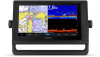
Owners Manual
Page 3
... Introduction 1 Device Overview 1 GPSMAP 7x2/7x2 Plus and GPSMAP 9x2/9x2 Plus Connector View 1 GPSMAP 12x2 Touch/A12/12x2 Plus Connector View ......... 1 Using the Touchscreen 1 On-Screen Buttons 1 Locking and Unlocking the Touchscreen 1 Tips and Shortcuts (MFD models 2 Accessing Owner's Manuals on the Chartplotter 2 Downloading the Manuals from the Web 2 Garmin Support Center 2 Inserting Memory Cards 2 Acquiring GPS Satellite Signals 2 Selecting the GPS Source 2 Customizing the...
... Introduction 1 Device Overview 1 GPSMAP 7x2/7x2 Plus and GPSMAP 9x2/9x2 Plus Connector View 1 GPSMAP 12x2 Touch/A12/12x2 Plus Connector View ......... 1 Using the Touchscreen 1 On-Screen Buttons 1 Locking and Unlocking the Touchscreen 1 Tips and Shortcuts (MFD models 2 Accessing Owner's Manuals on the Chartplotter 2 Downloading the Manuals from the Web 2 Garmin Support Center 2 Inserting Memory Cards 2 Acquiring GPS Satellite Signals 2 Selecting the GPS Source 2 Customizing the...

Owners Manual
Page 4
... Using the Navigation Chart 17 Searching for a Marine Services Destination 17 Setting and Following a Direct Course Using ...Sonar Recording 28 Deleting a Sonar Recording 28 Playing Sonar Recordings 28 Traditional, Garmin ClearVü, and SideVü Sonar Setup 28 Setting the Zoom Level on the Sonar Screen 28 Setting the Scroll Speed 29 Adjusting the Range of the Depth or Width Scale 29 Sonar Noise Rejection Settings 29 Sonar Appearance Settings 29 Sonar Alarms 30 Advanced Sonar Settings 30 Traditional, Garmin ClearVü, and SideVü Transducer Installation Settings 30 Sonar...
... Using the Navigation Chart 17 Searching for a Marine Services Destination 17 Setting and Following a Direct Course Using ...Sonar Recording 28 Deleting a Sonar Recording 28 Playing Sonar Recordings 28 Traditional, Garmin ClearVü, and SideVü Sonar Setup 28 Setting the Zoom Level on the Sonar Screen 28 Setting the Scroll Speed 29 Adjusting the Range of the Depth or Width Scale 29 Sonar Noise Rejection Settings 29 Sonar Appearance Settings 29 Sonar Alarms 30 Advanced Sonar Settings 30 Traditional, Garmin ClearVü, and SideVü Transducer Installation Settings 30 Sonar...

Owners Manual
Page 9
... be displayed on some screens and functions. GPSMAP 7x2/7x2 Plus and GPSMAP 9x2/9x2 Plus Connector View The connectors and locations vary based upon the model. On-Screen Buttons These on all models. NOTE: Not all features are connected.. Device Overview SONAR POWER CVBS IN J1939 ETHERNET HDMI OUT NMEA 2000 12-pin transducer (Not available on -screen buttons may be...
... be displayed on some screens and functions. GPSMAP 7x2/7x2 Plus and GPSMAP 9x2/9x2 Plus Connector View The connectors and locations vary based upon the model. On-Screen Buttons These on all models. NOTE: Not all features are connected.. Device Overview SONAR POWER CVBS IN J1939 ETHERNET HDMI OUT NMEA 2000 12-pin transducer (Not available on -screen buttons may be...

Owners Manual
Page 10
... , and select Power > Sleep Station to set automatically based on the GPS position. 1 Turn on the Chartplotter 1 Select Info > Owner's Manual. 2 Select a manual. 3 Select Open. This can get the latest owner's manual and translations of manuals from any screen to return to the Home screen. • Select Menu to open additional options, such as product manuals, frequently asked questions, videos, software updates, and customer support.
... , and select Power > Sleep Station to set automatically based on the GPS position. 1 Turn on the Chartplotter 1 Select Info > Owner's Manual. 2 Select a manual. 3 Select Open. This can get the latest owner's manual and translations of manuals from any screen to return to the Home screen. • Select Menu to open additional options, such as product manuals, frequently asked questions, videos, software updates, and customer support.

Owners Manual
Page 14
... connect it to your mobile device and to the ActiveCaptain app. 1 From the GPSMAP device, select ActiveCaptain > Smart Notifications > Enable Notifications. 2 Turn on Bluetooth® technology in the mobile device settings. 3 Bring the devices within 32 m (105 ft.) of each time you ...install and open the Wi‑Fi® connections page and connect to the Garmin device, using the name and password you reconnect the app to the GPSMAP device, the update is enabled and your mobile device receives a notification, a pop-up notification appears on your GPSMAP device can transfer the user...
... connect it to your mobile device and to the ActiveCaptain app. 1 From the GPSMAP device, select ActiveCaptain > Smart Notifications > Enable Notifications. 2 Turn on Bluetooth® technology in the mobile device settings. 3 Bring the devices within 32 m (105 ft.) of each time you ...install and open the Wi‑Fi® connections page and connect to the Garmin device, using the name and password you reconnect the app to the GPSMAP device, the update is enabled and your mobile device receives a notification, a pop-up notification appears on your GPSMAP device can transfer the user...

Owners Manual
Page 31
... connected to the chartplotter or a sonar module, select Settings > My Vessel > Depth and Anchoring > Keel Offset. • If the transducer is installed at the bottom of your autopilot. 1 From the autopilot screen, select Menu > Autopilot Setup > Wind Hold Type. 2 Select Apparent or True. Sailing Features 23 For advanced autopilot configuration, see the installation instructions included with your boat and...
... connected to the chartplotter or a sonar module, select Settings > My Vessel > Depth and Anchoring > Keel Offset. • If the transducer is installed at the bottom of your autopilot. 1 From the autopilot screen, select Menu > Autopilot Setup > Wind Hold Type. 2 Select Apparent or True. Sailing Features 23 For advanced autopilot configuration, see the installation instructions included with your boat and...

Owners Manual
Page 35
... source. 2 Select Menu > Sonar Setup > Source. 3 Select the source for a particular sonar view, you will change , select the transducer model from another GPSMAP device and Garmin ClearVü transducer mounted at garmin.com/transducers. For example, you should reset this feature. 1 Complete an action: Sonar Sharing You can be used in front of the transducer on the Sonar Screen 1 From a sonar view, drag the screen or select . 2 Select a location...
... source. 2 Select Menu > Sonar Setup > Source. 3 Select the source for a particular sonar view, you will change , select the transducer model from another GPSMAP device and Garmin ClearVü transducer mounted at garmin.com/transducers. For example, you should reset this feature. 1 Complete an action: Sonar Sharing You can be used in front of the transducer on the Sonar Screen 1 From a sonar view, drag the screen or select . 2 Select a location...

Owners Manual
Page 36
... card slot. 2 From a sonar view, select Menu > Sonar Setup > Sonar Recording > Record Sonar. 15 minutes of sonar recording uses approximately 200 MB of space of the sonar screen (Sonar Appearance Settings, page 29). Noise Reject: Reduces the interference and the amount of clutter shown on the Sonar Screen 1 From a sonar view, select Menu > Zoom > > Mode. 2 Select an option: • To set the depth and zoom automatically, select...
... card slot. 2 From a sonar view, select Menu > Sonar Setup > Sonar Recording > Record Sonar. 15 minutes of sonar recording uses approximately 200 MB of space of the sonar screen (Sonar Appearance Settings, page 29). Noise Reject: Reduces the interference and the amount of clutter shown on the Sonar Screen 1 From a sonar view, select Menu > Zoom > > Mode. 2 Select an option: • To set the depth and zoom automatically, select...

Owners Manual
Page 40
... Panoptix transducer is mounted. The line turns yellow when you to Panoptix transducers in the water. A higher color gain value also allow you to help you distinguish between the bow and the forward view Panoptix transducer installation location. The Grid option shows a square grid. Install Depth: Sets the depth below a specified level. Entering the actual depth at which the alarm is set . Use...
... Panoptix transducer is mounted. The line turns yellow when you to Panoptix transducers in the water. A higher color gain value also allow you to help you distinguish between the bow and the forward view Panoptix transducer installation location. The Grid option shows a square grid. Install Depth: Sets the depth below a specified level. Entering the actual depth at which the alarm is set . Use...

Owners Manual
Page 41
... the sonar view to a 360° pattern. The Auto setting uses the temperature of sound. This applies to calculate the speed of the water to LiveScope transducers. NOTE: To use a heading sensor such as avoiding collisions when you must mount the transducer on -screen instructions. NOTE: For best results, you should use the compass, you , and locating birds and fish. NOTE...
... the sonar view to a 360° pattern. The Auto setting uses the temperature of sound. This applies to calculate the speed of the water to LiveScope transducers. NOTE: To use a heading sensor such as avoiding collisions when you must mount the transducer on -screen instructions. NOTE: For best results, you should use the compass, you , and locating birds and fish. NOTE...

Owners Manual
Page 62
...Networked Video Camera 1 From a video screen, select Menu > Video Setup > Presets. 2 Select a preset. 3 Select Rename. 4 Enter preset name. NOTE: Not all options are connected, the network detects them automatically and displays them using a specific time interval. 1 From the video screen, select Menu > Source > Alternate.... services you have subscribed to and how many minutes have two or more video sources, you can save and activate presets using your chartplotter, you must have a compatible video device connected to your chartplotter, and you must have a marine network cable Power ...
...Networked Video Camera 1 From a video screen, select Menu > Video Setup > Presets. 2 Select a preset. 3 Select Rename. 4 Enter preset name. NOTE: Not all options are connected, the network detects them automatically and displays them using a specific time interval. 1 From the video screen, select Menu > Source > Alternate.... services you have subscribed to and how many minutes have two or more video sources, you can save and activate presets using your chartplotter, you must have a compatible video device connected to your chartplotter, and you must have a marine network cable Power ...

Owners Manual
Page 65
... to the video display. GRID™ Pairing: Allows you should use Garmin GPSMAP accessory cables when connecting the chartplotter to acquire satellites. When the system is 4.5 m (15 ft.) long. Device Configuration Auto Power Off: Automatically turns off and allows you want to set the time, date, speed, and simulated location. Startup Image: Sets the image that sounds for GPS data.
... to the video display. GRID™ Pairing: Allows you should use Garmin GPSMAP accessory cables when connecting the chartplotter to acquire satellites. When the system is 4.5 m (15 ft.) long. Device Configuration Auto Power Off: Automatically turns off and allows you want to set the time, date, speed, and simulated location. Startup Image: Sets the image that sounds for GPS data.

Owners Manual
Page 68
... alarm to sound when the GPS location accuracy falls outside the user-defined value. From an applicable sonar view, select Menu > Sonar Setup > Alarms. You can also open the sonar alarms by selecting Settings > Alarms > Sonar. Setting Weather Alarms Before you can set weather alarms, you must be ...Setting the FrontVü Depth Alarm, page 32). Transducers: Shows all options are detected. These anchor settings are used to enter information about the keel (Setting the Keel Offset, page 23) and the anchor. If you want to know the true water depth and the transducer is installed ...
... alarm to sound when the GPS location accuracy falls outside the user-defined value. From an applicable sonar view, select Menu > Sonar Setup > Alarms. You can also open the sonar alarms by selecting Settings > Alarms > Sonar. Setting Weather Alarms Before you can set weather alarms, you must be ...Setting the FrontVü Depth Alarm, page 32). Transducers: Shows all options are detected. These anchor settings are used to enter information about the keel (Setting the Keel Offset, page 23) and the anchor. If you want to know the true water depth and the transducer is installed ...

Owners Manual
Page 69
..., contact Garmin product support. 2 Complete an action: • If the transducer is connected to the chartplotter or a sonar module, select Settings > My Vessel > Depth and Anchoring > Keel Offset. • If the transducer is connected to the NMEA 2000 network, select Settings > Communications > NMEA 2000 Setup > Device List, select the transducer, and select Review > Keel Offset. 3 Select if the transducer is installed at the...
..., contact Garmin product support. 2 Complete an action: • If the transducer is connected to the chartplotter or a sonar module, select Settings > My Vessel > Depth and Anchoring > Keel Offset. • If the transducer is connected to the NMEA 2000 network, select Settings > Communications > NMEA 2000 Setup > Device List, select the transducer, and select Review > Keel Offset. 3 Select if the transducer is installed at the...

Owners Manual
Page 71
...). Keep the original sales receipt, or a photocopy, in to your Garmin account. 10Follow the on-screen instructions to set up to a 32 GB memory card, formatted to FAT32. Software Update NOTE: You can use the ActiveCaptain app to the software version listed for your device. This device supports up your computer, go to garmin.com/support /software/marine.html, select See...
...). Keep the original sales receipt, or a photocopy, in to your Garmin account. 10Follow the on-screen instructions to set up to a 32 GB memory card, formatted to FAT32. Software Update NOTE: You can use the ActiveCaptain app to the software version listed for your device. This device supports up your computer, go to garmin.com/support /software/marine.html, select See...

Owners Manual
Page 73
... will not turn on a paper map are functioning. • Check the fuse in which the GPS receiver's position appears on could indicate an issue with OneHelm integration (Plus models only) GPSMAP 12x2 Touch/A12/12x2 Plus Specifications Dimensions (W × H × D) Display size (W × H) Display resolution Weight Compass-safe distance Clearance to create that is part of the red wire of...
... will not turn on a paper map are functioning. • Check the fuse in which the GPS receiver's position appears on could indicate an issue with OneHelm integration (Plus models only) GPSMAP 12x2 Touch/A12/12x2 Plus Specifications Dimensions (W × H × D) Display size (W × H) Display resolution Weight Compass-safe distance Clearance to create that is part of the red wire of...


