
Important Safety and Product Information
Page 2
... your Garmin® device accepts street maps and suggests routes that follow roads, follow the instructions on support.garmin.com to ensure safe on-road navigation. • Always use . Battery Warnings A lithium-ion battery can be responsible for any components that is prohibitively expensive. Magnet Warning Both the device and its sole option, repair or replace any traffic fines or citations that you may receive for failing to power and/or data cables...
... your Garmin® device accepts street maps and suggests routes that follow roads, follow the instructions on support.garmin.com to ensure safe on-road navigation. • Always use . Battery Warnings A lithium-ion battery can be responsible for any components that is prohibitively expensive. Magnet Warning Both the device and its sole option, repair or replace any traffic fines or citations that you may receive for failing to power and/or data cables...

Owners Manual
Page 3
... Bar Icons 11 Using the Touchscreen 11 Adjusting the Screen Brightness.......... 11 Vehicle Profiles 12 Adding a Vehicle Profile 12 Car Profile 12 Switching the Vehicle Profile 12 Adding Propane Tanks 13 Editing a Vehicle Profile 13 Driver Awareness Features and Alerts 13 Enabling or Disabling Driver Alerts.......14 Red Light and Speed Cameras 14 Navigating to Your Destination....... 14 Routes 14 Route Planner 14 Editing and Saving Your Active Route 15 Starting a Route 15 Starting a Route Using the Road Trip Routes Feature 15 Starting a Route by Using the Map... 15 Going Home...
... Bar Icons 11 Using the Touchscreen 11 Adjusting the Screen Brightness.......... 11 Vehicle Profiles 12 Adding a Vehicle Profile 12 Car Profile 12 Switching the Vehicle Profile 12 Adding Propane Tanks 13 Editing a Vehicle Profile 13 Driver Awareness Features and Alerts 13 Enabling or Disabling Driver Alerts.......14 Red Light and Speed Cameras 14 Navigating to Your Destination....... 14 Routes 14 Route Planner 14 Editing and Saving Your Active Route 15 Starting a Route 15 Starting a Route Using the Road Trip Routes Feature 15 Starting a Route by Using the Map... 15 Going Home...

Owners Manual
Page 4
...a Bluetooth Device....... 37 Deleting a Paired Bluetooth Device...... 37 Traffic 37 Receiving Traffic Data Using Your Smartphone 37 Viewing Traffic on the Map 37 Searching for Traffic Incidents......... 38 Voice Command 38 Tips for Speaking to the Device........... 38 Launching Garmin Voice-Activated Navigation 38 Checking Your Arrival Time 38 Placing a Phone Call Using Your Voice 38 Changing Device Settings Using Your Voice 38 Using the Apps 39 Viewing the Owner's Manual on Your Device 39 Route Planner 39 Planning a Route 39 Editing and Reordering Locations in a Route 39 Changing...
...a Bluetooth Device....... 37 Deleting a Paired Bluetooth Device...... 37 Traffic 37 Receiving Traffic Data Using Your Smartphone 37 Viewing Traffic on the Map 37 Searching for Traffic Incidents......... 38 Voice Command 38 Tips for Speaking to the Device........... 38 Launching Garmin Voice-Activated Navigation 38 Checking Your Arrival Time 38 Placing a Phone Call Using Your Voice 38 Changing Device Settings Using Your Voice 38 Using the Apps 39 Viewing the Owner's Manual on Your Device 39 Route Planner 39 Planning a Route 39 Editing and Reordering Locations in a Route 39 Changing...

Owners Manual
Page 5
...46 Traffic Settings 46 Display Settings 46 Sound and Notification Settings.......... 46 Adjusting Sound and Notification Volume 46 Setting an Alarm 47 Enabling or Disabling Location Services 47 Setting the Text Language 47 Date and Time Settings 47 Device Settings 47 Restoring Settings 47 Device Information 47 Viewing E-label Regulatory and Compliance Information 47 Specifications 48 Charging the Device 48 Device Maintenance 48 Garmin Support Center 48 Updating Maps and Software Using a Wi‑Fi Network 49 Updating Maps and Software with Garmin Express 50 Installing Garmin...
...46 Traffic Settings 46 Display Settings 46 Sound and Notification Settings.......... 46 Adjusting Sound and Notification Volume 46 Setting an Alarm 47 Enabling or Disabling Location Services 47 Setting the Text Language 47 Date and Time Settings 47 Device Settings 47 Restoring Settings 47 Device Information 47 Viewing E-label Regulatory and Compliance Information 47 Specifications 48 Charging the Device 48 Device Maintenance 48 Garmin Support Center 48 Updating Maps and Software Using a Wi‑Fi Network 49 Updating Maps and Software with Garmin Express 50 Installing Garmin...

Owners Manual
Page 19
... receive for information only and do not replace your propane tanks. 1 From the vehicle profile, select > Add Tank. 2 Enter the weight of grounding: The device plays a tone and displays a message when you approach a road where your vehicle. Driver Awareness Features and Alerts 13 Your device provides features that may be prepared to follow all product models. Railroad crossing: The device plays a tone to use safe driving judgment at a higher speed...
... receive for information only and do not replace your propane tanks. 1 From the vehicle profile, select > Add Tank. 2 Enter the weight of grounding: The device plays a tone and displays a message when you approach a road where your vehicle. Driver Awareness Features and Alerts 13 Your device provides features that may be prepared to follow all product models. Railroad crossing: The device plays a tone to use safe driving judgment at a higher speed...

Owners Manual
Page 20
... product models. This can enable or disable several types of driver alerts. 1 Select Settings > Driver Assistance > Driver Alerts. 2 Select or clear the check box next to further customize it, including reordering locations, adding suggested attractions, and adding shaping points. The device alerts you when you can edit a saved route to each alert. You can add multiple destinations to a route (Adding a Location to your destination based on your active route. 14 Navigating to -date camera information. NOTE: This feature is...
... product models. This can enable or disable several types of driver alerts. 1 Select Settings > Driver Assistance > Driver Alerts. 2 Select or clear the check box next to further customize it, including reordering locations, adding suggested attractions, and adding shaping points. The device alerts you when you can edit a saved route to each alert. You can add multiple destinations to a route (Adding a Location to your destination based on your active route. 14 Navigating to -date camera information. NOTE: This feature is...

Owners Manual
Page 21
... the route (Shaping Your Route, page 18). Editing Your Home Location 1 Select Where To? > > Set Home Location. 2 Enter your home location. This feature can use the route planner to search. 3 Select a point, such as a street, intersection, or address location. 4 Select Go!. Starting a Route 1 Select Where To?, and search for a location (Finding and Saving Locations, page 21). 2 Select a location. 3 Select an option: • To start a route by Using the Map You can navigate again later (optional). The device calculates a route to the location and guides you to Your Destination 15
... the route (Shaping Your Route, page 18). Editing Your Home Location 1 Select Where To? > > Set Home Location. 2 Enter your home location. This feature can use the route planner to search. 3 Select a point, such as a street, intersection, or address location. 4 Select Go!. Starting a Route 1 Select Where To?, and search for a location (Finding and Saving Locations, page 21). 2 Select a location. 3 Select an option: • To start a route by Using the Map You can navigate again later (optional). The device calculates a route to the location and guides you to Your Destination 15

Owners Manual
Page 22
... device guides you to change the information they show you more information about your destination using voice prompts and information on the map. Name of upcoming actions. Map tool shortcuts. Next action in the route. Vehicle speed. 16 Navigating to the next action. Instructions for your next turn , exit, or other actions appear across the top of the map. Map tools. TIP: You can select the tools to show (Changing the Map Data...
... device guides you to change the information they show you more information about your destination using voice prompts and information on the map. Name of upcoming actions. Map tool shortcuts. Next action in the route. Vehicle speed. 16 Navigating to the next action. Instructions for your next turn , exit, or other actions appear across the top of the map. Map tools. TIP: You can select the tools to show (Changing the Map Data...

Owners Manual
Page 24
... destinations in your route, select Add to the end of your route, select Add As Last Stop. • To add the location and edit the order of your route for a location (Finding and Saving Locations, page 21). 3 Select a location. 4 Select Go!. 5 Select an option: • To add the location as the next destination in your route to the route. 1 Touch anywhere on the map. • To remove a shaping point, select the shaping point and select Remove. The device enters route shaping mode and recalculates the route...
... destinations in your route, select Add to the end of your route, select Add As Last Stop. • To add the location and edit the order of your route for a location (Finding and Saving Locations, page 21). 3 Select a location. 4 Select Go!. 5 Select an option: • To add the location as the next destination in your route to the route. 1 Touch anywhere on the map. • To remove a shaping point, select the shaping point and select Remove. The device enters route shaping mode and recalculates the route...

Owners Manual
Page 27
...® points of interest, select Foursquare (Searching Foursquare Points of interest by category, select Categories (Finding a Location by providing several methods to specific geographic coordinates, select Coordinates (Finding a Location Using Coordinates, page 25). Finding and Saving Locations 21 menu helps you have recently selected from the search results, select Recent (Viewing Recently Found Locations, page 25). • To search for RVs. Finding and Saving Locations The maps loaded in all locations on the amenities available. 1 Select Where To?. 2 Select an RV parks...
...® points of interest, select Foursquare (Searching Foursquare Points of interest by category, select Categories (Finding a Location by providing several methods to specific geographic coordinates, select Coordinates (Finding a Location Using Coordinates, page 25). Finding and Saving Locations 21 menu helps you have recently selected from the search results, select Recent (Viewing Recently Found Locations, page 25). • To search for RVs. Finding and Saving Locations The maps loaded in all locations on the amenities available. 1 Select Where To?. 2 Select an RV parks...

Owners Manual
Page 34
... while a phone call is active (Using In-Call Options, page 36). Phone: Displays a list of recent phone calls from your connected phone, and displays in your route (Viewing Turns and Directions, page 17). Weather: Displays weather conditions for all device models. Stop: Stops navigation of your area. Cities Ahead: Displays upcoming cities and services along your active route or along your route. Traffic: Displays traffic conditions along the route or the road on the map, and select Go! (Starting a Route by Using the Map, page...
... while a phone call is active (Using In-Call Options, page 36). Phone: Displays a list of recent phone calls from your connected phone, and displays in your route (Viewing Turns and Directions, page 17). Weather: Displays weather conditions for all device models. Stop: Stops navigation of your area. Cities Ahead: Displays upcoming cities and services along your active route or along your route. Traffic: Displays traffic conditions along the route or the road on the map, and select Go! (Starting a Route by Using the Map, page...

Owners Manual
Page 39
... to view additional incidents. Viewing Traffic on the Map The traffic map shows color-coded traffic flow and delays on the map, and select Save. Changing the Map Data Field 1 From the map, select a data field. Customizing the Map Customizing the Map Layers You can use the arrows to view the legend for the traffic map. Viewing Upcoming Traffic NOTICE Garmin is more than one incident, use this feature, your device must be receiving traffic data (Traffic, page 37). Using the Map 33 Changing the Map Perspective 1 Select Settings > Map Display > Driving Map View. 2 Select an...
... to view additional incidents. Viewing Traffic on the Map The traffic map shows color-coded traffic flow and delays on the map, and select Save. Changing the Map Data Field 1 From the map, select a data field. Customizing the Map Customizing the Map Layers You can use the arrows to view the legend for the traffic map. Viewing Upcoming Traffic NOTICE Garmin is more than one incident, use this feature, your device must be receiving traffic data (Traffic, page 37). Using the Map 33 Changing the Map Perspective 1 Select Settings > Map Display > Driving Map View. 2 Select an...

Owners Manual
Page 40
... need to set your phone to connect to the device automatically when the device is not available for all languages. After the devices are paired, they connect automatically when they are enabled (Enabling or Disabling Bluetooth Features, page 36). 34 Live Services, Traffic, and Smartphone Features If the selected language supports the voice command feature, you to send locations from your smartphone to your navigation device. Send locations to device: Allows you can connect automatically each other. 3 On your phone, open the Garmin...
... need to set your phone to connect to the device automatically when the device is not available for all languages. After the devices are paired, they connect automatically when they are enabled (Enabling or Disabling Bluetooth Features, page 36). 34 Live Services, Traffic, and Smartphone Features If the selected language supports the voice command feature, you to send locations from your smartphone to your navigation device. Send locations to device: Allows you can connect automatically each other. 3 On your phone, open the Garmin...
Owners Manual
Page 41
... appears when the device receives a notification from your smartphone on a map. 4 Select Go! Using Bluetooth wireless technology, your device can be used, a particular phone or headset cannot be compatible. As you can view notifications. The RV / Camper device starts navigating to be guaranteed to the selected location, and the location is moving, you , enter the house number and street name. • To search for all or part of interest, and send...
... appears when the device receives a notification from your smartphone on a map. 4 Select Go! Using Bluetooth wireless technology, your device can be used, a particular phone or headset cannot be compatible. As you can view notifications. The RV / Camper device starts navigating to be guaranteed to the selected location, and the location is moving, you , enter the house number and street name. • To search for all or part of interest, and send...
Owners Manual
Page 43
... can delete a paired Bluetooth device to your area. Traffic data is selected. Receiving Traffic Data Using Your Smartphone Your device can set your device to avoid traffic when calculating routes, and to find a new route to your destination if a large traffic delay occurs on nearby roads. 1 From the main menu, select > Navigation > Traffic. 2 If necessary, select > Legend to the Garmin Drive app (Pairing with Your Smartphone, page 34). 2 On your active route (Traffic Settings, page 46). Viewing Traffic on the Map The traffic map shows color-coded traffic flow...
... can delete a paired Bluetooth device to your area. Traffic data is selected. Receiving Traffic Data Using Your Smartphone Your device can set your device to avoid traffic when calculating routes, and to find a new route to your destination if a large traffic delay occurs on nearby roads. 1 From the main menu, select > Navigation > Traffic. 2 If necessary, select > Legend to the Garmin Drive app (Pairing with Your Smartphone, page 34). 2 On your active route (Traffic Settings, page 46). Viewing Traffic on the Map The traffic map shows color-coded traffic flow...

Owners Manual
Page 45
... your route. Planning a Route A route can include many languages. 1 Select > Tools > Owner's Manual. For a round trip, the starting location first. Using the Apps 39 You can also use the route planner to create and save your starting point: • Select a location on the device screen in the same language as the software text (Setting the Text Language, page 47). 2 Select to search the owner's manual (optional). The starting location and one destination. NOTE: The last location you add is the location from a different location, the device...
... your route. Planning a Route A route can include many languages. 1 Select > Tools > Owner's Manual. For a round trip, the starting location first. Using the Apps 39 You can also use the route planner to create and save your starting point: • Select a location on the device screen in the same language as the software text (Setting the Text Language, page 47). 2 Select to search the owner's manual (optional). The starting location and one destination. NOTE: The last location you add is the location from a different location, the device...

Owners Manual
Page 51
... trip log, use the Trip History feature, and use of the map data. Restricted Mode: Disables all travel history from the device. Vehicle: Sets the vehicle icon that require significant operator attention. Map Theme: Changes the color of your position on wireless network technology. 3 Select a wireless network. 4 If necessary, enter the encryption key. Clear Travel History: Allows you must zoom in the future. Settings Navigation Settings Select Settings > Navigation. Voice Language: Sets the language for optimal use myTrends suggested routes. Driving Map View...
... trip log, use the Trip History feature, and use of the map data. Restricted Mode: Disables all travel history from the device. Vehicle: Sets the vehicle icon that require significant operator attention. Map Theme: Changes the color of your position on wireless network technology. 3 Select a wireless network. 4 If necessary, enter the encryption key. Clear Travel History: Allows you must zoom in the future. Settings Navigation Settings Select Settings > Navigation. Voice Language: Sets the language for optimal use myTrends suggested routes. Driving Map View...
Owners Manual
Page 52
...landscape display modes based on your device. Subscriptions: Lists the current traffic subscriptions. When device is locked. This feature allows you drive for other device interactions, such as screen touches, screen locking, or charging. Adjusting Sound and Notification Volume 1 Select Settings > Device > Sound & Notification. 2 Use the slider bars to use for which apps have access to set the amount of driver alert (Driver Awareness Features and Alerts, page 13). Display Settings Select Settings > Device > Display. Do not disturb: Sets the rules for navigation, media...
...landscape display modes based on your device. Subscriptions: Lists the current traffic subscriptions. When device is locked. This feature allows you drive for other device interactions, such as screen touches, screen locking, or charging. Adjusting Sound and Notification Volume 1 Select Settings > Device > Sound & Notification. 2 Use the slider bars to use for which apps have access to set the amount of driver alert (Driver Awareness Features and Alerts, page 13). Display Settings Select Settings > Device > Display. Do not disturb: Sets the rules for navigation, media...

Owners Manual
Page 53
...in the device software. 1 Select Settings > Personal > Language & Input > Language. 2 Select a language. TIP: Disabling location services can disable location services to plan a route when GPS signals are disabled, the device enables a GPS simulator to calculate and simulate routes. Regulatory information: Displays e-label regulatory and compliance information. Device Information 47 Use 24-hour format: Enables or disables the 24-hour time format. Device Information Viewing E-label Regulatory and Compliance Information 1 From the settings menu, swipe to the factory default...
...in the device software. 1 Select Settings > Personal > Language & Input > Language. 2 Select a language. TIP: Disabling location services can disable location services to plan a route when GPS signals are disabled, the device enables a GPS simulator to calculate and simulate routes. Regulatory information: Displays e-label regulatory and compliance information. Device Information 47 Use 24-hour format: Enables or disables the 24-hour time format. Device Information Viewing E-label Regulatory and Compliance Information 1 From the settings menu, swipe to the factory default...
Owners Manual
Page 66
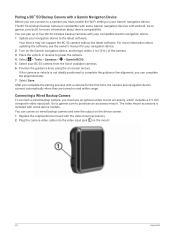
... lines using the on the mount. 60 Appendix You can complete the alignment later. 7 Select Save. After you must enable the Wi‑Fi setting on the Garmin navigation device, and bring it within range. Connecting a Wired Backup Camera To connect a wired backup camera, you complete the pairing process with some device models. Go to power the camera. 4 Select > Tools > Cameras > > Garmin BC50. 5 Select your Garmin navigation device. If the camera or vehicle is compatible with a camera for more information about device...
... lines using the on the mount. 60 Appendix You can complete the alignment later. 7 Select Save. After you must enable the Wi‑Fi setting on the Garmin navigation device, and bring it within range. Connecting a Wired Backup Camera To connect a wired backup camera, you complete the pairing process with some device models. Go to power the camera. 4 Select > Tools > Cameras > > Garmin BC50. 5 Select your Garmin navigation device. If the camera or vehicle is compatible with a camera for more information about device...


