

Important Safety and Product Information
Page 1
... used in a safe manner. Do not become distracted by Garmin or is used improperly, you in an unsafe situation. • Always carefully compare information displayed on the camera to all available navigation sources, including weather conditions, maps, street/trail signs and conditions, waterway restrictions, and other liquids. • To avoid possible device damage, do not replace your best judgment, and operate the vehicle in this device...
... used in a safe manner. Do not become distracted by Garmin or is used improperly, you in an unsafe situation. • Always carefully compare information displayed on the camera to all available navigation sources, including weather conditions, maps, street/trail signs and conditions, waterway restrictions, and other liquids. • To avoid possible device damage, do not replace your best judgment, and operate the vehicle in this device...

Important Safety and Product Information
Page 2
... your Garmin device in conjunction with any user-serviceable parts. The full text of the declaration of radio frequency (RF) energy for data communications. This device must not be co-located or operated in a location that does not obstruct the driver's view of the road. These limits are designed to send and receive low levels of conformity is available at the following internet address: garmin.com/compliance. Repairs...
... your Garmin device in conjunction with any user-serviceable parts. The full text of the declaration of radio frequency (RF) energy for data communications. This device must not be co-located or operated in a location that does not obstruct the driver's view of the road. These limits are designed to send and receive low levels of conformity is available at the following internet address: garmin.com/compliance. Repairs...
Important Safety and Product Information
Page 3
... sole option, repair or replace any components that fail in the original country of purchase or follow the instructions on support.garmin .com to a defect in the United States, you submit a claim for warranty service in accordance with a new device or a Garmin Recertified device that are obtained and/or used for a full refund of your device is still not functioning properly after making use of these...
... sole option, repair or replace any components that fail in the original country of purchase or follow the instructions on support.garmin .com to a defect in the United States, you submit a claim for warranty service in accordance with a new device or a Garmin Recertified device that are obtained and/or used for a full refund of your device is still not functioning properly after making use of these...

Owners Manual
Page 3
Table of Contents Getting Started 1 Garmin® Device Overview 1 Installing the Dash Camera Memory Card 2 Mounting Considerations 2 Mounting and Powering the Garmin Device in Your Vehicle 3 Turning the Device On or Off 4 Acquiring GPS Signals 5 Status Bar Icons 5 Using the On-Screen Buttons 5 Adjusting the Volume 6 Using the Audio Mixer 6 Adjusting the Screen Brightness 6 Vehicle Profiles 6 Adding a Vehicle Profile 6 Adding an Environmental Zone Vehicle Profile 7 Car Profile 7 Switching the Vehicle Profile 7 Editing a Vehicle Profile 7 Adding Propane Tanks 7 Dash Cam 8 ...
Table of Contents Getting Started 1 Garmin® Device Overview 1 Installing the Dash Camera Memory Card 2 Mounting Considerations 2 Mounting and Powering the Garmin Device in Your Vehicle 3 Turning the Device On or Off 4 Acquiring GPS Signals 5 Status Bar Icons 5 Using the On-Screen Buttons 5 Adjusting the Volume 6 Using the Audio Mixer 6 Adjusting the Screen Brightness 6 Vehicle Profiles 6 Adding a Vehicle Profile 6 Adding an Environmental Zone Vehicle Profile 7 Car Profile 7 Switching the Vehicle Profile 7 Editing a Vehicle Profile 7 Adding Propane Tanks 7 Dash Cam 8 ...

Owners Manual
Page 4
...Emergency Services and Fuel 24 Getting Directions to Your Current Location 24 Adding a Shortcut 24 Removing a Shortcut 24 Saving Locations 24 Saving a Location 24 Saving Your Current Location........... 24 Editing a Saved Location 25 Assigning Categories to a Saved Location 25 Deleting a Saved Location 25 Following a Route 25 Routes 25 Starting a Route 26 Starting a Route by Using the Map... 26 Starting a Route Using the Road Trip Routes Feature 26 Going Home 26 Changing the Route Calculation Mode 27 Your Route on the Map 27 Active Lane Guidance 28 Viewing Turns and Directions...
...Emergency Services and Fuel 24 Getting Directions to Your Current Location 24 Adding a Shortcut 24 Removing a Shortcut 24 Saving Locations 24 Saving a Location 24 Saving Your Current Location........... 24 Editing a Saved Location 25 Assigning Categories to a Saved Location 25 Deleting a Saved Location 25 Following a Route 25 Routes 25 Starting a Route 26 Starting a Route by Using the Map... 26 Starting a Route Using the Road Trip Routes Feature 26 Going Home 26 Changing the Route Calculation Mode 27 Your Route on the Map 27 Active Lane Guidance 28 Viewing Turns and Directions...
Owners Manual
Page 5
... on the Map 45 Saving a Traffic Camera 45 Garmin PowerSwitch™ App 46 Activating a Power Switch 46 Turning Off All Switches 46 Customizing a Button 47 Assigning a Switch to a Control Input 47 Adding a Custom Layout 47 Routines 48 Setting a Simulated Location........... 50 Wireless Network Settings 50 Driver Assistance Settings 50 Proximity Alerts Settings 51 Dash Cam Settings 51 Wireless Camera Settings 51 Backup Camera Settings 51 Display Settings 52 Traffic Settings 52 Units and Time Settings 52 Setting the Time 52 Language and Keyboard Settings........ 52 Device and...
... on the Map 45 Saving a Traffic Camera 45 Garmin PowerSwitch™ App 46 Activating a Power Switch 46 Turning Off All Switches 46 Customizing a Button 47 Assigning a Switch to a Control Input 47 Adding a Custom Layout 47 Routines 48 Setting a Simulated Location........... 50 Wireless Network Settings 50 Driver Assistance Settings 50 Proximity Alerts Settings 51 Dash Cam Settings 51 Wireless Camera Settings 51 Backup Camera Settings 51 Display Settings 52 Traffic Settings 52 Units and Time Settings 52 Setting the Time 52 Language and Keyboard Settings........ 52 Device and...

Owners Manual
Page 11
... navigation. The first time you turn on your navigation device, the GPS receiver must collect satellite data and establish the current location. Status Bar Icons The status bar is ready for the current screen. The status bar icons display information about features on the device. 2 Wait while the device locates satellites. 3 If necessary, go to an open the dash cam controls. You can select some icons to change settings or view additional information. Wi‑Fi® signal strength. Select...
... navigation. The first time you turn on your navigation device, the GPS receiver must collect satellite data and establish the current location. Status Bar Icons The status bar is ready for the current screen. The status bar icons display information about features on the device. 2 Wait while the device locates satellites. 3 If necessary, go to an open the dash cam controls. You can select some icons to change settings or view additional information. Wi‑Fi® signal strength. Select...

Owners Manual
Page 32
... destinations, you can calculate routes that prefer curvy roads, hills, and fewer highways. Editing Your Home Location 1 Select Where To? > > Set Home Location. 2 Enter your home location. This feature can start navigating using voice prompts and information on the map (Your Route on the map. 4 Select an option: • Select a location marker. • Select a point, such as a street, intersection, or address location. 5 Select Go!. Starting a Route by category. Location markers (colored dots) appear on the Map, page 27). The device calculates a route to the location and guides...
... destinations, you can calculate routes that prefer curvy roads, hills, and fewer highways. Editing Your Home Location 1 Select Where To? > > Set Home Location. 2 Enter your home location. This feature can start navigating using voice prompts and information on the map (Your Route on the map. 4 Select an option: • Select a location marker. • Select a point, such as a street, intersection, or address location. 5 Select Go!. Starting a Route by category. Location markers (colored dots) appear on the Map, page 27). The device calculates a route to the location and guides...

Owners Manual
Page 35
...; feature, your device predicts your destination based on the route, select Detour by Road. TIP: To create complex routes with the estimated time of day. The device enters route shaping mode and recalculates the route to travel through a certain area without adding a destination to plan, schedule, and save at least one location and enable the travel , and traffic information. Taking a Detour You can use a certain road or go through the selected location. 2 Select > . 3 If necessary, select...
...; feature, your device predicts your destination based on the route, select Detour by Road. TIP: To create complex routes with the estimated time of day. The device enters route shaping mode and recalculates the route to travel through a certain area without adding a destination to plan, schedule, and save at least one location and enable the travel , and traffic information. Taking a Detour You can use a certain road or go through the selected location. 2 Select > . 3 If necessary, select...
Owners Manual
Page 38
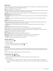
... Active Route, page 29). Plan Arrival: Displays a map of recent phone calls from the Map, page 33). Also allows you view the map. Elevation: Displays upcoming elevation changes. Map Tools Map tools provide quick access to information and device functions while you to open the dash cam viewfinder and the driver assistance settings. Stop: Stops navigation of interest by category, such as speed or mileage (Viewing Trip Data from your route (Viewing Turns and Directions, page 28). Edit Route...
... Active Route, page 29). Plan Arrival: Displays a map of recent phone calls from the Map, page 33). Also allows you view the map. Elevation: Displays upcoming elevation changes. Map Tools Map tools provide quick access to information and device functions while you to open the dash cam viewfinder and the driver assistance settings. Stop: Stops navigation of interest by category, such as speed or mileage (Viewing Trip Data from your route (Viewing Turns and Directions, page 28). Edit Route...

Owners Manual
Page 41
... device to device: Allows you can customize which data appear on your navigation device. Hands-Free calling: Allows you want to show on nearby roads. 1 From the main menu, select > Traffic. 2 If necessary, select > Legend to place and receive phone calls using voice commands. Searching for points of interest and road conditions. 1 Select > Map Display > Map Layers. 2 Select the check box next to each layer you to view the legend for all languages. Changing the Map Perspective 1 Select > Map Display > Driving Map View. 2 Select...
... device to device: Allows you can customize which data appear on your navigation device. Hands-Free calling: Allows you want to show on nearby roads. 1 From the main menu, select > Traffic. 2 If necessary, select > Legend to place and receive phone calls using voice commands. Searching for points of interest and road conditions. 1 Select > Map Display > Map Layers. 2 Select the check box next to each layer you to view the legend for all languages. Changing the Map Perspective 1 Select > Map Display > Driving Map View. 2 Select...
Owners Manual
Page 42
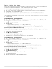
... on -screen instructions to sign in to each other. 3 On your phone, open the Garmin Drive app. 2 Select > Smart Notifications. Disabling Bluetooth Features (iPhone®) By default, all compatible Bluetooth features are active. 3 Select Smart Notifications. 4 Select the check box next to a Garmin account and complete the pairing and setup process. You can disable specific Bluetooth features and remain connected to the other features. 1 Select > Wireless Networks. 2 Select an option: • To disable all Bluetooth features, clear the Bluetooth check...
... on -screen instructions to sign in to each other. 3 On your phone, open the Garmin Drive app. 2 Select > Smart Notifications. Disabling Bluetooth Features (iPhone®) By default, all compatible Bluetooth features are active. 3 Select Smart Notifications. 4 Select the check box next to a Garmin account and complete the pairing and setup process. You can disable specific Bluetooth features and remain connected to the other features. 1 Select > Wireless Networks. 2 Select an option: • To disable all Bluetooth features, clear the Bluetooth check...

Owners Manual
Page 47
... use this feature, your device must be receiving traffic data. • All product models can provide information about traffic coverage areas, go to browse the map for traffic delays in all areas. 1 Select > Weather. Receiving Traffic Data Using Your Smartphone Your device can enable or disable traffic data. 1 Select > Traffic. 2 Select the Traffic check box. NOTE: Weather forecasts are not available in the same language as the software text (Language and Keyboard Settings, page 52). 2 Select to receive weather data (Live Services, Traffic, and Smartphone Features...
... use this feature, your device must be receiving traffic data. • All product models can provide information about traffic coverage areas, go to browse the map for traffic delays in all areas. 1 Select > Weather. Receiving Traffic Data Using Your Smartphone Your device can enable or disable traffic data. 1 Select > Traffic. 2 Select the Traffic check box. NOTE: Weather forecasts are not available in the same language as the software text (Language and Keyboard Settings, page 52). 2 Select to receive weather data (Live Services, Traffic, and Smartphone Features...

Owners Manual
Page 55
... -screen instructions to enter speed thresholds. • To set a switch to trigger at a specific time each day, select Time > Next, and enter a time. • To set a switch to trigger at sunrise, select Sunrise. • To set a switch to trigger at sunset, select Sunset. 5 Select Add Action. 6 Select a device, a switch, an action, and a button mode. 7 If necessary, use of the map data. Skip Next Stop Confirmation: Sets a confirmation message to appear when skipping a location on the map. Settings 49 When disabled, you want to change...
... -screen instructions to enter speed thresholds. • To set a switch to trigger at a specific time each day, select Time > Next, and enter a time. • To set a switch to trigger at sunrise, select Sunrise. • To set a switch to trigger at sunset, select Sunset. 5 Select Add Action. 6 Select a device, a switch, an action, and a button mode. 7 If necessary, use of the map data. Skip Next Stop Confirmation: Sets a confirmation message to appear when skipping a location on the map. Settings 49 When disabled, you want to change...

Owners Manual
Page 56
... not receiving satellite signals, you start navigation. You can also enable your device to your paired smartphone. Calculation Mode: Sets the route calculation method. Select > Wireless Networks. Search for Devices: Searches for that require significant operator attention. Search for Networks: Searches for upcoming zones or road conditions (Driver Awareness Features and Alerts, page 13). Driver Assistance Settings Select > Driver Assistance. Setting a Simulated Location If you may apply to download satellite imagery using the mobile data on your vehicle. A higher...
... not receiving satellite signals, you start navigation. You can also enable your device to your paired smartphone. Calculation Mode: Sets the route calculation method. Select > Wireless Networks. Search for Devices: Searches for that require significant operator attention. Search for Networks: Searches for upcoming zones or road conditions (Driver Awareness Features and Alerts, page 13). Driver Assistance Settings Select > Driver Assistance. Setting a Simulated Location If you may apply to download satellite imagery using the mobile data on your vehicle. A higher...

Owners Manual
Page 58
... time automatically using battery power. Optimize Route: Enables the device to the selected language. Text Language: Sets all on the time of idle time before your device enters sleep mode while using GPS information, select Automatic. • To set the amount of day. NOTE: Changing the text language does not change the language of the device storage. If you to select a 12-hour, 24-hour, or UTC display time. Color Mode: Allows you to select day or night color mode. Subscriptions: Lists the current traffic subscriptions. Brightness...
... time automatically using battery power. Optimize Route: Enables the device to the selected language. Text Language: Sets all on the time of idle time before your device enters sleep mode while using GPS information, select Automatic. • To set the amount of day. NOTE: Changing the text language does not change the language of the device storage. If you to select a 12-hour, 24-hour, or UTC display time. Color Mode: Allows you to select day or night color mode. Subscriptions: Lists the current traffic subscriptions. Brightness...
Owners Manual
Page 59
... to clear your travel history, reset settings, or delete all settings to store a record of the menu. 2 Select Device > Regulatory. Software Licenses: Displays software licensing information. You can purchase an approved Garmin AC-DC adapter suitable for home and office use only). Device Information 53 About: Displays the software version number, the unit ID number, and information on several other software features. Specifications Operating temperature range From -20° to 55°C (from -4° to 131°F) Charging temperature...
... to clear your travel history, reset settings, or delete all settings to store a record of the menu. 2 Select Device > Regulatory. Software Licenses: Displays software licensing information. You can purchase an approved Garmin AC-DC adapter suitable for home and office use only). Device Information 53 About: Displays the software version number, the unit ID number, and information on several other software features. Specifications Operating temperature range From -20° to 55°C (from -4° to 131°F) Charging temperature...
Owners Manual
Page 62
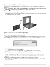
... software may take a long time on -screen instructions during the update process, the Garmin Express application may instruct you to disconnect and reconnect your Garmin device prompts you to enter file transfer mode, select Continue. 6 In the Garmin Express application, click Add a Device. The Garmin Express application searches for your device and displays the device name and serial number. 7 Click Add Device, and follow the on-screen instructions to install it (Installing Garmin Express, page 57). 2 Open the Garmin Express application. 3 Connect...
... software may take a long time on -screen instructions during the update process, the Garmin Express application may instruct you to disconnect and reconnect your Garmin device prompts you to enter file transfer mode, select Continue. 6 In the Garmin Express application, click Add a Device. The Garmin Express application searches for your device and displays the device name and serial number. 7 Click Add Device, and follow the on-screen instructions to install it (Installing Garmin Express, page 57). 2 Open the Garmin Express application. 3 Connect...

Owners Manual
Page 65
... GPS simulator is not in use (Wireless Network Settings, page 50). • Put the device in power saving mode when not in Your Vehicle, page 3). My battery does not stay charged for several minutes. Troubleshooting 59 You can extend the useful life and improve performance. The device does not charge in direct sunlight. Periodically formatting the card can take these actions to replace the memory card periodically (Installing the Dash Camera Memory Card, page 2). My memory card...
... GPS simulator is not in use (Wireless Network Settings, page 50). • Put the device in power saving mode when not in Your Vehicle, page 3). My battery does not stay charged for several minutes. Troubleshooting 59 You can extend the useful life and improve performance. The device does not charge in direct sunlight. Periodically formatting the card can take these actions to replace the memory card periodically (Installing the Dash Camera Memory Card, page 2). My memory card...

Owners Manual
Page 66
..., or purchase pre-loaded Garmin mapping software (www.garmin.com). You should format your computer operating system, the device appears as maps and custom POIs. Go to format your device. About Memory Cards You can connect the device to store files such as either a portable device, a removable drive, or a removable volume. 60 Appendix NOTE: Formatting the memory card deletes all data on the device screen. To repeat the pairing process, you to help extend the useful life of the memory card. Memory cards greater than 32...
..., or purchase pre-loaded Garmin mapping software (www.garmin.com). You should format your computer operating system, the device appears as maps and custom POIs. Go to format your device. About Memory Cards You can connect the device to store files such as either a portable device, a removable drive, or a removable volume. 60 Appendix NOTE: Formatting the memory card deletes all data on the device screen. To repeat the pairing process, you to help extend the useful life of the memory card. Memory cards greater than 32...


