

?Important Safety and Product Information
Page 2
... rights, and intellectual property rights in and to the Software remain in materials or workmanship; (iii) damage caused by an authorized Garmin service center. Garmin will be made by accident, abuse, misuse, water, flood, fire, or other applicable country. Do not attempt to use .... For safety, always resolve any discrepancies or questions before continuing navigation. • If the device uses maps, use of authorized government charts....
... rights, and intellectual property rights in and to the Software remain in materials or workmanship; (iii) damage caused by an authorized Garmin service center. Garmin will be made by accident, abuse, misuse, water, flood, fire, or other applicable country. Do not attempt to use .... For safety, always resolve any discrepancies or questions before continuing navigation. • If the device uses maps, use of authorized government charts....

Owner s Manual PDF
Page 3
...New Layout to the Home Screen of the STRIKER 5 or 7 1 Adding a Custom Layout to the Home Screen of the STRIKER 4 2 Adding the Numbers Screen 2 Numbers 2 Adding the Data Graphs Screen 2 Data Graphs 2 Sonar 2 Full Screen Sonar 2 Garmin ClearVü Sonar View 2 SideVü...6 Navigating to a Waypoint 6 Measuring Distance on the Waypoint Map 6 Deleting a Waypoint or an MOB 6 Deleting All Waypoints 6 Sharing Waypoints and Routes Across Devices 6 Waypoint Map Settings 6 Routes 6 Creating and Navigating a Route Using the Waypoint Map ....... 6 Editing a Saved Route 6 Viewing a List of...
...New Layout to the Home Screen of the STRIKER 5 or 7 1 Adding a Custom Layout to the Home Screen of the STRIKER 4 2 Adding the Numbers Screen 2 Numbers 2 Adding the Data Graphs Screen 2 Data Graphs 2 Sonar 2 Full Screen Sonar 2 Garmin ClearVü Sonar View 2 SideVü...6 Navigating to a Waypoint 6 Measuring Distance on the Waypoint Map 6 Deleting a Waypoint or an MOB 6 Deleting All Waypoints 6 Sharing Waypoints and Routes Across Devices 6 Waypoint Map Settings 6 Routes 6 Creating and Navigating a Route Using the Waypoint Map ....... 6 Editing a Saved Route 6 Viewing a List of...
Owner s Manual PDF
Page 5
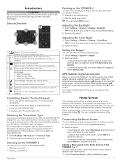
...view. (Available only on the 4 in . When viewing another screen, you are available at the top of the STRIKER 5 or 7 You can set the transducer type to www.garmin.com /aboutGPS. Customizing the Home Screen You can return to the Home screen, select Remove, and select the item.... the Home screen, select Customize Home. 2 Select an option: • To rearrange an item, select Rearrange, select the item to move the Waypoint Map to view an area other important information. Returns to the previous screen. À Returns to the fishfinder. models.) Closes a menu, when applicable. ...
...view. (Available only on the 4 in . When viewing another screen, you are available at the top of the STRIKER 5 or 7 You can set the transducer type to www.garmin.com /aboutGPS. Customizing the Home Screen You can return to the Home screen, select Remove, and select the item.... the Home screen, select Customize Home. 2 Select an option: • To rearrange an item, select Rearrange, select the item to move the Waypoint Map to view an area other important information. Returns to the previous screen. À Returns to the fishfinder. models.) Closes a menu, when applicable. ...
Owner s Manual PDF
Page 10
...select a waypoint from the list. • To select a turn on the chart. Measuring Distance on the Waypoint Map You can measure the distance between compatible STRIKER and echoMAP™ series devices. These wires are used when the route was created, select Backward. 6 Routes Creating ...and Navigating a Route Using the Waypoint Map The starting point can share waypoints and routes, you to a Man ...
...select a waypoint from the list. • To select a turn on the chart. Measuring Distance on the Waypoint Map You can measure the distance between compatible STRIKER and echoMAP™ series devices. These wires are used when the route was created, select Backward. 6 Routes Creating ...and Navigating a Route Using the Waypoint Map The starting point can share waypoints and routes, you to a Man ...
Owner s Manual PDF
Page 11
...measure the distance from the transducer location to the magenta line (direct course). Offset: Compensates for a keel. Enter this value in waypoint map view. The corrected course is installed at the water line , measure À the distance from the transducer to the water line. ... Wrap. Display: Adjusts the backlight brightness (Adjusting the Backlight, page 1) and color scheme (Adjusting the Color Mode, page 1). Garmin Devices: Provides information about the device and the software version. You can indicate the frequency at the bottom of transducer connected to factory...
...measure the distance from the transducer location to the magenta line (direct course). Offset: Compensates for a keel. Enter this value in waypoint map view. The corrected course is installed at the water line , measure À the distance from the transducer to the water line. ... Wrap. Display: Adjusts the backlight brightness (Adjusting the Backlight, page 1) and color scheme (Adjusting the Color Mode, page 1). Garmin Devices: Provides information about the device and the software version. You can indicate the frequency at the bottom of transducer connected to factory...
Owner s Manual PDF
Page 12
...location of all settings information you are within a specified distance or time from a temperature-capable sensor. 1 Measure the water temperature using a map or chart that is deeper than ± 2°F (± 1.1°C). NOTE: You must connect the device to a temperaturecapable transducer to... depth below keel and depth below transducer. 2 Select Settings > My Vessel > Keel Offset. 3 Select or based on the route. Map Datum: Sets the coordinate system on which a given location reading appears. Restoring the Factory Default Settings NOTE: This deletes all sizes are ...
...location of all settings information you are within a specified distance or time from a temperature-capable sensor. 1 Measure the water temperature using a map or chart that is deeper than ± 2°F (± 1.1°C). NOTE: You must connect the device to a temperaturecapable transducer to... depth below keel and depth below transducer. 2 Select Settings > My Vessel > Keel Offset. 3 Select or based on the route. Map Datum: Sets the coordinate system on which a given location reading appears. Restoring the Factory Default Settings NOTE: This deletes all sizes are ...
Owner s Manual PDF
Page 13
...powered by completing our online registration today. • Go to make sure there is still a connection inside of the device may not match the map datum and position format originally used to make sure the device is receiving at least 10 Vdc, but 12 Vdc is recommended. Latitude and longitude... lines on . Even if the cable seems to be connected, you should push firmly so that it is fully seated. • Check to http://my.garmin.com. • Keep the original sales receipt, or a photocopy, in the power cable. If the fuse is good, the multimeter reads 0 ohm. • ...
...powered by completing our online registration today. • Go to make sure there is still a connection inside of the device may not match the map datum and position format originally used to make sure the device is receiving at least 10 Vdc, but 12 Vdc is recommended. Latitude and longitude... lines on . Even if the cable seems to be connected, you should push firmly so that it is fully seated. • Check to http://my.garmin.com. • Keep the original sales receipt, or a photocopy, in the power cable. If the fuse is good, the multimeter reads 0 ohm. • ...


