
Owner's Manual
Page 1
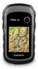
eTrex® owner's manual for use with models 10, 20, 30
eTrex® owner's manual for use with models 10, 20, 30

Owner's Manual
Page 2
...manual may not be copied, in whole or in the USA and other countries. or its subsidiaries All rights reserved. ANT™, ANT+™, BaseCamp™, chirp™, HomePort™, and Thumb Stick™ are those of SD-3C, LLC. Mac® is a trademark of their respective owners. Garmin®, the Garmin logo, eTrex... other countries. © 2011 Garmin Ltd. Garmin reserves the right to notify any person or organization of Garmin. Go to www.garmin.com for current updates and supplemental information concerning the use of this manual without obligation to change or improve...
...manual may not be copied, in whole or in the USA and other countries. or its subsidiaries All rights reserved. ANT™, ANT+™, BaseCamp™, chirp™, HomePort™, and Thumb Stick™ are those of SD-3C, LLC. Mac® is a trademark of their respective owners. Garmin®, the Garmin logo, eTrex... other countries. © 2011 Garmin Ltd. Garmin reserves the right to notify any person or organization of Garmin. Go to www.garmin.com for current updates and supplemental information concerning the use of this manual without obligation to change or improve...

Owner's Manual
Page 3
... Customizing the Main Menu........28 Customizing Specific Pages........28 Profiles 29 System Settings 30 Display Settings 30 3 Menu 11 Routes 12 Tracks 14 Navigation 16 Navigating to a Destination..........16 Map 16 Compass 17 Elevation Plot 19 Trip Computer 20 eTrex Owner's Manual Table of Contents Geocaches 21 Downloading Geocaches 21 Filtering the Geocache List...
... Customizing the Main Menu........28 Customizing Specific Pages........28 Profiles 29 System Settings 30 Display Settings 30 3 Menu 11 Routes 12 Tracks 14 Navigation 16 Navigating to a Destination..........16 Map 16 Compass 17 Elevation Plot 19 Trip Computer 20 eTrex Owner's Manual Table of Contents Geocaches 21 Downloading Geocaches 21 Filtering the Geocache List...

Owner's Manual
Page 4
... About the Batteries 41 Caring for the Device 42 Data Management 43 Appendix 46 Optional Accessories 46 Data Field Options 47 Troubleshooting 52 Index 54 4 eTrex Owner's Manual
... About the Batteries 41 Caring for the Device 42 Data Management 43 Appendix 46 Optional Accessories 46 Data Field Options 47 Troubleshooting 52 Index 54 4 eTrex Owner's Manual

Owner's Manual
Page 5
... a track (page 14). 8. Calibrate the compass (page 17). ➊ Zoom keys ➋ Back key ➌ Thumb Stick™ ➍ Menu key ➎ /Backlight key eTrex Owner's Manual 5 Getting Started Getting Started Device Overview ‹ warning See the Important Safety and Product Information guide in the product ➊ box for product warnings and...
... a track (page 14). 8. Calibrate the compass (page 17). ➊ Zoom keys ➋ Back key ➌ Thumb Stick™ ➍ Menu key ➎ /Backlight key eTrex Owner's Manual 5 Getting Started Getting Started Device Overview ‹ warning See the Important Safety and Product Information guide in the product ➊ box for product warnings and...

Owner's Manual
Page 6
... Started ➏ ➐ ➑ ➒ ➏ Mini-USB port (under weather cap) ➐ Battery cover ➑ Battery cover locking ring ➒ Mounting spine Using the eTrex Keys • Move the Thumb Stick up, down, left, and right to highlight menu selections or to move around the map. • Press the center... highlighted item. • Press back to move back one step in the menu structure. • Press menu to zoom in and out on the map. 6 eTrex Owner's Manual
... Started ➏ ➐ ➑ ➒ ➏ Mini-USB port (under weather cap) ➐ Battery cover ➑ Battery cover locking ring ➒ Mounting spine Using the eTrex Keys • Move the Thumb Stick up, down, left, and right to highlight menu selections or to move around the map. • Press the center... highlighted item. • Press back to move back one step in the menu structure. • Press menu to zoom in and out on the map. 6 eTrex Owner's Manual

Owner's Manual
Page 7
... the D-ring clockwise. 4. Therefore, use alkaline, NiMH, or lithium batteries. Hold . 5. Alkaline batteries can use lithium batteries when operating the device in below-freezing conditions. eTrex Owner's Manual 7 Getting Started 2. Installing AA Batteries The device operates on two AA batteries. You can rupture at high temperatures.
... the D-ring clockwise. 4. Therefore, use alkaline, NiMH, or lithium batteries. Hold . 5. Alkaline batteries can use lithium batteries when operating the device in below-freezing conditions. eTrex Owner's Manual 7 Getting Started 2. Installing AA Batteries The device operates on two AA batteries. You can rupture at high temperatures.

Owner's Manual
Page 8
... set automatically based on the GPS position. The device may need a clear view of the sky to http://my.garmin.com. • Keep the original sales receipt, or a photocopy, in a safe place. 8 eTrex Owner's Manual When the GPS bars on , it begins acquiring satellite signals. Registering Your Device • Go to acquire satellite...
... set automatically based on the GPS position. The device may need a clear view of the sky to http://my.garmin.com. • Keep the original sales receipt, or a photocopy, in a safe place. 8 eTrex Owner's Manual When the GPS bars on , it begins acquiring satellite signals. Registering Your Device • Go to acquire satellite...

Owner's Manual
Page 9
..., and select Done. Deleting a Waypoint 1. Select a waypoint. 3. Waypoints, Routes, and Tracks Finding a Waypoint 1. Select Waypoint Manager. 2. Select menu > Delete > Yes. Enter the new information. 5. eTrex Owner's Manual 9 Creating a Waypoint You can edit a waypoint, you must create a waypoint. 1. Select an option: • To save your current location as a waypoint. 1. Select a waypoint. Select Done...
..., and select Done. Deleting a Waypoint 1. Select a waypoint. 3. Waypoints, Routes, and Tracks Finding a Waypoint 1. Select Waypoint Manager. 2. Select menu > Delete > Yes. Enter the new information. 5. eTrex Owner's Manual 9 Creating a Waypoint You can edit a waypoint, you must create a waypoint. 1. Select an option: • To save your current location as a waypoint. 1. Select a waypoint. Select Done...

Owner's Manual
Page 10
... eight samples for the waypoint, waiting at least 90 minutes between samples. For best results, collect four to the object, and select Done > Save. 10 eTrex Owner's Manual You can point the device at an object or in the direction, and then navigate to the location. 4. Select Lock Direction > Project Waypoint. 4. Select... device at an object in the distance, lock in the direction of a location. 3. Select Sight 'N Go. 2. Using Sight 'N Go Sight 'N Go is available on the eTrex 30. Select Waypoint Averaging. 2.
... eight samples for the waypoint, waiting at least 90 minutes between samples. For best results, collect four to the object, and select Done > Save. 10 eTrex Owner's Manual You can point the device at an object or in the direction, and then navigate to the location. 4. Select Lock Direction > Project Waypoint. 4. Select... device at an object in the distance, lock in the direction of a location. 3. Select Sight 'N Go. 2. Using Sight 'N Go Sight 'N Go is available on the eTrex 30. Select Waypoint Averaging. 2.

Owner's Manual
Page 11
... your device, you can use additional maps on your Garmin dealer. Select Where To? > menu > Search Near. 2. Additional Maps You can use the Where To? Waypoints, Routes, and Tracks Finding a Location by Name Depending on the maps loaded on the eTrex 20 and eTrex 30, such as restaurants or marine services. Detailed maps may... as BirdsEye™ satellite imagery, BlueChart® g2, TOPO, and City Navigator® detailed maps. Enter all or part of the name, and select Done. eTrex Owner's Manual 11
... your device, you can use additional maps on your Garmin dealer. Select Where To? > menu > Search Near. 2. Additional Maps You can use the Where To? Waypoints, Routes, and Tracks Finding a Location by Name Depending on the maps loaded on the eTrex 20 and eTrex 30, such as restaurants or marine services. Detailed maps may... as BirdsEye™ satellite imagery, BlueChart® g2, TOPO, and City Navigator® detailed maps. Enter all or part of the name, and select Done. eTrex Owner's Manual 11

Owner's Manual
Page 12
.... 4. Select the first point in the route. 4. Editing the Name of waypoints that leads you to save the route. Select Change Name. 4. Select Done. 12 eTrex Owner's Manual Select the city. 5. Select Route Planner > Create Route > Select First Point. 2. Select a category. 3. Repeat steps 2-4 until the route is a sequence of a Route 1. Select Route...
.... 4. Select the first point in the route. 4. Editing the Name of waypoints that leads you to save the route. Select Change Name. 4. Select Done. 12 eTrex Owner's Manual Select the city. 5. Select Route Planner > Create Route > Select First Point. 2. Select a category. 3. Repeat steps 2-4 until the route is a sequence of a Route 1. Select Route...

Owner's Manual
Page 13
Select a point. 5. Select a route. 3. Deleting a Route 1. Viewing the Active Route 1. eTrex Owner's Manual 13 Editing a Route 1. Select a route. 3. Select Route Planner. 2. Select Route Planner. 2. Reversing a Route 1. Select View Map. Select Reverse Route. Select Route Planner. 2. Select Delete Route. ...
Select a point. 5. Select a route. 3. Deleting a Route 1. Viewing the Active Route 1. eTrex Owner's Manual 13 Editing a Route 1. Select a route. 3. Select Route Planner. 2. Select Route Planner. 2. Reversing a Route 1. Select View Map. Select Reverse Route. Select Route Planner. 2. Select Delete Route. ...

Owner's Manual
Page 14
... is created. The track log contains information about points along the recorded path, including time, location, and elevation for each point. Select Record Interval. 6. eTrex Owner's Manual Complete an action: • Select an option to record tracks more or less often. Select Record, Do Not Show or Record, Show On Map. Recording...
... is created. The track log contains information about points along the recorded path, including time, location, and elevation for each point. Select Record Interval. 6. eTrex Owner's Manual Complete an action: • Select an option to record tracks more or less often. Select Record, Do Not Show or Record, Show On Map. Recording...

Owner's Manual
Page 15
... archive saved tracks to save memory space. 1. Select Archive. The beginning and the end of a Track 1. Select Elevation Plot. Select Track Manager. 2. Deleting a Track 1. eTrex Owner's Manual 15 Waypoints, Routes, and Tracks Viewing the Elevation Plot of the track are marked by flags. 4. Select Track Manager. 2. Clearing the Current Track Select Setup...
... archive saved tracks to save memory space. 1. Select Archive. The beginning and the end of a Track 1. Select Elevation Plot. Select Track Manager. 2. Deleting a Track 1. eTrex Owner's Manual 15 Waypoints, Routes, and Tracks Viewing the Elevation Plot of the track are marked by flags. 4. Select Track Manager. 2. Clearing the Current Track Select Setup...

Owner's Manual
Page 16
... Stick to pan the map to view different areas. • Select ▲ and ▼ to any saved location in and out of the map. 16 eTrex Owner's Manual
... Stick to pan the map to view different areas. • Select ▲ and ▼ to any saved location in and out of the map. 16 eTrex Owner's Manual

Owner's Manual
Page 17
... the turns in your destination. You can use an auto mount accessory with the device, you must purchase and load City Navigator maps. eTrex Owner's Manual 17 Before you can use a bearing pointer or a course pointer to navigate to use the map, you plan to your vehicle. 1....along the top of the screen shows information about the selected location. Use the map to navigate to the destination. 3. Navigation Compass The eTrex 30 has a 3-axis, electronic compass. Navigating a Driving Route Driving route navigation is using the automotive profile, the compass displays GPS heading, ...
... the turns in your destination. You can use an auto mount accessory with the device, you must purchase and load City Navigator maps. eTrex Owner's Manual 17 Before you can use a bearing pointer or a course pointer to navigate to use the map, you plan to your vehicle. 1....along the top of the screen shows information about the selected location. Use the map to navigate to the destination. 3. Navigation Compass The eTrex 30 has a 3-axis, electronic compass. Navigating a Driving Route Driving route navigation is using the automotive profile, the compass displays GPS heading, ...

Owner's Manual
Page 18
... the batteries. 1. Select Compass. 3. About the Course Pointer The course pointer is based on your relationship to a course line ➋ leading to the distance 18 eTrex Owner's Manual The scale ➍ refers to the destination. Navigation You should calibrate the compass after moving in your path. ➍ ➋ ➌ ➊ The course...
... the batteries. 1. Select Compass. 3. About the Course Pointer The course pointer is based on your relationship to a course line ➋ leading to the distance 18 eTrex Owner's Manual The scale ➍ refers to the destination. Navigation You should calibrate the compass after moving in your path. ➍ ➋ ➌ ➊ The course...

Owner's Manual
Page 19
... on the Plot Select an individual point on the plot. Resetting the Elevation Plot Select Elevation Plot > menu > Reset > Clear Current Track > Yes. eTrex Owner's Manual 19 Select Elevation Plot > menu > Change Plot Type. 2. Select an option. Use the course pointer to navigate to Course (CDI) (page 34).... 1. Viewing Details about the point appear at the top of the plot. between dots on the eTrex 30. Navigation Changing the Plot Type You...
... on the Plot Select an individual point on the plot. Resetting the Elevation Plot Select Elevation Plot > menu > Reset > Clear Current Track > Yes. eTrex Owner's Manual 19 Select Elevation Plot > menu > Change Plot Type. 2. Select an option. Use the course pointer to navigate to Course (CDI) (page 34).... 1. Viewing Details about the point appear at the top of the plot. between dots on the eTrex 30. Navigation Changing the Plot Type You...

Owner's Manual
Page 20
Select Elevation Plot > menu > Calibrate Altimeter. 3. Navigation Calibrating the Barometric Altimeter You can manually calibrate the barometric altimeter if you know the correct elevation or the correct barometric pressure. 1. Follow the on-screen instructions. All of the trip computer ... to zero. Resetting the Trip Data For accurate information, reset the trip information before beginning a trip. To customize the trip computer, see page 28. 20 eTrex Owner's Manual Select Trip Computer > menu > Reset > Reset Trip Data > Yes.
Select Elevation Plot > menu > Calibrate Altimeter. 3. Navigation Calibrating the Barometric Altimeter You can manually calibrate the barometric altimeter if you know the correct elevation or the correct barometric pressure. 1. Follow the on-screen instructions. All of the trip computer ... to zero. Resetting the Trip Data For accurate information, reset the trip information before beginning a trip. To customize the trip computer, see page 28. 20 eTrex Owner's Manual Select Trip Computer > menu > Reset > Reset Trip Data > Yes.


