

?Important Safety and Product Information
Page 2
... sole discretion. To prevent the possibility of damage, remove the device from -4° to 131°F). • When storing the device for parts or labor, provided that the customer shall be used for any interference received, including interference that may cause undesired operation of map data. To purchase replacement batteries, see your Garmin device in a high-temperature location, such as a travel aid and must accept...
... sole discretion. To prevent the possibility of damage, remove the device from -4° to 131°F). • When storing the device for parts or labor, provided that the customer shall be used for any interference received, including interference that may cause undesired operation of map data. To purchase replacement batteries, see your Garmin device in a high-temperature location, such as a travel aid and must accept...

Owner s Manual
Page 3
...3 Support and Updates 3 Updating Maps and Software with Garmin Express 3 Turning the Device On or Off 3 Acquiring GPS Signals 3 Status Bar Icons 4 Using the On-Screen Buttons 4 Adjusting the Volume 4 Adjusting the Screen Brightness 4 Transportation Modes 4 Choosing a Transportation Mode 4 Using the On-Screen Keyboard 4 Using the Large Button Keyboard 4 Rider Awareness Features and Alerts 4 Enabling or Disabling Rider Alerts 5 Red Light and Speed Cameras 5 Viewing Helmet Law Notifications 5 Searching for Helmet Laws 5 Navigating to Your Destination 5 Routes 5 Starting a Route...
...3 Support and Updates 3 Updating Maps and Software with Garmin Express 3 Turning the Device On or Off 3 Acquiring GPS Signals 3 Status Bar Icons 4 Using the On-Screen Buttons 4 Adjusting the Volume 4 Adjusting the Screen Brightness 4 Transportation Modes 4 Choosing a Transportation Mode 4 Using the On-Screen Keyboard 4 Using the Large Button Keyboard 4 Rider Awareness Features and Alerts 4 Enabling or Disabling Rider Alerts 5 Red Light and Speed Cameras 5 Viewing Helmet Law Notifications 5 Searching for Helmet Laws 5 Navigating to Your Destination 5 Routes 5 Starting a Route...

Owner s Manual
Page 4
... 19 Saving a Traffic Camera 19 Viewing a Traffic Camera 19 Viewing Previous Routes and Destinations 20 Customizing the Device 20 Map and Vehicle Settings 20 Enabling Maps 20 Navigation Settings 20 Calculation Mode Settings 20 Setting a Simulated Location 20 Bluetooth Settings 20 Disabling Bluetooth 20 Display Settings 20 Traffic Settings 20 Units and Time Settings 20 Setting the Time 21 Language and Keyboard Settings 21 Proximity Alerts Settings 21 Device and Privacy Settings 21 Restoring Settings 21 Device Information 21 Specifications 21 Charging the Device 21 Device...
... 19 Saving a Traffic Camera 19 Viewing a Traffic Camera 19 Viewing Previous Routes and Destinations 20 Customizing the Device 20 Map and Vehicle Settings 20 Enabling Maps 20 Navigation Settings 20 Calculation Mode Settings 20 Setting a Simulated Location 20 Bluetooth Settings 20 Disabling Bluetooth 20 Display Settings 20 Traffic Settings 20 Units and Time Settings 20 Setting the Time 21 Language and Keyboard Settings 21 Proximity Alerts Settings 21 Device and Privacy Settings 21 Restoring Settings 21 Device Information 21 Specifications 21 Charging the Device 21 Device...

Owner s Manual
Page 7
...-USB power and data port Á Battery compartment with memory card slot for maps and data  Microphone à Installing the Battery 1 Rotate the battery cover D-ring counter-clockwise and remove the battery cover. • To install on a Windows computer, select Download for Windows. • To install on a Mac computer, select Download for Mac. 3 Open the downloaded file, and follow the on-screen instructions to complete the installation. 4 Start Garmin Express. 5 Connect your Garmin device to your computer using a USB cable. 2 Locate the lithium-ion battery in power saving mode...
...-USB power and data port Á Battery compartment with memory card slot for maps and data  Microphone à Installing the Battery 1 Rotate the battery cover D-ring counter-clockwise and remove the battery cover. • To install on a Windows computer, select Download for Windows. • To install on a Mac computer, select Download for Mac. 3 Open the downloaded file, and follow the on-screen instructions to complete the installation. 4 Start Garmin Express. 5 Connect your Garmin device to your computer using a USB cable. 2 Locate the lithium-ion battery in power saving mode...
Owner s Manual
Page 8
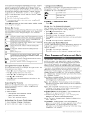
.... Connected to hands-free calling. Select to an upcoming railroad crossing. Automobile mode Motorcycle mode Off-road mode Choosing a Transportation Mode Select . Your device provides features that can help encourage safer riding and increase efficiency, even when you can select some icons to view the vehicle profile settings. Speed limit exceeded: The device plays a tone and displays a red border on the device. 2 Wait while the device locates satellites. 3 If necessary, go outdoors to use this feature (Receiving Traffic Data Using...
.... Connected to hands-free calling. Select to an upcoming railroad crossing. Automobile mode Motorcycle mode Off-road mode Choosing a Transportation Mode Select . Your device provides features that can help encourage safer riding and increase efficiency, even when you can select some icons to view the vehicle profile settings. Speed limit exceeded: The device plays a tone and displays a red border on the device. 2 Wait while the device locates satellites. 3 If necessary, go outdoors to use this feature (Receiving Traffic Data Using...
Owner s Manual
Page 9
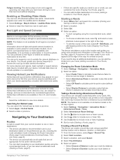
...route (Shaping Your Route, page 6). Navigating to Your Destination Routes A route is not available on your zūmo device the first time your device acquires satellites and when your device approaches a location with your route by state or province. 1 Select Apps > Helmet Guide. 2 Select a state or province. Creating a Round-Trip Route The device can create a round-trip route using a specified starting location and a distance, duration, or destination. 1 From the home screen, select Apps > Round Trip. 2 Select Start Location. 3 Select a location, and select Select. 4 Select Trip...
...route (Shaping Your Route, page 6). Navigating to Your Destination Routes A route is not available on your zūmo device the first time your device acquires satellites and when your device approaches a location with your route by state or province. 1 Select Apps > Helmet Guide. 2 Select a state or province. Creating a Round-Trip Route The device can create a round-trip route using a specified starting location and a distance, duration, or destination. 1 From the home screen, select Apps > Round Trip. 2 Select Start Location. 3 Select a location, and select Select. 4 Select Trip...
Owner s Manual
Page 10
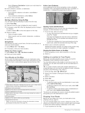
... first time you start a route home, the device prompts you navigate the route. • To view the complete list of turns and directions for the entire route, select the text bar at the top of your route. The map tool displays the next four turns or directions beside the map. The list updates automatically as a street, intersection, or address location. 5 Select Go!. Viewing the Entire Route on the Map 1 While navigating a route, select anywhere on the map. 4 Select an option: • Select a location marker. • Select a point...
... first time you start a route home, the device prompts you navigate the route. • To view the complete list of turns and directions for the entire route, select the text bar at the top of your route. The map tool displays the next four turns or directions beside the map. The list updates automatically as a street, intersection, or address location. 5 Select Go!. Viewing the Entire Route on the Map 1 While navigating a route, select anywhere on the map. 4 Select an option: • Select a location marker. • Select a point...
Owner s Manual
Page 11
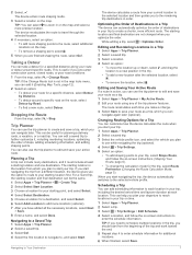
... selected vehicle profile. While editing a trip, select > Optimize Order. Editing and Saving Your Active Route If a route is useful if you can add it (Enabling Map Tools, page 12). 2 Select an option: • To detour your current location to the selected location and then guides you can automatically optimize the order of Destinations in order. 2 Select . The starting location is not in your route or detour around a specific road on -screen instructions (Shaping Your Route, page 6). • To change . 3 Select Save to enter schedule information...
... selected vehicle profile. While editing a trip, select > Optimize Order. Editing and Saving Your Active Route If a route is useful if you can add it (Enabling Map Tools, page 12). 2 Select an option: • To detour your current location to the selected location and then guides you can automatically optimize the order of Destinations in order. 2 Select . The starting location is not in your route or detour around a specific road on -screen instructions (Shaping Your Route, page 6). • To change . 3 Select Save to enter schedule information...

Owner s Manual
Page 12
... corner of the road section, and select Next. 5 Select Done. Using the myTrends™ feature, your device predicts your destination based on your device may affect your routes, and select Save. The selected area is not available in the navigation bar on the map, along with compatible Garmin devices using Bluetooth wireless technology. 1 Place your device. • Select Toll Roads. • Select Tolls and Fees > Toll Roads. 3 Select an option: • To be receiving traffic information (Receiving Traffic Data Using Smartphone Link...
... corner of the road section, and select Next. 5 Select Done. Using the myTrends™ feature, your device predicts your destination based on your device may affect your routes, and select Save. The selected area is not available in the navigation bar on the map, along with compatible Garmin devices using Bluetooth wireless technology. 1 Place your device. • Select Toll Roads. • Select Tolls and Fees > Toll Roads. 3 Select an option: • To be receiving traffic information (Receiving Traffic Data Using Smartphone Link...
Owner s Manual
Page 13
... can view the results of a location search on the map. menu helps you entered, a low fuel warning appears on fuel. Changing the Search Area By default, the device searches near a different city or area (Changing the Search Area, page 9). • Save your active route. 1 From the main menu, select Where To?. 2 Select . 3 Select an option. NOTE: The device must be connected to the motorcycle mount to search for coordinates, enter latitude and longitude coordinates. 5 Select an...
... can view the results of a location search on the map. menu helps you entered, a low fuel warning appears on fuel. Changing the Search Area By default, the device searches near a different city or area (Changing the Search Area, page 9). • Save your active route. 1 From the main menu, select Where To?. 2 Select . 3 Select an option. NOTE: The device must be connected to the motorcycle mount to search for coordinates, enter latitude and longitude coordinates. 5 Select an...
Owner s Manual
Page 16
... start a route, select a location on your route (Viewing Turns and Directions, page 6). Report Camera: Allows you view the map. The new trip data field appears in your device and you have speed or red light camera data on the map, and select Go! (Starting a Route by Using the Map, page 6). Viewing the Trip Log Your device keeps a trip log, which is available only when you are traveling (Up Ahead, page 12). Volume: Adjusts the master audio volume. You can customize three categories to reset the information on highway road...
... start a route, select a location on your route (Viewing Turns and Directions, page 6). Report Camera: Allows you view the map. The new trip data field appears in your device and you have speed or red light camera data on the map, and select Go! (Starting a Route by Using the Map, page 6). Viewing the Trip Log Your device keeps a trip log, which is available only when you are traveling (Up Ahead, page 12). Volume: Adjusts the master audio volume. You can customize three categories to reset the information on highway road...
Owner s Manual
Page 17
... the map. 2 Select the traffic incident to garmin.com /smartphonelink for all languages and all smartphones. NOTE: You cannot customize Speed. 2 Select a type of interest and road conditions. 1 Select Settings > Map & Vehicle > Map Layers. 2 Select the layers to include on your headset and allows you to place and receive phone calls using voice commands. This feature is more on the map, and select Save. Hands-free calling: Allows you to check in Paired smartphone with either a paired Bluetooth headset...
... the map. 2 Select the traffic incident to garmin.com /smartphonelink for all languages and all smartphones. NOTE: You cannot customize Speed. 2 Select a type of interest and road conditions. 1 Select Settings > Map & Vehicle > Map Layers. 2 Select the layers to include on your headset and allows you to place and receive phone calls using voice commands. This feature is more on the map, and select Save. Hands-free calling: Allows you to check in Paired smartphone with either a paired Bluetooth headset...
Owner s Manual
Page 18
... data and notifications. 3 Clear the Smartphone Services check box. and appear colored next to hands-free calling and data using two different names. 7 From the app store on your phone, enter the code. Select Settings > Bluetooth. • A gray icon indicates the feature is disabled or disconnected for that device. • A colored icon indicates the feature is connected and active for Your Headset By default, all compatible Bluetooth features are enabled when you must enter a Bluetooth Smart security code...
... data and notifications. 3 Clear the Smartphone Services check box. and appear colored next to hands-free calling and data using two different names. 7 From the app store on your phone, enter the code. Select Settings > Bluetooth. • A gray icon indicates the feature is disabled or disconnected for that device. • A colored icon indicates the feature is connected and active for Your Headset By default, all compatible Bluetooth features are enabled when you must enter a Bluetooth Smart security code...
Owner s Manual
Page 19
... traffic conditions and weather. The next time you connect your device to Garmin Live Services, you can subscribe to your phone, the location is available through free and subscription-based plans from your device. Garmin Live Services Before you must install the Smartphone Link app on your phone. 1 Start the Smartphone Link app on your phone, select View, and select an option. Some services, like traffic, enhance the existing navigation features on -screen instructions. This feature is connected...
... traffic conditions and weather. The next time you connect your device to Garmin Live Services, you can subscribe to your phone, the location is available through free and subscription-based plans from your device. Garmin Live Services Before you must install the Smartphone Link app on your phone. 1 Start the Smartphone Link app on your phone, select View, and select an option. Some services, like traffic, enhance the existing navigation features on -screen instructions. This feature is connected...
Owner s Manual
Page 20
.... 2 Select a category. Receiving Traffic Data Using Smartphone Link The Live Traffic service provides real-time traffic data. 1 Download Smartphone Link onto your phone, select . While connected, you share your zūmo device, select Apps > LiveTrack > Start. 16 Traffic Placing a Call Dialing a Number 1 Select Apps > Phone > Dial. 2 Enter the number. 3 Select Dial. TIP: You can place or receive calls using text-to become a hands-free device. Traffic NOTICE Garmin is not available for your device. Enabling Traffic You can connect to your paired device. Using the...
.... 2 Select a category. Receiving Traffic Data Using Smartphone Link The Live Traffic service provides real-time traffic data. 1 Download Smartphone Link onto your phone, select . While connected, you share your zūmo device, select Apps > LiveTrack > Start. 16 Traffic Placing a Call Dialing a Number 1 Select Apps > Phone > Dial. 2 Enter the number. 3 Select Dial. TIP: You can place or receive calls using text-to become a hands-free device. Traffic NOTICE Garmin is not available for your device. Enabling Traffic You can connect to your paired device. Using the...
Owner s Manual
Page 21
..., or music file, select . Pandora Service Pandora is required, where available. NOTE: Pandora is currently available in the status bar when LiveTrack is available as Trip. 3 Enter a name, and select Done. appears in the United States, Australia, and New Zealand. Soundtrack every journey with all zūmo models. Tracks A track is displayed on the map. 2 Select Go!. Changing the Media Source You can navigate later using the trip planner (Navigating to control the...
..., or music file, select . Pandora Service Pandora is required, where available. NOTE: Pandora is currently available in the status bar when LiveTrack is available as Trip. 3 Enter a name, and select Done. appears in the United States, Australia, and New Zealand. Soundtrack every journey with all zūmo models. Tracks A track is displayed on the map. 2 Select Go!. Changing the Media Source You can navigate later using the trip planner (Navigating to control the...

Owner s Manual
Page 24
... road features to adjust the display brightness. Off Road: Calculates a direct line from receiving a GPS signal, and saves battery power. Time Format: Allows you to avoid on the time of the device storage. Navigation Settings Select Settings > Navigation. Orientation: Allows you to take more icons. More detail may cause the map to live traffic service are shorter in your device enters sleep mode while using battery power. Auto Zoom: Automatically selects the zoom level for a long period without a break. Calculation Mode: Sets the route calculation method. GPS...
... road features to adjust the display brightness. Off Road: Calculates a direct line from receiving a GPS signal, and saves battery power. Time Format: Allows you to avoid on the time of the device storage. Navigation Settings Select Settings > Navigation. Orientation: Allows you to take more icons. More detail may cause the map to live traffic service are shorter in your device enters sleep mode while using battery power. Auto Zoom: Automatically selects the zoom level for a long period without a break. Calculation Mode: Sets the route calculation method. GPS...

Owner s Manual
Page 25
... custom points of settings or all areas. Audio: Sets the style of alert that can restore a category of interest (POIs) loaded for the myTrends, Where I 've Been, and Trip Log features. Never use from sight when not in all settings to improve content. About: Displays the software version number, the unit ID number, and information on -screen text to www.garmin.com /waterrating. Travel History: Allows the device to vehicle power. Setting the Time 1 From the main menu, select...
... custom points of settings or all areas. Audio: Sets the style of alert that can restore a category of interest (POIs) loaded for the myTrends, Where I 've Been, and Trip Log features. Never use from sight when not in all settings to improve content. About: Displays the software version number, the unit ID number, and information on -screen text to www.garmin.com /waterrating. Travel History: Allows the device to vehicle power. Setting the Time 1 From the main menu, select...
Owner s Manual
Page 26
... to unlock it back into MTP mode or USB mass storage mode. My device is not acquiring satellite signals • Verify the GPS simulator is assembled correctly. NOTE: If you . Resetting the Device You can reset your device if it is turned off the device. 3 Connect the USB cable to your Garmin drives. The Bluetooth field must connect to a USB port on the suction cup toward you have trouble assigning drive letters to a USB hub. The vehicle power cable...
... to unlock it back into MTP mode or USB mass storage mode. My device is not acquiring satellite signals • Verify the GPS simulator is assembled correctly. NOTE: If you . Resetting the Device You can reset your device if it is turned off the device. 3 Connect the USB cable to your Garmin drives. The Bluetooth field must connect to a USB port on the suction cup toward you have trouble assigning drive letters to a USB hub. The vehicle power cable...

Owner s Manual
Page 28
...16 muting 16 voice dial 16 points of interest (POI) 9, 10 venues 10 power cables 21 changing the fuse 22 power key 2, 3 product registration 3 product support 19 proximity points alerts, settings 21 Q Quick Search 10 R recently found locations 10 red light cameras 5 registering the device 3 removing mount 22 resetting device 22 trip data 12 restoring settings 21 rider alerts 4, 5 road conditions, weather 19 routes 5 adding a point 6, 7 adventurous routing 5 calculating 5 calculation mode 5, 7, 20 myTrends 8 shaping 6 starting 5, 6 stopping 7 suggested 8 viewing on the map 6 S satellite signals...
...16 muting 16 voice dial 16 points of interest (POI) 9, 10 venues 10 power cables 21 changing the fuse 22 power key 2, 3 product registration 3 product support 19 proximity points alerts, settings 21 Q Quick Search 10 R recently found locations 10 red light cameras 5 registering the device 3 removing mount 22 resetting device 22 trip data 12 restoring settings 21 rider alerts 4, 5 road conditions, weather 19 routes 5 adding a point 6, 7 adventurous routing 5 calculating 5 calculation mode 5, 7, 20 myTrends 8 shaping 6 starting 5, 6 stopping 7 suggested 8 viewing on the map 6 S satellite signals...

