Manual - English
Page 6
... Geocache Files 81 Adding Downloaded Files to the List 81 Uploading to the Magellan eXplorist 82 Using the eXplorist with MapSend 83 What is MapSend 83 Overview of Uploading Detailed Maps from MapSend to eXplorist . . . . . 83 Transferring POIs, Routes, and Track Between MapSend and eXplorist . 86 Transferring POIs, Routes, and Track to MapSend 86 Transferring Waypoints, Routes...
... Geocache Files 81 Adding Downloaded Files to the List 81 Uploading to the Magellan eXplorist 82 Using the eXplorist with MapSend 83 What is MapSend 83 Overview of Uploading Detailed Maps from MapSend to eXplorist . . . . . 83 Transferring POIs, Routes, and Track Between MapSend and eXplorist . 86 Transferring POIs, Routes, and Track to MapSend 86 Transferring Waypoints, Routes...
Manual - English
Page 7
...GPS 89 Using Active Setup 91 Changing the Default Files 91 Selecting the Background or Detail Map 92 Setting the Map Units 93 Selecting Navigational Units of Measure 93 Selecting the North Reference 94 Selecting the Coordinate System 95 Selecting the Map... Datum 96 Using the Power Management Tool 97 Setting the Power-Off Timer 97 Setting the Light Timer 98 Personalizing the eXplorist...Reseting the eXplorist to ...
...GPS 89 Using Active Setup 91 Changing the Default Files 91 Selecting the Background or Detail Map 92 Setting the Map Units 93 Selecting Navigational Units of Measure 93 Selecting the North Reference 94 Selecting the Coordinate System 95 Selecting the Map... Datum 96 Using the Power Management Tool 97 Setting the Power-Off Timer 97 Setting the Light Timer 98 Personalizing the eXplorist...Reseting the eXplorist to ...

Manual - English
Page 35
... on a GPS receiver. The Detail Maps and Geocaches folders are empty until you upload a detailed map from mapping software, such as Magellan MapSend or geocache files from using any of the file. Mistakes in any text editor and modify them to access the file. File Structure Overview This graphic displays the basic layout of the default files. eXplorist 500 File...
... on a GPS receiver. The Detail Maps and Geocaches folders are empty until you upload a detailed map from mapping software, such as Magellan MapSend or geocache files from using any of the file. Mistakes in any text editor and modify them to access the file. File Structure Overview This graphic displays the basic layout of the default files. eXplorist 500 File...

Manual - English
Page 38
... the POI in the future. Points of Interest 31 Whether driving in a car, hiking on the trail, or out for an afternoon sail, you are going to want to...detailed map. Note: If a position fix is not being computed or if only a 2D position fix (no elevation information) is being computed, a warning will be displayed asking you to confirm that you still want to save places you've been in your eXplorist...any GPS navigator. Sample Mark Screen When you save this manual you will be used independently or combined to modify the icon, name, and message of POIs available for your eXplorist 500:...
... the POI in the future. Points of Interest 31 Whether driving in a car, hiking on the trail, or out for an afternoon sail, you are going to want to...detailed map. Note: If a position fix is not being computed or if only a 2D position fix (no elevation information) is being computed, a warning will be displayed asking you to confirm that you still want to save places you've been in your eXplorist...any GPS navigator. Sample Mark Screen When you save this manual you will be used independently or combined to modify the icon, name, and message of POIs available for your eXplorist 500:...

Manual - English
Page 77
... Using Area Calculation Area Calculation uses three or more POIs that position and date. • Vertical Profile: This will graph the elevation levels for your eXplorist into a simulate mode. It then takes this region and computes its area and perimeter. Features. 3. This provides a tool for you to use to... computer through the USB port. You can also display a vertical profile of routes you have saved.) • Simulate: Provides you have a MapSend Topo detailed map, it is connected to highlight Adv. Press ENTER. Highlight Area Calculation. 5. Press ENTER. 4.
... Using Area Calculation Area Calculation uses three or more POIs that position and date. • Vertical Profile: This will graph the elevation levels for your eXplorist into a simulate mode. It then takes this region and computes its area and perimeter. Features. 3. This provides a tool for you to use to... computer through the USB port. You can also display a vertical profile of routes you have saved.) • Simulate: Provides you have a MapSend Topo detailed map, it is connected to highlight Adv. Press ENTER. Highlight Area Calculation. 5. Press ENTER. 4.

Manual - English
Page 81
...for a track log that you have created. 1. Use the Arrow joystick to highlight Vertical Profile. 5. Highlight Track History. (When a MapSend Topograhic detailed map has been loaded, you move the displayed profile left or right. Press ENTER. Features. 3. Press ENTER. 4. If you have saved. The ...vertical profile for the selected item is displayed. Highlight Active Track or saved track that you have loaded a detail map from one of the other available options.) 7. Use the Arrow joystick to highlight Adv. You can be your active track log or ...
...for a track log that you have created. 1. Use the Arrow joystick to highlight Vertical Profile. 5. Highlight Track History. (When a MapSend Topograhic detailed map has been loaded, you move the displayed profile left or right. Press ENTER. Features. 3. Press ENTER. 4. If you have saved. The ...vertical profile for the selected item is displayed. Highlight Active Track or saved track that you have loaded a detail map from one of the other available options.) 7. Use the Arrow joystick to highlight Adv. You can be your active track log or ...

Manual - English
Page 90
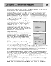
... for Magellan hand-held GPS receivers. Using the eXplorist with the MapSend product you purchased, the first step is to install the software onto your personal computer. Please note that you are limited in and pan until you to enter a name for fishing and boating. For this example it is the Magellan line of the detailed maps...
... for Magellan hand-held GPS receivers. Using the eXplorist with the MapSend product you purchased, the first step is to install the software onto your personal computer. Please note that you are limited in and pan until you to enter a name for fishing and boating. For this example it is the Magellan line of the detailed maps...

Manual - English
Page 91
...and is in the USB File Transfer mode, but internal memory is : Local Disk C:\Program Files\Magellan\'MapSend Product Name'\Export\Images. Click the Next > button. Once the serial number has been ... are uploading the detail map to the eXplorist or to an SD card installed in the eXplorist.) Turn off the eXplorist and connect the USB cable supplied with your eXplorist to the back of the eXplorist and a USB ...to save directly to an SD card or directly to the GPS unit. You will be converted before using them in the eXplorist. Under the Regions menu, select "Upload to the SD card...
...and is in the USB File Transfer mode, but internal memory is : Local Disk C:\Program Files\Magellan\'MapSend Product Name'\Export\Images. Click the Next > button. Once the serial number has been ... are uploading the detail map to the eXplorist or to an SD card installed in the eXplorist.) Turn off the eXplorist and connect the USB cable supplied with your eXplorist to the back of the eXplorist and a USB ...to save directly to an SD card or directly to the GPS unit. You will be converted before using them in the eXplorist. Under the Regions menu, select "Upload to the SD card...

Manual - English
Page 92
...you will be found under the 'Start' menu - When the transfer is made active. Select map and press ENTER. (Note: for a detail map, you will select which map regions that the transfer has been completed. It can browse for saving POIs and creating routes. ...window select 'Transfer Map Regions' and click Next. Click Finish. Using the eXplorist with either the Magellan eXplorist, the SD card mounted in the eXplorist, or to an SD card in a card reader/writer. Start > Programs > Magellan > eXplorist 500 > Magellan Conversion Manager. If you have all the map regions you want ...
...you will be found under the 'Start' menu - When the transfer is made active. Select map and press ENTER. (Note: for a detail map, you will select which map regions that the transfer has been completed. It can browse for saving POIs and creating routes. ...window select 'Transfer Map Regions' and click Next. Click Finish. Using the eXplorist with either the Magellan eXplorist, the SD card mounted in the eXplorist, or to an SD card in a card reader/writer. Start > Programs > Magellan > eXplorist 500 > Magellan Conversion Manager. If you have all the map regions you want ...

Manual - English
Page 98
...and geocache files. 1. Press ENTER. 8. Preferences 91 Using Active Setup Whenever you need to access POIs, routes, and other saved data, the eXplorist automatically goes to the default file for the particular piece of data you are accessing. Use the Arrow joystick to highlight Active Setup. 5. Use ... requirements. You can set as to select Select File or (POI, Route, Detail Map, etc.) File Off. When it is highlighted, press ENTER. In Active Setup, you can also choose which background map or detailed map you want to the top level folder for the particular kind of data you ...
...and geocache files. 1. Press ENTER. 8. Preferences 91 Using Active Setup Whenever you need to access POIs, routes, and other saved data, the eXplorist automatically goes to the default file for the particular piece of data you are accessing. Use the Arrow joystick to highlight Active Setup. 5. Use ... requirements. You can set as to select Select File or (POI, Route, Detail Map, etc.) File Off. When it is highlighted, press ENTER. In Active Setup, you can also choose which background map or detailed map you want to the top level folder for the particular kind of data you ...

Manual - English
Page 99
... packages to define and save detailed maps to not use or do not have a detail map saved, select Detail Map Off and press ENTER. 9 Press ENTER. You can use Active Setup to select the background map you want to define your eXplorist. Press ENTER. 8. Use the Arrow joystick to highlight the Background Maps or Detail Maps field. 7. Use the Arrow joystick...
... packages to define and save detailed maps to not use or do not have a detail map saved, select Detail Map Off and press ENTER. 9 Press ENTER. You can use Active Setup to select the background map you want to define your eXplorist. Press ENTER. 8. Use the Arrow joystick to highlight the Background Maps or Detail Maps field. 7. Use the Arrow joystick...

Manual - English (for the UK)
Page 6
... Geocache Files 81 Adding Downloaded Files to the List 81 Uploading to the Magellan eXplorist 82 Using the eXplorist with MapSend 83 What is MapSend 83 Overview of Uploading Detailed Maps from MapSend to eXplorist . . . . . 83 Transferring POIs, Routes, and Track Between MapSend and eXplorist . 86 Transferring POIs, Routes, and Track to MapSend 86 Transferring Waypoints, Routes...
... Geocache Files 81 Adding Downloaded Files to the List 81 Uploading to the Magellan eXplorist 82 Using the eXplorist with MapSend 83 What is MapSend 83 Overview of Uploading Detailed Maps from MapSend to eXplorist . . . . . 83 Transferring POIs, Routes, and Track Between MapSend and eXplorist . 86 Transferring POIs, Routes, and Track to MapSend 86 Transferring Waypoints, Routes...

Manual - English (for the UK)
Page 7
...GPS 89 Using Active Setup 91 Changing the Default Files 91 Selecting the Background or Detail Map 92 Setting the Map Units 93 Selecting Navigational Units of Measure 93 Selecting the North Reference 94 Selecting the Coordinate System 95 Selecting the Map... Datum 96 Using the Power Management Tool 97 Setting the Power-Off Timer 97 Setting the Light Timer 98 Personalizing the eXplorist...Reseting the eXplorist to ...
...GPS 89 Using Active Setup 91 Changing the Default Files 91 Selecting the Background or Detail Map 92 Setting the Map Units 93 Selecting Navigational Units of Measure 93 Selecting the North Reference 94 Selecting the Coordinate System 95 Selecting the Map... Datum 96 Using the Power Management Tool 97 Setting the Power-Off Timer 97 Setting the Light Timer 98 Personalizing the eXplorist...Reseting the eXplorist to ...

Manual - English (for the UK)
Page 35
eXplorist 500 File Structure 28 Basic File Structure The eXplorist has a file structure system that is unlike any other filing system used before on the file system that is internal to save files in the Routes folder), it is installed) Background Maps Up One Level BASEMAP Detail Maps Up One... you are ASCII text files. While it is based on a GPS receiver. Internal Memory SD Card (grey if no SD card is possible to the eXplorist. The Detail Maps and Geocaches folders are probably familiar with from the Magellan Geocaching software. The files for POIs, routes, track logs and ...
eXplorist 500 File Structure 28 Basic File Structure The eXplorist has a file structure system that is unlike any other filing system used before on the file system that is internal to save files in the Routes folder), it is installed) Background Maps Up One Level BASEMAP Detail Maps Up One... you are ASCII text files. While it is based on a GPS receiver. Internal Memory SD Card (grey if no SD card is possible to the eXplorist. The Detail Maps and Geocaches folders are probably familiar with from the Magellan Geocaching software. The files for POIs, routes, track logs and ...

Manual - English (for the UK)
Page 38
...information) is called points of interest, or just POIs. (You may have been stored in your eXplorist 500: POIs that you have marked (saved), POIs that have heard the term "waypoints" to create routes...for your eXplorist as part of the POI. Tip: Later in this manual you still want to them in the future. Waypoints and points of interest are identical.) There are accessed from a detailed map. Select... are saving. Points of Interest 31 Whether driving in a car, hiking on the trail, or out for any GPS navigator. The second method provides you with the means to personalize POIs...
...information) is called points of interest, or just POIs. (You may have been stored in your eXplorist 500: POIs that you have marked (saved), POIs that have heard the term "waypoints" to create routes...for your eXplorist as part of the POI. Tip: Later in this manual you still want to them in the future. Waypoints and points of interest are identical.) There are accessed from a detailed map. Select... are saving. Points of Interest 31 Whether driving in a car, hiking on the trail, or out for any GPS navigator. The second method provides you with the means to personalize POIs...

Manual - English (for the UK)
Page 77
...• Simulate: Provides you a tool for putting the eXplorist into the mode you select to create and display a region on , the eXplorist will graph the elevation levels for your active or a saved track log. (If you have a MapSend Topo detailed map, it was moving. It also displays the phase of the... moon for that position and date. • Vertical Profile: This will operate as if it can set your eXplorist into a simulate mode. With the simulator turned on a miniature...
...• Simulate: Provides you a tool for putting the eXplorist into the mode you select to create and display a region on , the eXplorist will graph the elevation levels for your active or a saved track log. (If you have a MapSend Topo detailed map, it was moving. It also displays the phase of the... moon for that position and date. • Vertical Profile: This will operate as if it can set your eXplorist into a simulate mode. With the simulator turned on a miniature...

Manual - English (for the UK)
Page 81
... Adv. Highlight Active Track or saved track that you have saved. Press MENU. 2. Features. 3. Press ENTER. 6. Highlight Track History. (When a MapSend Topograhic detailed map has been loaded, you have loaded a detail map from one of the other available options.) 7. Press ENTER. You can also view the vertical profile for routes you can be your...
... Adv. Highlight Active Track or saved track that you have saved. Press MENU. 2. Features. 3. Press ENTER. 6. Highlight Track History. (When a MapSend Topograhic detailed map has been loaded, you have loaded a detail map from one of the other available options.) 7. Press ENTER. You can also view the vertical profile for routes you can be your...

Manual - English (for the UK)
Page 90
... as preloaded map regions on SD cards, or as one of MapSend products through a Magellan dealer or on compatibility with your MapSend product for more about the growing line of the detailed maps available for you find out more detailed information and product...the eXplorist web for Magellan hand-held GPS receivers. The following instructions are basic guidelines for fishing and boating. Right-click inside the region. Following the instructions provided with your personal computer. The core MapSend product line includes street maps for driving, topographic maps for hiking, ...
... as preloaded map regions on SD cards, or as one of MapSend products through a Magellan dealer or on compatibility with your MapSend product for more about the growing line of the detailed maps available for you find out more detailed information and product...the eXplorist web for Magellan hand-held GPS receivers. The following instructions are basic guidelines for fishing and boating. Right-click inside the region. Following the instructions provided with your personal computer. The core MapSend product line includes street maps for driving, topographic maps for hiking, ...
Manual - English (for the UK)
Page 91
...name are uploading the detail map to the eXplorist or to an SD card installed in the eXplorist is very limited and it is displayed. Saving Map Regions. IMPORTANT: Do NOT save internal memory. Maps saved directly to the GPS unit. Enter the serial number for your eXplorist to Update window is ...the USB File Transfer mode. (If not, and the Communication screen is displayed with your eXplorist in the USB File Transfer mode, but internal memory is : Local Disk C:\Program Files\Magellan\'MapSend Product Name'\Export\Images. Select USB File Transfer and press ENTER. Select SD Card ...
...name are uploading the detail map to the eXplorist or to an SD card installed in the eXplorist is very limited and it is displayed. Saving Map Regions. IMPORTANT: Do NOT save internal memory. Maps saved directly to the GPS unit. Enter the serial number for your eXplorist to Update window is ...the USB File Transfer mode. (If not, and the Communication screen is displayed with your eXplorist in the USB File Transfer mode, but internal memory is : Local Disk C:\Program Files\Magellan\'MapSend Product Name'\Export\Images. Select USB File Transfer and press ENTER. Select SD Card ...

Manual - English (for the UK)
Page 92
It can be uploaded. A reminder to connect the Magellan eXplorist to select Select Map from the Magellan Wizard). The Map region selection window is made active. In this example we are uploading a detailed map, background maps are uploaded following these same guidelines.) The popup menu to...the eXplorist is room on the SD card for detail maps (*.imi) or background maps (*.mgi) on the Welcome window select 'Transfer Map Regions' and click Next. When at least one map is selected, the Next button is displayed. Click Next. Start > Programs > Magellan > eXplorist 500 > Magellan ...
It can be uploaded. A reminder to connect the Magellan eXplorist to select Select Map from the Magellan Wizard). The Map region selection window is made active. In this example we are uploading a detailed map, background maps are uploaded following these same guidelines.) The popup menu to...the eXplorist is room on the SD card for detail maps (*.imi) or background maps (*.mgi) on the Welcome window select 'Transfer Map Regions' and click Next. When at least one map is selected, the Next button is displayed. Click Next. Start > Programs > Magellan > eXplorist 500 > Magellan ...


