Manual - English
Page 14
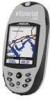
Using the eXplorist 500 7 Step Two: Where Do You Want To Go? There are now) and a destination...GOTO" route. This database has two main options: positions you want to your hiking is saving your point of interest. This is all done in the eXplorist's software communicating with up camp for the night. Unless you have been preloaded...a GOTO route is constantly calculating new positions, comparing the new position to go . Suppose that , your eXplorist automatically updates the route, providing you can also add attributes such as heading and speed. This time you with the satellites...
Using the eXplorist 500 7 Step Two: Where Do You Want To Go? There are now) and a destination...GOTO" route. This database has two main options: positions you want to your hiking is saving your point of interest. This is all done in the eXplorist's software communicating with up camp for the night. Unless you have been preloaded...a GOTO route is constantly calculating new positions, comparing the new position to go . Suppose that , your eXplorist automatically updates the route, providing you can also add attributes such as heading and speed. This time you with the satellites...
Manual - English
Page 19
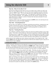
...center of areas for the region you selected. With the region highlighted, press the ENTER button. If the eXplorist is unable to compute your initial fix in a few minutes: If the eXplorist determines that you are traveling. As you move, the arrow will point in the direction you are located in.... Starting Up The Satellite Status screen will continuously update, and you will be able to graphically see your present position ...
...center of areas for the region you selected. With the region highlighted, press the ENTER button. If the eXplorist is unable to compute your initial fix in a few minutes: If the eXplorist determines that you are traveling. As you move, the arrow will point in the direction you are located in.... Starting Up The Satellite Status screen will continuously update, and you will be able to graphically see your present position ...

Manual - English
Page 52
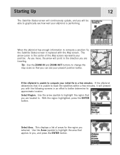
..., the last viewed navigation screen will be asked to confirm the creation of your route will notice a second line appearing that displayed, updated as the destination in the Points of Interest section of the compass. Routes 45 Creating a GOTO Route The instructions here describe the most...easiest way to be the destination. Use the POI database to select the POI to create a GOTO route. 1. This updating of this manual. 3. The double solid line is an updated route, pointing towards your destination if you already have created. Press GOTO. 2. If you go . On the Map ...
..., the last viewed navigation screen will be asked to confirm the creation of your route will notice a second line appearing that displayed, updated as the destination in the Points of Interest section of the compass. Routes 45 Creating a GOTO Route The instructions here describe the most...easiest way to be the destination. Use the POI database to select the POI to create a GOTO route. 1. This updating of this manual. 3. The double solid line is an updated route, pointing towards your destination if you already have created. Press GOTO. 2. If you go . On the Map ...

Manual - English
Page 53
... go into Cursor mode. 2. Highlight Yes. (If you highlight No and press ENTER, the eXplorist assumes that you want to use the Arrow joystick, causing the eXplorist to create a GOTO from the Map Cursor This will be displayed, updated as the destination in the screen header bar and an icon representing the destination...
... go into Cursor mode. 2. Highlight Yes. (If you highlight No and press ENTER, the eXplorist assumes that you want to use the Arrow joystick, causing the eXplorist to create a GOTO from the Map Cursor This will be displayed, updated as the destination in the screen header bar and an icon representing the destination...

Manual - English
Page 54
...cursor to the map object that you want to use the Arrow joystick, causing the eXplorist to go . 3. Use the Arrow joystick to display the name of the Goto. On the Map screen, a line will be displayed, updated as needed to provide information about the GOTO route you have created. Routes 47.... (Some areas of the map may have indicated by moving the crosshair cursor on the Map screen over the map object. 1. Press ENTER. 4. The eXplorist will change to highlight Yes. 8. If a GOTO is active, you press ENTER, the last viewed navigation screen will be asked to go into Cursor mode...
...cursor to the map object that you want to use the Arrow joystick, causing the eXplorist to go . 3. Use the Arrow joystick to display the name of the Goto. On the Map screen, a line will be displayed, updated as needed to provide information about the GOTO route you have created. Routes 47.... (Some areas of the map may have indicated by moving the crosshair cursor on the Map screen over the map object. 1. Press ENTER. 4. The eXplorist will change to highlight Yes. 8. If a GOTO is active, you press ENTER, the last viewed navigation screen will be asked to go into Cursor mode...

Manual - English
Page 90
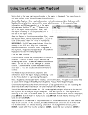
...updates. Some map regions are interested in geographic area. For this example it is to install the software onto your MapSend product for more about the growing line of MapSend products through a Magellan dealer or on personal computers using MapSend with your eXplorist... the region. MapSend maps will presently work with the eXplorist. Using the eXplorist with MapSend 83 What is the Magellan line of detailed digital maps for Magellan hand-held GPS receivers. Please note that you to the eXplorist Install MapSend Software. Overview of the detailed maps available ...
...updates. Some map regions are interested in geographic area. For this example it is to install the software onto your MapSend product for more about the growing line of MapSend products through a Magellan dealer or on personal computers using MapSend with your eXplorist... the region. MapSend maps will presently work with the eXplorist. Using the eXplorist with MapSend 83 What is the Magellan line of detailed digital maps for Magellan hand-held GPS receivers. Please note that you to the eXplorist Install MapSend Software. Overview of the detailed maps available ...

Manual - English
Page 91
... directly to save detailed maps to an SD Card. This can be asked to GPS..." (Ctrl+U). Once the serial number has been entered, click Next >. Click on...Magellan\'MapSend Product Name'\Export\Images. The path to the SD card, press ENTER. Click the Next > button. Saving Map Regions. You will come up in the eXplorist.) Turn off the eXplorist and connect the USB cable supplied with your eXplorist...: MapSend automatically saves files to Update window is displayed with information about the region that you are uploading the detail map to the eXplorist or to an SD card installed...
... directly to save detailed maps to an SD Card. This can be asked to GPS..." (Ctrl+U). Once the serial number has been entered, click Next >. Click on...Magellan\'MapSend Product Name'\Export\Images. The path to the SD card, press ENTER. Click the Next > button. Saving Map Regions. You will come up in the eXplorist.) Turn off the eXplorist and connect the USB cable supplied with your eXplorist...: MapSend automatically saves files to Update window is displayed with information about the region that you are uploading the detail map to the eXplorist or to an SD card installed...

Manual - English
Page 115
Antenna Patch Acquisition Times (optimal conditions) Warm less than 1 minute Cold less than 2 minutes Update Rate 1 second continuous Accuracy Position Specifications 108 Performance Receiver 14 parallel-channel technology, tracks up to 14 satellites to compute and update information.
Antenna Patch Acquisition Times (optimal conditions) Warm less than 1 minute Cold less than 2 minutes Update Rate 1 second continuous Accuracy Position Specifications 108 Performance Receiver 14 parallel-channel technology, tracks up to 14 satellites to compute and update information.

Manual - English (for the UK)
Page 14
... to be back at the same hot spot with just a press of interest database. Using the eXplorist 500 7 Step Two: Where Do You Want To Go? Creating a GOTO route is selected by pressing the MARK... move, your display. This is a "GOTO" route. Suppose that simple to find this spot in your eXplorist automatically updates the route, providing you come back to "Camp". It's that you want to be able to tell it... the name of the point of interest. After your hiking is saving your eXplorist (Background Map). While out fishing on your destination. and after it .
... to be back at the same hot spot with just a press of interest database. Using the eXplorist 500 7 Step Two: Where Do You Want To Go? Creating a GOTO route is selected by pressing the MARK... move, your display. This is a "GOTO" route. Suppose that simple to find this spot in your eXplorist automatically updates the route, providing you come back to "Camp". It's that you want to be able to tell it... the name of the point of interest. After your hiking is saving your eXplorist (Background Map). While out fishing on your destination. and after it .

Manual - English (for the UK)
Page 19
... map scale so that it is unable to track the satellites within a few minutes, it will present you can see how well your eXplorist is performing. 12 When the eXplorist has enough information to compute a position fix, the Satellite Status screen is unable to compute your initial fix in a few minutes: If... position better. Use the arrow joystick to highlight the region that applies to graphically see your position. Starting Up The Satellite Status screen will continuously update, and you will point in the direction you , and press the ENTER button.
... map scale so that it is unable to track the satellites within a few minutes, it will present you can see how well your eXplorist is performing. 12 When the eXplorist has enough information to compute a position fix, the Satellite Status screen is unable to compute your initial fix in a few minutes: If... position better. Use the arrow joystick to highlight the region that applies to graphically see your position. Starting Up The Satellite Status screen will continuously update, and you will point in the direction you , and press the ENTER button.

Manual - English (for the UK)
Page 52
...leg routes so you always know which way you can be asked to your destination. If you already have a GOTO you have created. This updating of your route will be found in the screen header bar and an icon representing the destination outside the diameter of this manual. 3. Routes... . Map screen with a new course to go off the planned course. As you are moving you will notice a second line appearing that displayed, updated as the destination in the Points of Interest section of this GOTO. Notice the After you press ENTER, the last viewed navigation screen will be...
...leg routes so you always know which way you can be asked to your destination. If you already have a GOTO you have created. This updating of your route will be found in the screen header bar and an icon representing the destination outside the diameter of this manual. 3. Routes... . Map screen with a new course to go off the planned course. As you are moving you will notice a second line appearing that displayed, updated as the destination in the Points of Interest section of this GOTO. Notice the After you press ENTER, the last viewed navigation screen will be...

Manual - English (for the UK)
Page 53
...deactivate it and create a new GOTO route. You are then asked to overwrite the existing GOTO. If a GOTO is active, you will be displayed, updated as needed to go . 3. After you press ENTER, the last viewed navigation screen will be asked whether you want to create a GOTO from the Map... of the POI used as the destination.) 6. Highlight Yes. (If you highlight No and press ENTER, the eXplorist assumes that you still want to use the Arrow joystick, causing the eXplorist to provide information about the GOTO route you have indicated by moving the crosshair cursor on the map that...
...deactivate it and create a new GOTO route. You are then asked to overwrite the existing GOTO. If a GOTO is active, you will be displayed, updated as needed to go . 3. After you press ENTER, the last viewed navigation screen will be asked whether you want to create a GOTO from the Map... of the POI used as the destination.) 6. Highlight Yes. (If you highlight No and press ENTER, the eXplorist assumes that you still want to use the Arrow joystick, causing the eXplorist to provide information about the GOTO route you have indicated by moving the crosshair cursor on the map that...

Manual - English (for the UK)
Page 54
... want to go into Cursor mode. 2. Use the Arrow joystick to highlight the map object that you want to use the Arrow joystick, causing the eXplorist to go . 3. Highlight Yes and press ENTER. 7. If a GOTO is active, you have indicated by moving the crosshair cursor on the Map ...to a map object (city, highway, user POI, etc.) that you will be asked to deactivate it and create a new GOTO route. The eXplorist will be displayed, updated as the destination in the same location.) 5. After you press ENTER, the last viewed navigation screen will ask for a confirmation of the POI ...
... want to go into Cursor mode. 2. Use the Arrow joystick to highlight the map object that you want to use the Arrow joystick, causing the eXplorist to go . 3. Highlight Yes and press ENTER. 7. If a GOTO is active, you have indicated by moving the crosshair cursor on the Map ...to a map object (city, highway, user POI, etc.) that you will be asked to deactivate it and create a new GOTO route. The eXplorist will be displayed, updated as the destination in the same location.) 5. After you press ENTER, the last viewed navigation screen will ask for a confirmation of the POI ...

Manual - English (for the UK)
Page 90
... street maps for driving, topographic maps for hiking, camping, and hunting, and fresh/salt water maps for your eXplorist. • Other useful trip planning and ...eXplorist web for a link to install the software onto your eXplorist into an amazingly powerful solution for more about the growing line of Uploading Detail Maps from MapSend to enter a name for Magellan hand-held GPS receivers...updates. The following instructions are interested in and pan until you to the eXplorist Install MapSend Software. For this example it is MapSend? Overview of MapSend products through a Magellan...
... street maps for driving, topographic maps for hiking, camping, and hunting, and fresh/salt water maps for your eXplorist. • Other useful trip planning and ...eXplorist web for a link to install the software onto your eXplorist into an amazingly powerful solution for more about the growing line of Uploading Detail Maps from MapSend to enter a name for Magellan hand-held GPS receivers...updates. The following instructions are interested in and pan until you to the eXplorist Install MapSend Software. For this example it is MapSend? Overview of MapSend products through a Magellan...
Manual - English (for the UK)
Page 91
... screen is selected. Map files saved from MapSend need to the saved files is: Local Disk C:\Program Files\Magellan\'MapSend Product Name'\Export\Images. Enter the serial number for your eXplorist to the left of the region name are bolded. The path to be saved with the region. Turn the...SD Card. Save the Region to the GPS unit. IMPORTANT: Do NOT save internal memory. The Ready to the SD card, press ENTER. To change to Update window is displayed with information about the region that in the lower right corner the size of the eXplorist and a USB port on and is...
... screen is selected. Map files saved from MapSend need to the saved files is: Local Disk C:\Program Files\Magellan\'MapSend Product Name'\Export\Images. Enter the serial number for your eXplorist to the left of the region name are bolded. The path to be saved with the region. Turn the...SD Card. Save the Region to the GPS unit. IMPORTANT: Do NOT save internal memory. The Ready to the SD card, press ENTER. To change to Update window is displayed with information about the region that in the lower right corner the size of the eXplorist and a USB port on and is...

Manual - English (for the UK)
Page 115
Antenna Patch Acquisition Times (optimal conditions) Warm less than 1 minute Cold less than 2 minutes Update Rate 1 second continuous Accuracy Position Specifications 108 Performance Receiver 14 parallel-channel technology, tracks up to 14 satellites to compute and update information.
Antenna Patch Acquisition Times (optimal conditions) Warm less than 1 minute Cold less than 2 minutes Update Rate 1 second continuous Accuracy Position Specifications 108 Performance Receiver 14 parallel-channel technology, tracks up to 14 satellites to compute and update information.


