
Garmin STRIKER 7cv Support Question
Garmin STRIKER 7cv Support Question
Find answers below for this question about Garmin STRIKER 7cv.Need a Garmin STRIKER 7cv manual? We have 3 online manuals for this item!
Question posted by kristicatoir on January 16th, 2017
Route
How do I make a route from point a to point b. I have read the manuel and i'm a little confused. Please explain.
Current Answers
Answer #1: Posted by techyagent on January 16th, 2017 8:31 AM
techyagent

Member since:
June 17th, 2014 Points: 4,799,770

Member since:
June 17th, 2014 Points: 4,799,770
Creating a route manuallyThe easiest way to create a route manually, on many units, is to use the "mark" key to mark the route as you are traveling. The menu that appears when the "mark" key is depressed includes an entry called "add to route __". If this entry is filled in then the new waypoint will be automatically added to the end of the numbered route, if there is room. The route number is remembered so the next time you can easily repeat the process. Just press mark at the appropriate point and then hit enter to save the waypoint and add it to the route. The waypoint name will be a unique sequential number. I would recommend a tape recorder or one of these new digital recorders be used to note the location referenced to the waypoint number. Later when you are not so busy driving, hiking, or sailing, you can return to these waypoints and rename them to something more meaningful.
The advantages of creating a route this way are that you can pick exactly the points where decisions need to be made. Also the waypoints you make will be tagged with the time you made them which can be useful it determining average speed and other trip history data. Note the newest units that store altitude with the waypoint do not have comments or store the time the waypoint was created.
Creating a route from a paper mapIf you have a map that includes lat/lon numbers or utm numbers then you can create a route using the exact same technique described above, if your units supports this (Most older non-mapping receivers do.). Place the unit in simulation mode, select the grid system that matches your map, select the datum that matches your map, and then go to the position screen. You should find that you can edit the positions on the position screen directly using the simulation mode. Use the cursor keys to highlight the position data and hit enter to select it. (If your unit doesn't support this then you will not be able to use this technique.) Once you have entered the data for the location hit the mark key as above and edit the screen to fill in the appropriate data. Repeat for each waypoint in the route.If you have a scaled map but no grid or would rather not enter all of those coordinate then you can use the following technique to create a route.
- You must have an actual coordinate for the first point in the route. You can create this first waypoint from a map containing the coordinates or by actually visiting the location. If you only have coordinates for the corner of the map then you can create a temporary waypoint using that corner that will be removed later. Create this waypoint. (See the chapter on waypoints to create this if you don't know how.)
- Select the route menu item from the main menu and create a new route page.On the G-III family you select a new route page by picking it off the local menu. You could use the active route page for this if you wish since it is always present and is designed to be used for planning purposes. The emap and etrex can only reach the route page from the main menu.On other Garmin units - To select a new route highlight the route number, hit enter, and use the up/down arrow keys to find a number that is not in use. Hit enter again and move to the first route point entry.
- Hit enter on the blank routepoint line. You will be allowed to enter the name for the first routepoint, pick the name of the waypoint you entered above. (Or use the local menu if you have a menu key.)
- Bring up the route menu again and select review waypoint on this waypoint name. This will bring up the waypoint editing screen with the waypoint selected.
- Select NEW and fill in the new name you want. Fill in the REF: field with the name of the earlier waypoint. Using a ruler and protractor enter the distance and bearing under the reference keyword. You will have to scale the map to real numbers based on your current unit preferences. A calculator or set of dividers can be of use here. Selecting DONE will create this new waypoint as a projection of the information of the earlier point.
- Repeat these steps for each waypoint you wish to create for the route.
http://www.gpsinformation.org/dale/routes.htm
Thanks
Techygirl
Related Garmin STRIKER 7cv Manual Pages
Installation Instructions - Page 1

...;ncia segura da bússola •Sikkerhedsafstand for kompas •Trygg avstand fra et kompass •Säkerhetsavstånd till kompass
•STRIKER 5: 25 cm (9.84 in.) •STRIKER 7: 30 cm (11.81 in.)
➀ ➁
3 mm (1/8 in.)
➂
➃
➄
Fuse: 3.0 A
12 Vdc
12 Vdc
November 2015
190-01950-92_0A...
?Important Safety and Product Information - Page 2

... means of preventing grounding or collision. Supplement depth data readings with part 15 of the FCC Rules. Industry Canada ...call Garmin Product Support for warranty repairs. Garmin makes no charge to the customer for parts or labor... from the GPS device. • Consult the dealer or an experienced radio/TV technician for warranty verification. Marine Operation Warnings ...
Owner s Manual PDF - Page 1

STRIKER™ Series
Owner's Manual
Owner s Manual PDF - Page 2

...without the express permission of Garmin. Follow the leader.® or its products and to make changes in the content of this manual without obligation to www.garmin.com for current ... the written consent of Garmin. © 2015-2016 Garmin Ltd. Garmin ClearVü™ and STRIKER™ are trademarks of Garmin Ltd.
Garmin®, the Garmin logo, and Ultrascroll® are ...
Owner s Manual PDF - Page 3

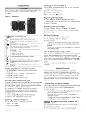
...STRIKER 4 1 Panning on the STRIKER 4 1 Adjusting the Backlight 1 Adjusting the Color Mode 1 Setting the Beeper 1 GPS Satellite Signal Acquisition 1
Home Screen 1 Customizing the Home Screen 1
Adding a New Layout to the Home Screen of the STRIKER...Recording Interval of the Track Log 7 Deleting All Saved Waypoints, Routes, and Tracks 7
Device Configuration 7 System Settings 7
System ...
Owner s Manual PDF - Page 5
... 870 850 1241.
Customizing the Home Screen
You can return to make the sonar function properly. Introduction
1
TIP: Press from any screen ... you have the device beep when you turn on the STRIKER 4
You can select to pan. Adding a New Layout ... Screen of a view. (Available only on the 5 in . GPS Satellite Signal Acquisition
When you select an item and when an alarm ...
Owner s Manual PDF - Page 6

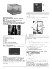
... two narrow beams, similar to the shape of sonar readings from right to choose the direction of depth that appear..., you must add it to the Home Screen of the STRIKER 4 You can customize these features. Numbers To customize the ... devices have these sonar views. Bottom depth
À
Water temperature
Á
GPS speed
Â
Device voltage
Ã
Time
Ä
Transducer type and frequency...
Owner s Manual PDF - Page 7
NOTE: To receive SideVü scanning sonar, you a picture of the sonar return. You can see a full-view graph of sonar readings on a circular depth scale, indicating what lies to adjust the zoom automatically by specifying the span and a fixed starting depth is received at your vessel
&#...
Owner s Manual PDF - Page 9

... at which the auto range feature searches for situations when you adjust the interference setting from the bottom to all sonar views. Surface noise is little effect on all screens.
Owner s Manual PDF - Page 10
...All.
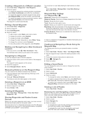
Editing a Saved Route
You can measure the distance between compatible STRIKER and echoMAP™ series devices. The waypoint is a line drawn on the
STRIKER 4, page 1). 2 ...route. 1 Select User Data > Routes. 2 Select a route. 3 Select Navigate To. 4 Select an option:
• To navigate the route from the starting point used when the route was created, select Backward.
6
Routes...
Owner s Manual PDF - Page 11
...recording a track point. Setting the ...reading for a keel.
The resolution interval is a thinner purple line that may draw several feet of a keel,
making...Route
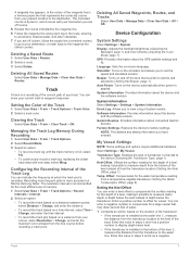
1 Select User Data > Routes. 2 Select a route. 3 Select Delete.
Deleting All Saved Waypoints, Routes, and Tracks
Select User Data > Manage Data > Clear User Data > All > OK.
Garmin Devices: Provides information about the GPS...
Owner s Manual PDF - Page 12
...saved when the device is the temperature offset. Route Start: Selects a starting point for your present location.
Water Temp.: Sounds...alarm to sound when the GPS location
accuracy falls outside the user-defined value. GPS Accuracy: Sets an alarm ... references used in which the map is selected for the temperature reading from a turn transition to sound when the battery
reaches a ...
Owner s Manual PDF - Page 13
...point should push firmly so that is commonly displayed as latitude/ longitude in the power cable. The fuse should be connected, you should be , the map datum and position format of the earth. Check the fuse to make... instructions for DC voltage.
If the fuse is good, the multimeter reads 0 ohm. • Check to a specific map datum. 1 ...GPS receiver's position appears on the screen.
Owner s Manual PDF - Page 14

... 7 signals 1 GPS accuracy 8
H home screen, customizing 1
K keel offset 7 keys 1
power 1
L language 7
M man overboard 6 mark location 5 measuring distance 6
N navigation alarms 8 navigation inset 5
O off course alarm 8 overlay numbers 5
P pages. See routes troubleshooting 9
U units of 6 waypoints 6
10
S safe depth 8 safe height 8 satellite signals, acquiring 1 screen, brightness 1 settings...
Similar Questions

How Do I Go Into Simulation Mode On A Garmin Marine Gps Modle741xs
how do I use simulation mode on a garmin 741xs marine ver
how do I use simulation mode on a garmin 741xs marine ver
(Posted by Curthupp 7 years ago)

Why Does My Striker Blow Fuses?
My striker 7 blows the fuse when the power cord is plugged in with the battery switch one.
My striker 7 blows the fuse when the power cord is plugged in with the battery switch one.
(Posted by donsheetz 8 years ago)
Our Garmin Will Not Power Up. Does It Have To Have Sim Card To Power Up?
(Posted by dudleybv 8 years ago)

541s Marine Gps. Depth Not Reading Out.
Depth has been working since installed. Now blank. Is there an on off control for this that may have...
Depth has been working since installed. Now blank. Is there an on off control for this that may have...
(Posted by therad50 11 years ago)